I traveled to this city to see my friend Nicole. We worked together the first year in China and I have not seen her for 6 years. Actually the last time was the Christmas before COVID started…
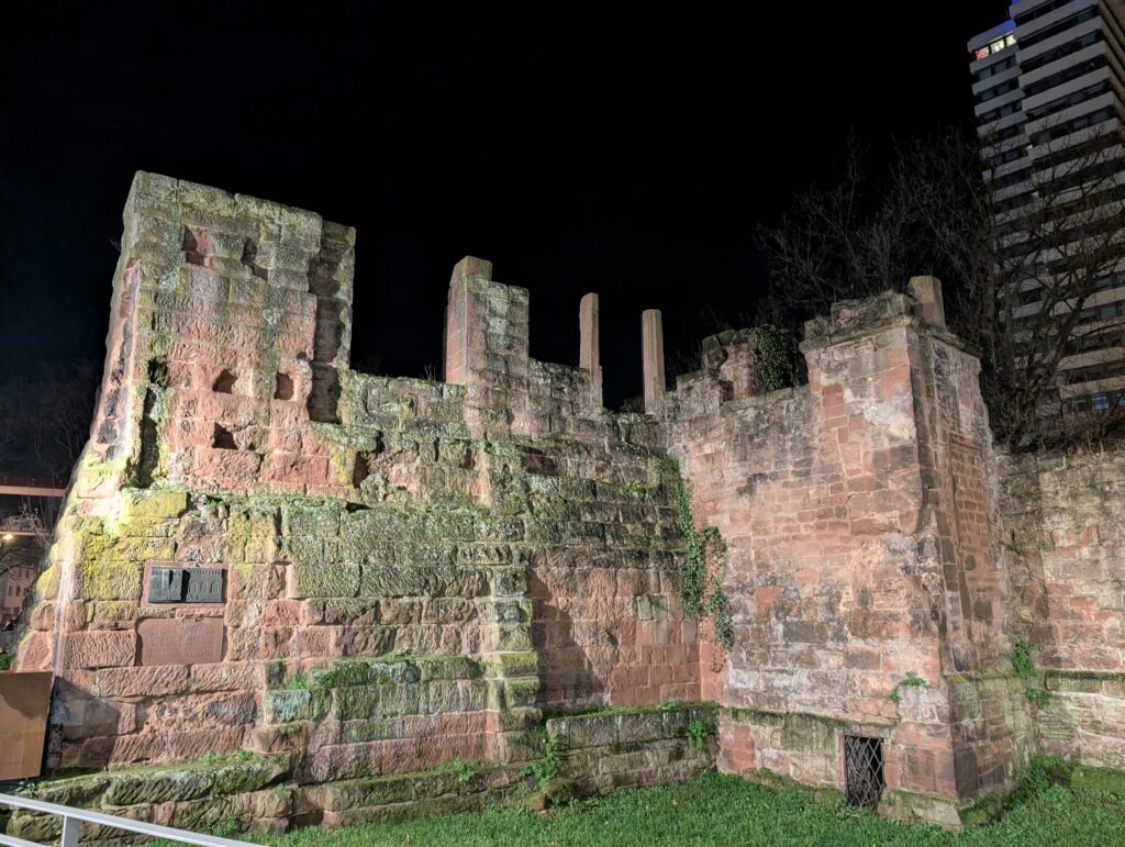
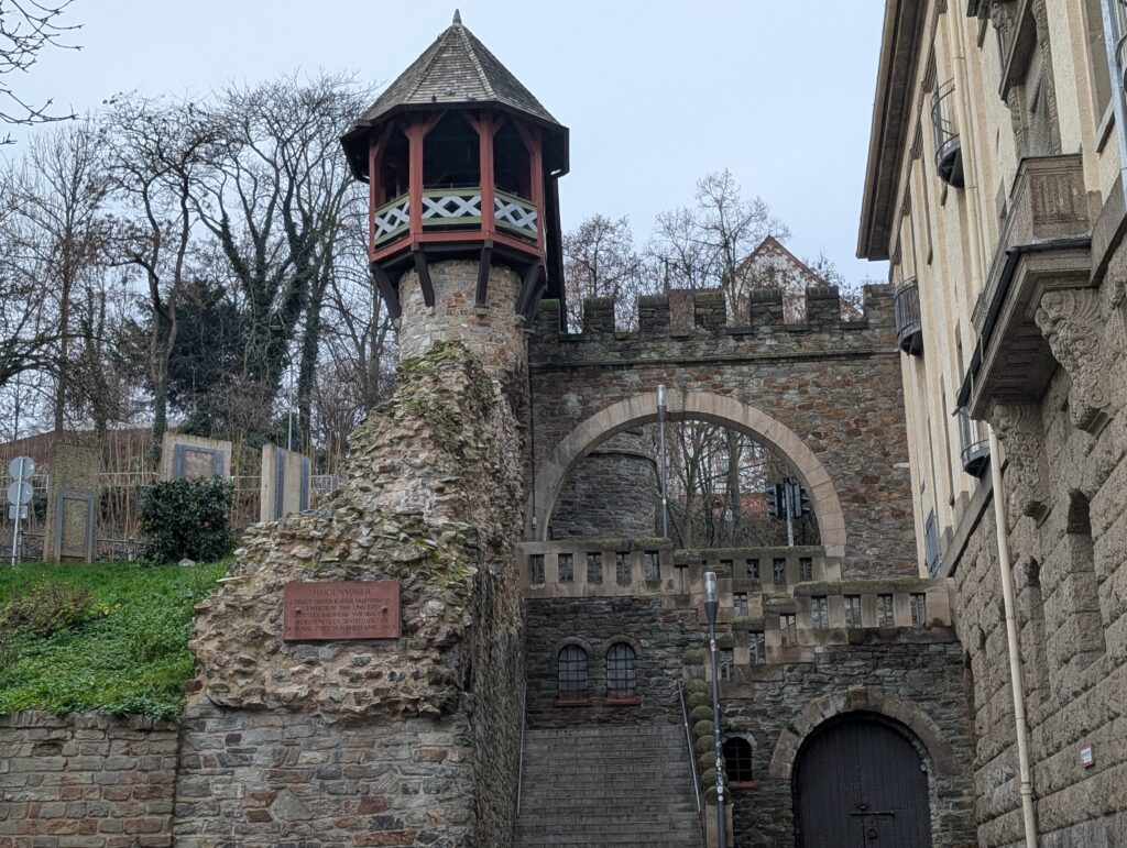
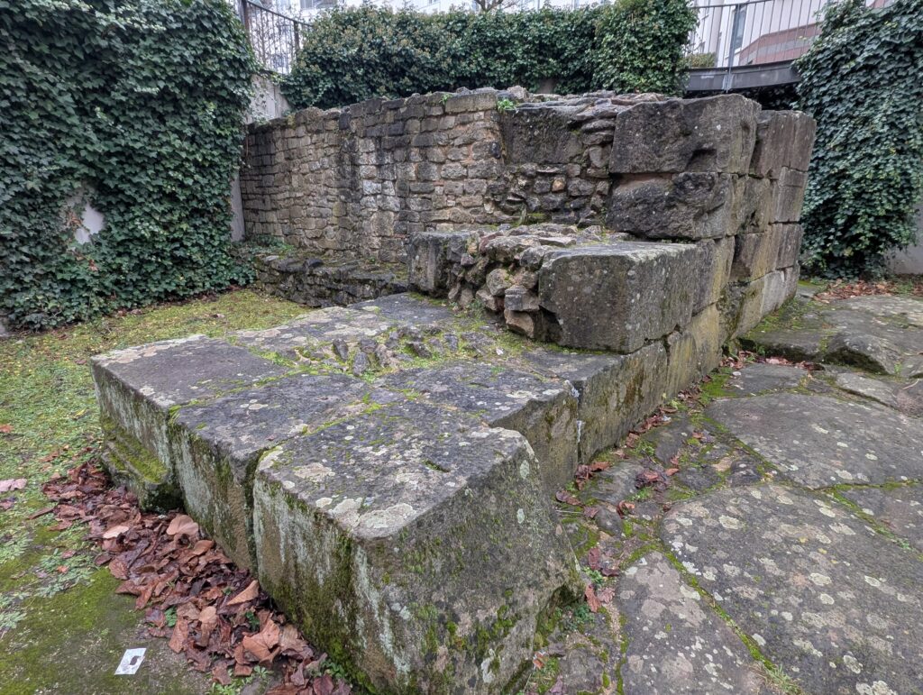
The area was settled by the Celt’s and then the Romans (structures can still be seen today). In the 12th century, Roman emperor Fredrick I “Barbarossa” built an imperial palace Kaierpfalz, which is the ruins in one of the pictures below. He named the city using Kaiser (emperor) and Lautern (of the river). The city became protestant during the Reformation and was heavily damaged during the 30 years war and the French and Germany.
During the Napoleanic wars, it was under control of the French. After the defeat of Napolean, it became part of Bavaria. It is known for its textile production and was heavily damaged during WWII.
It has a 2000 year history shaped by emperor’s, wars, and rebuilding.
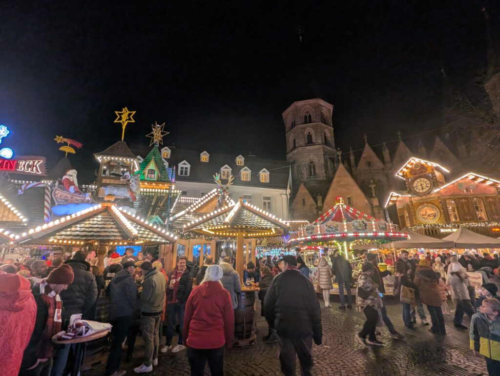
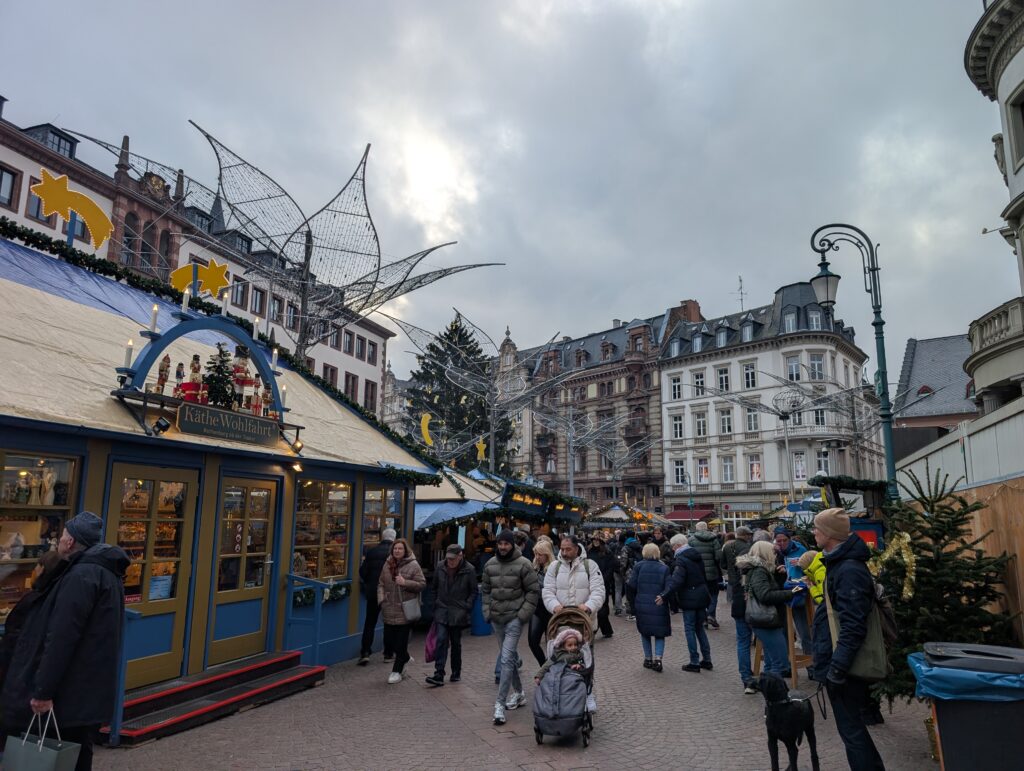
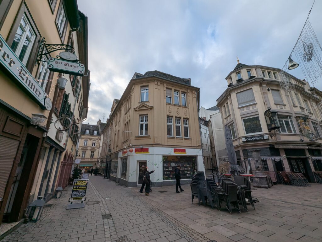
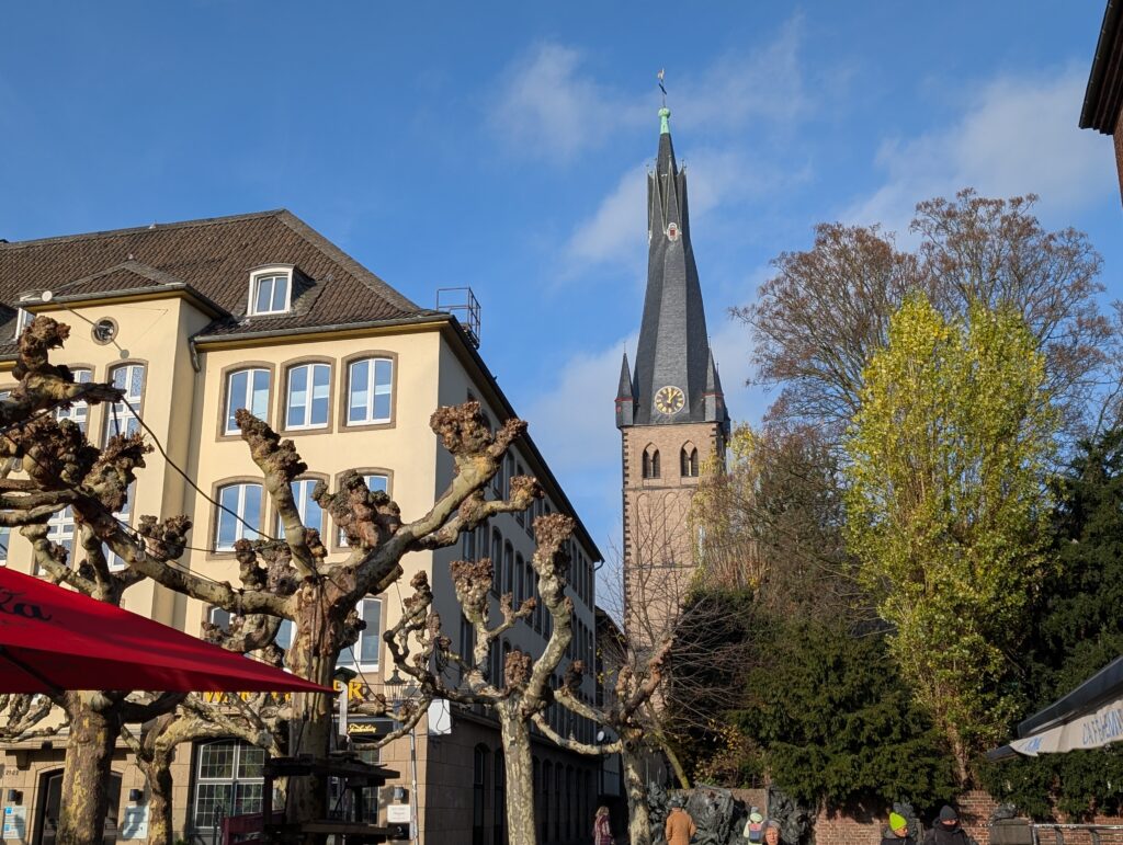
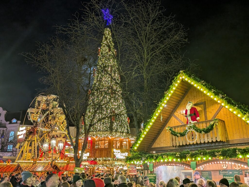
We spent the first day going around the Christmas markets and some of the sights. This city actually has an American Air base (Rammstein) and a university so it is very international. Both have heavily influenced the economy and culture.
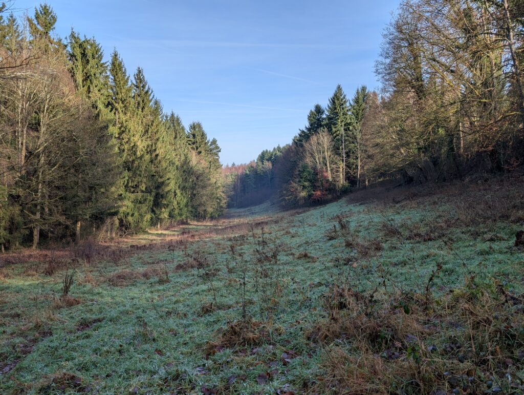
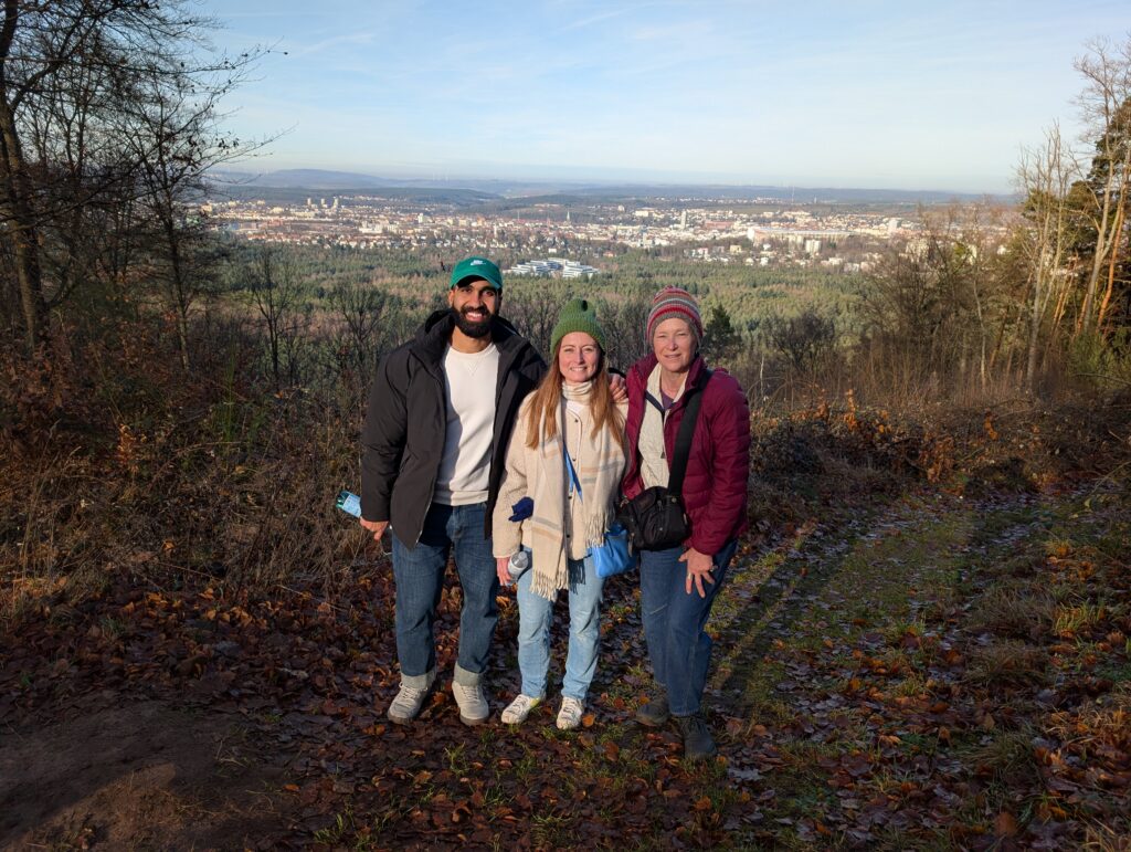
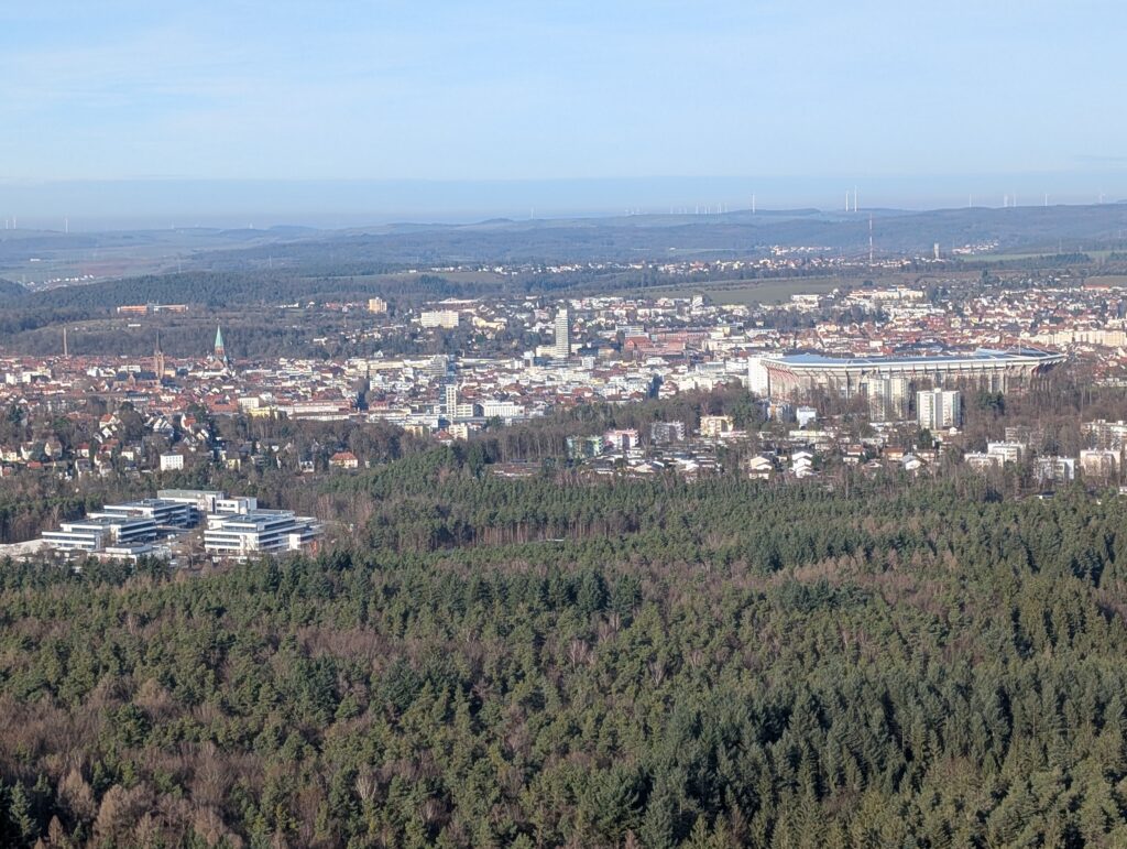
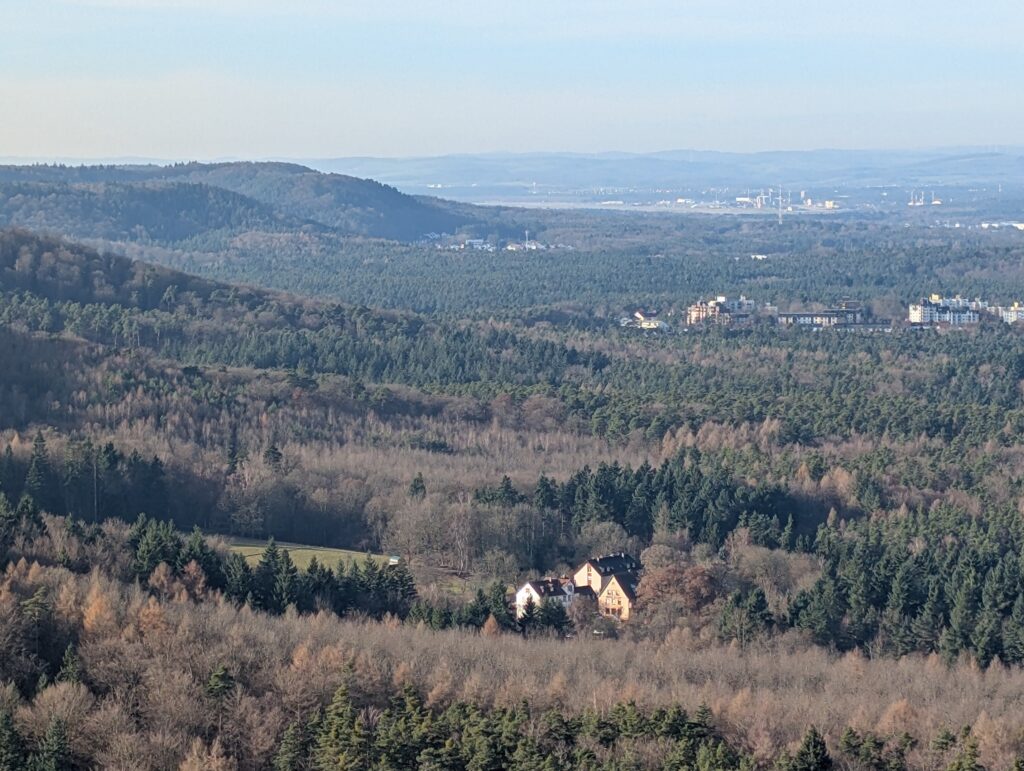
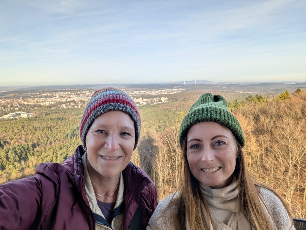
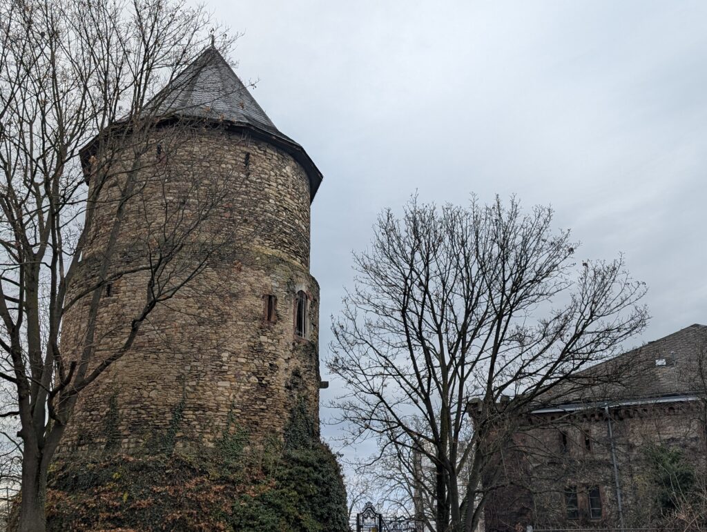
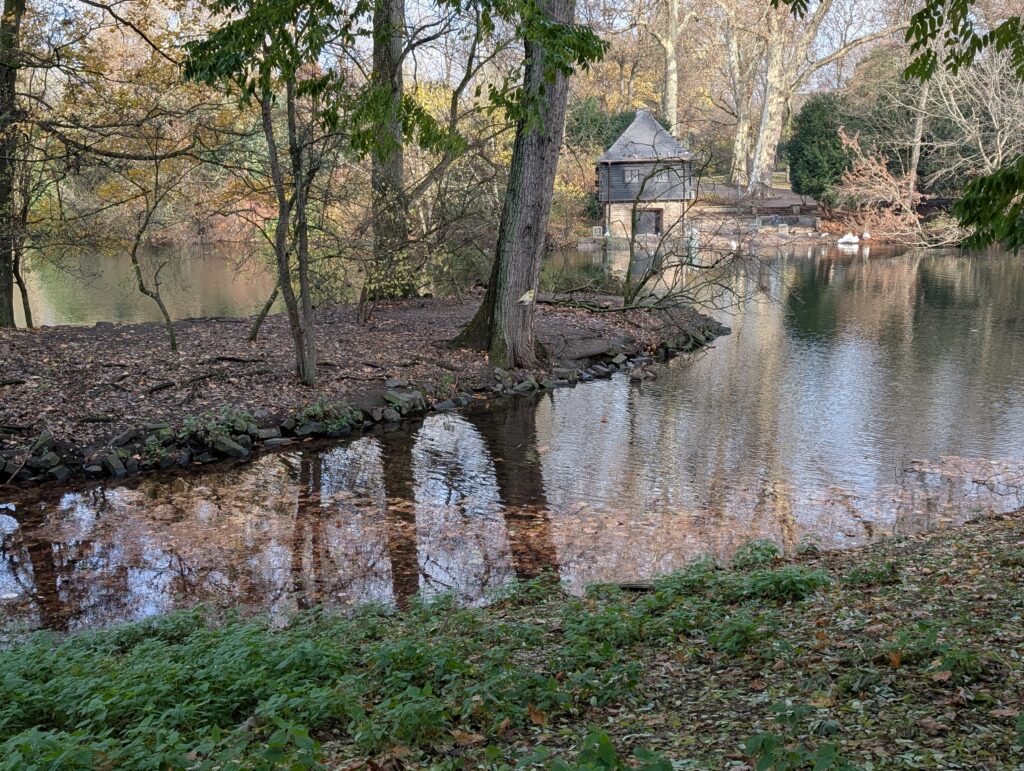
The next morning we went to walk in the Palatinate Forest to a very old stone tower (Humbergtum) to look at the views.
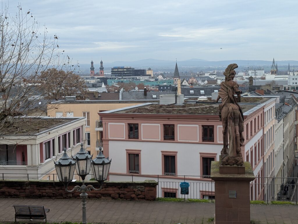
It was a beautiful day and the views from the top were amazing.
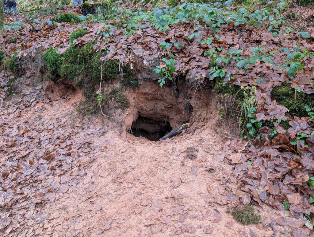
We also noticed that there were some holes in the ground, possibly a badger or hedgehog.
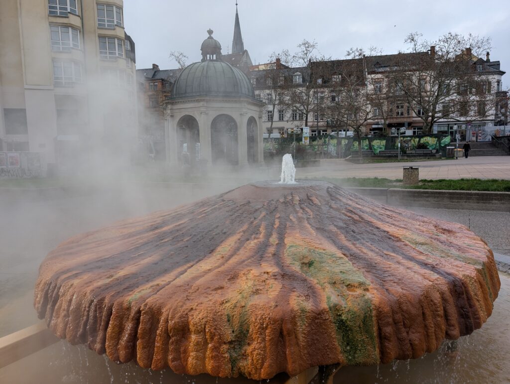
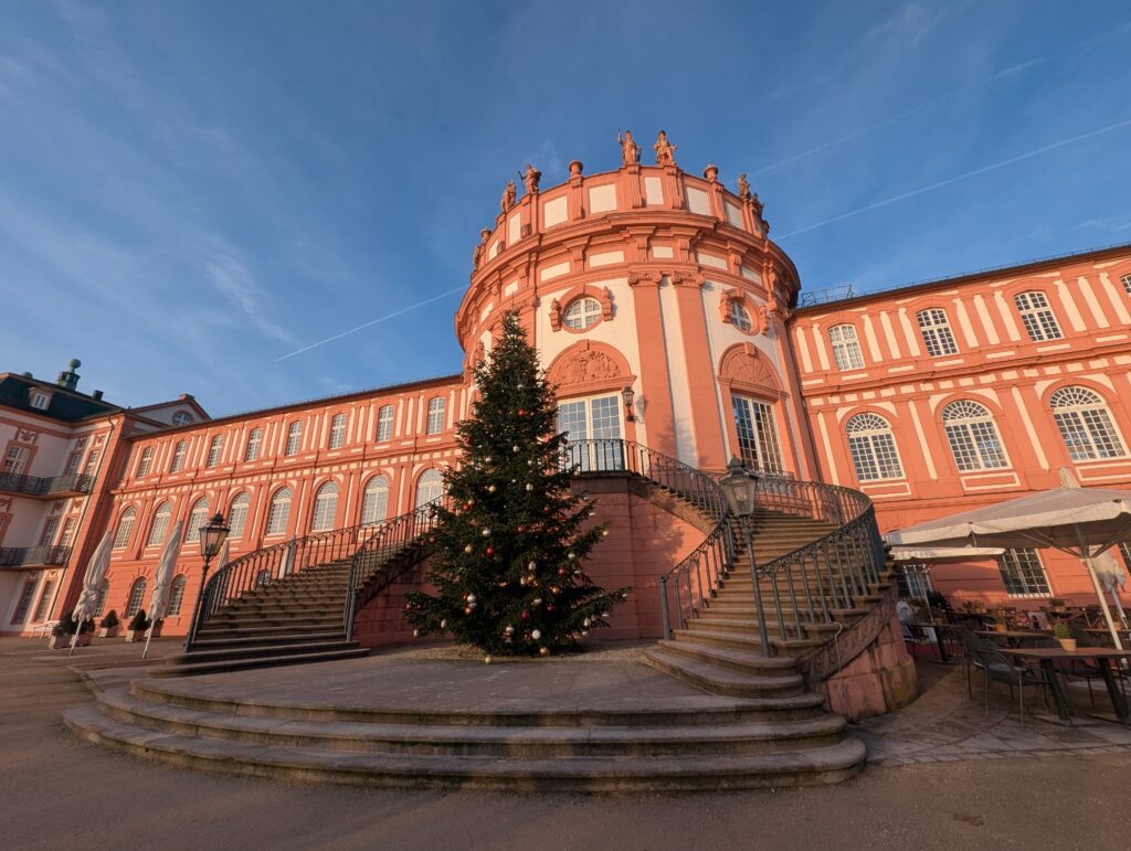
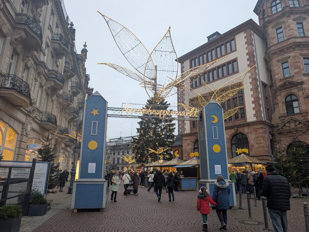
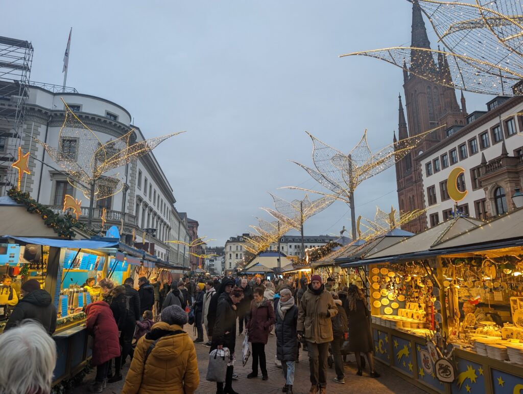
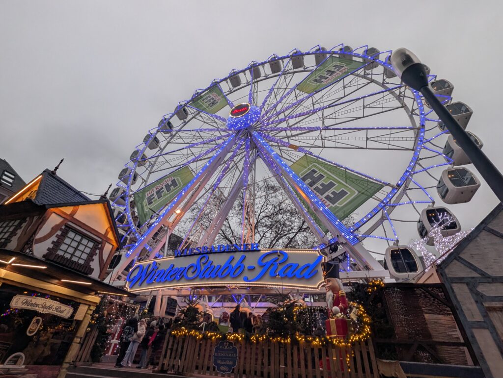
Wiesbaden is a short train ride from Mainz. It was founded in 6 CE and became an important spa town for the Romans. in fact, there is a fountain where the hot spring runs near the surface, called Thermalquelle Kochbrunnen.
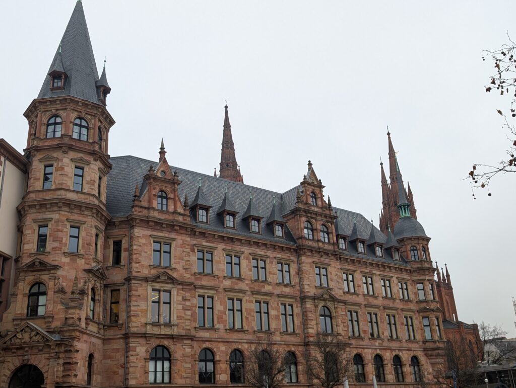
It has been and is still known as a spa town and is one of the wealthiest in Germany. It suffered less damage during WWII and has generally been a protestant city.
Roman wall
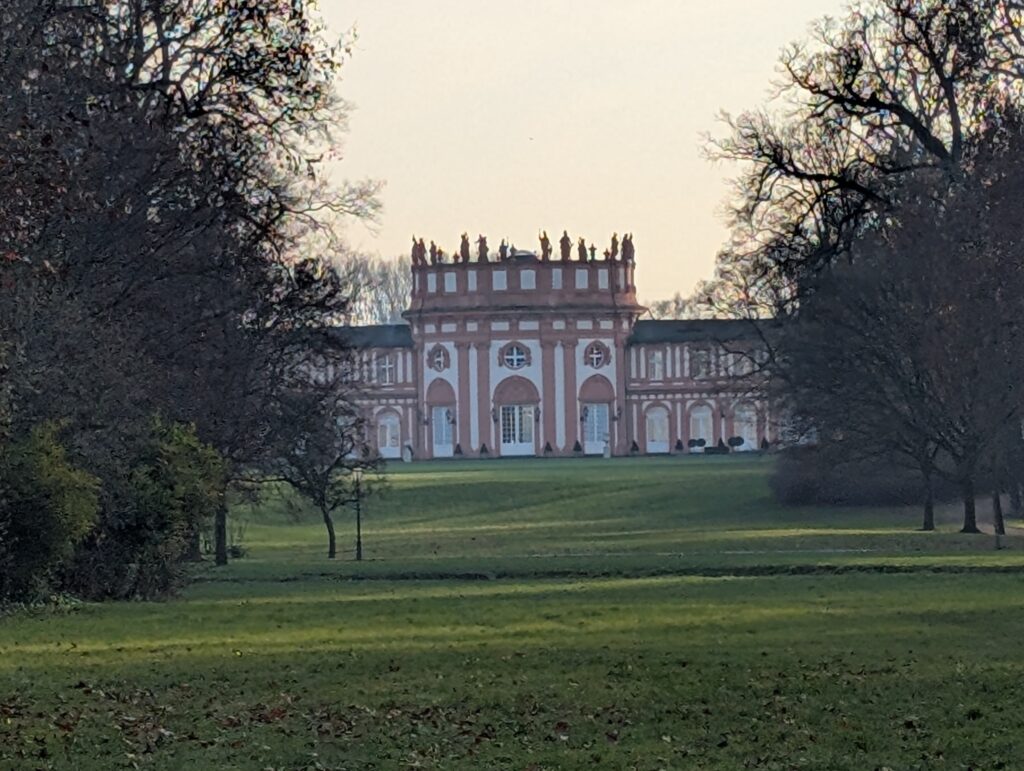
Schloss Biebrich. I really wanted to visit this palatial house but it was closed for the season.
Mainz was founded by the Romans in 13 BCE and called it Mogontiacum. It had a large population as it was a military and administrative center, helping to protect Roman front lines to the north through the use of the Rhine River. Roman walls were found when excavating for construction.
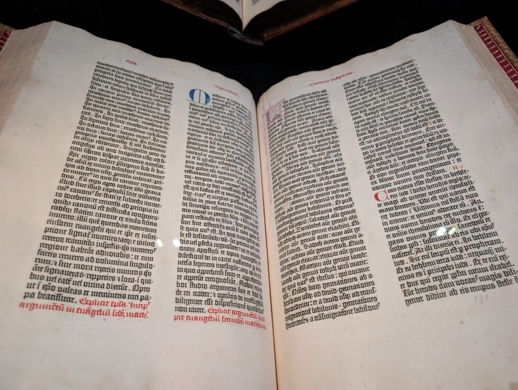
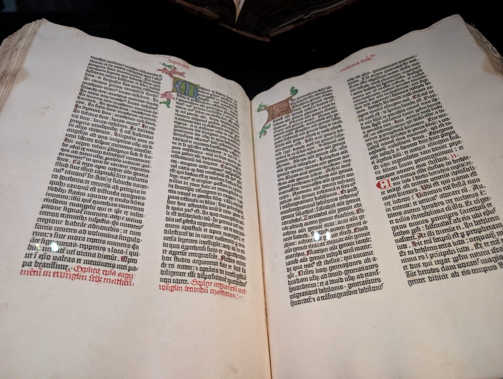
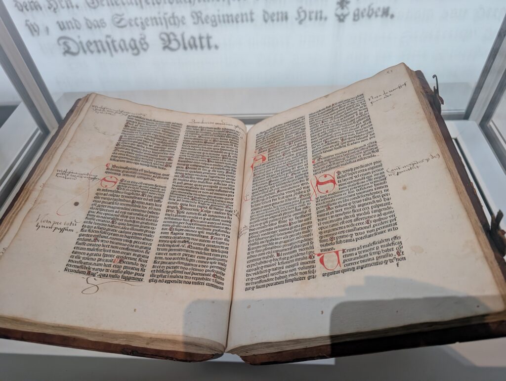
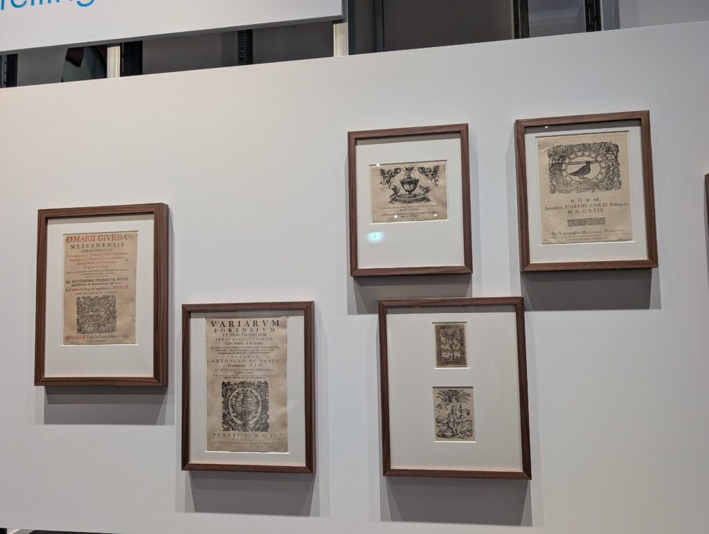
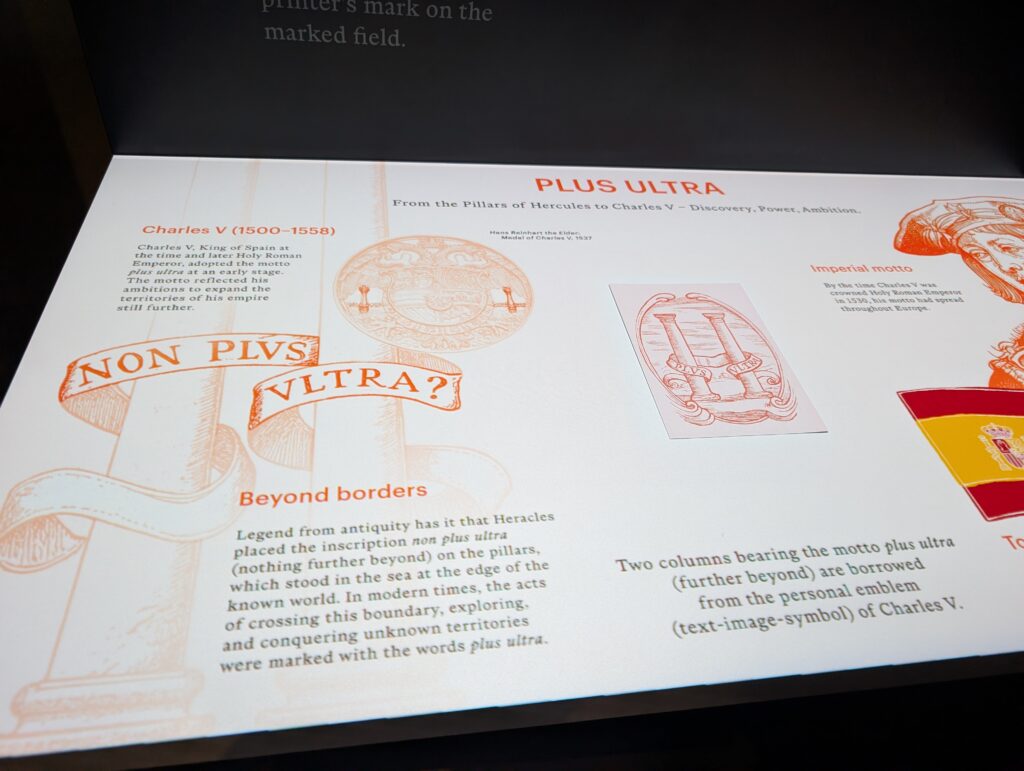
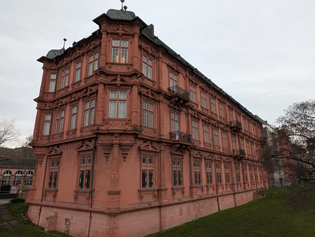
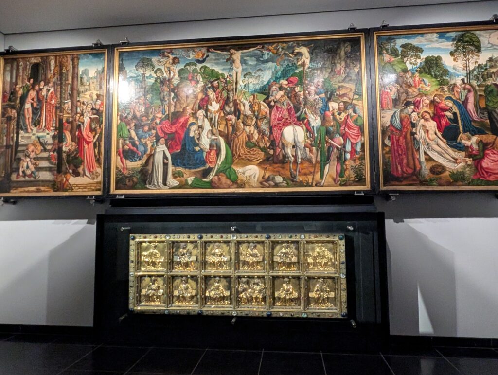
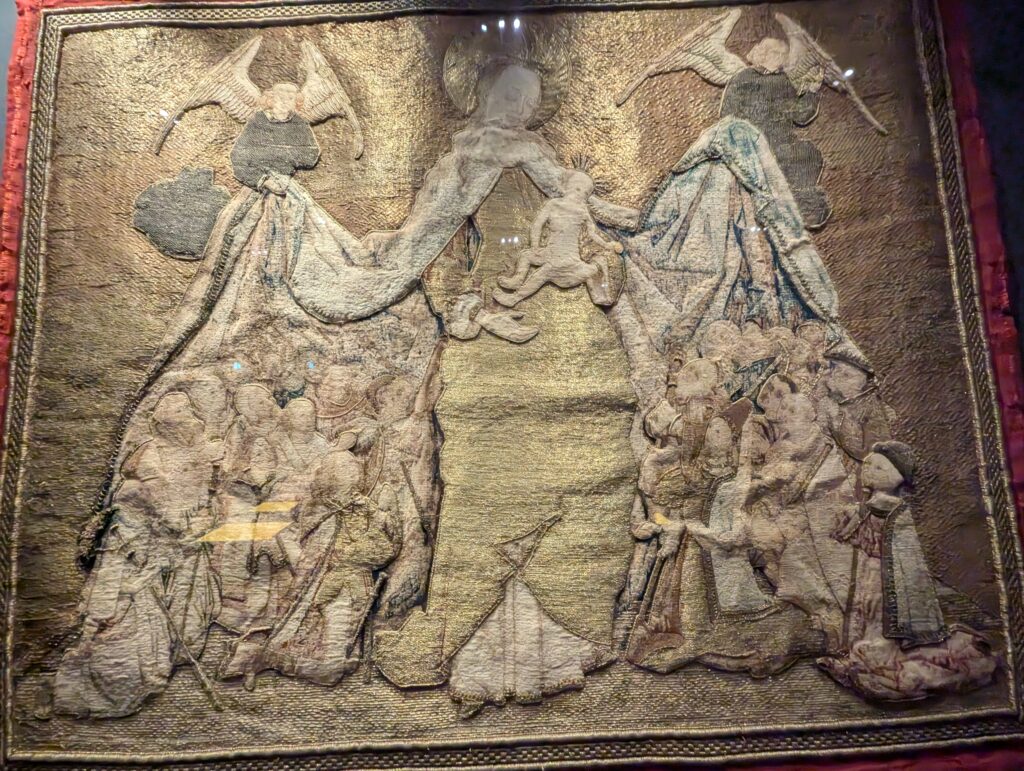
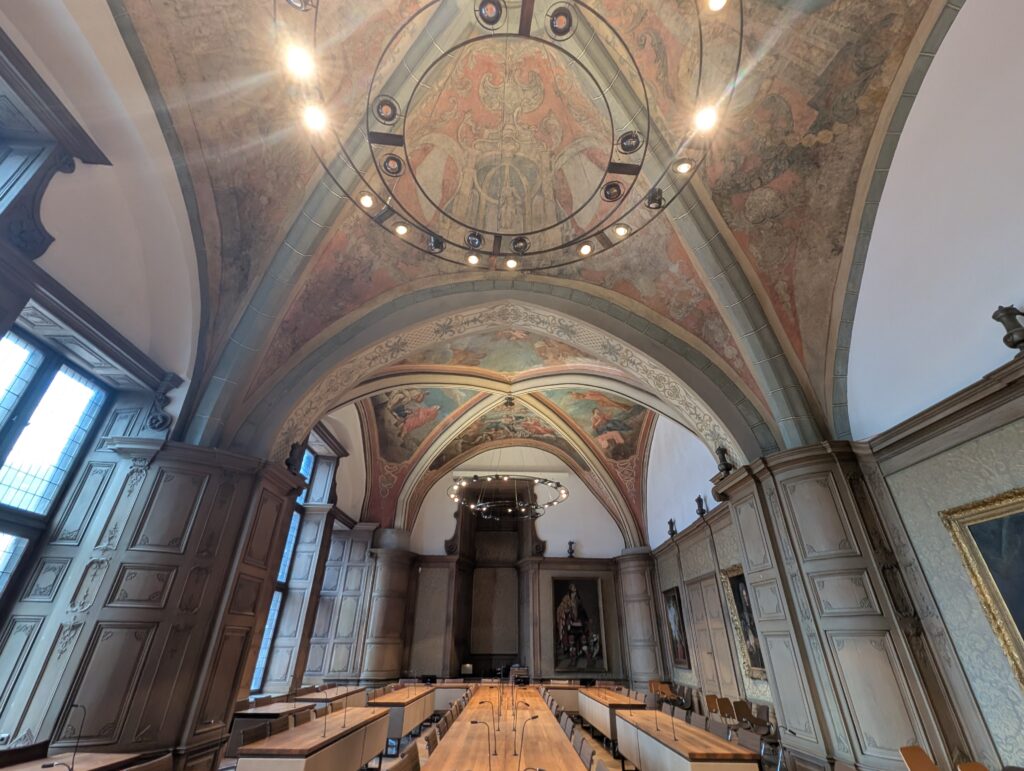
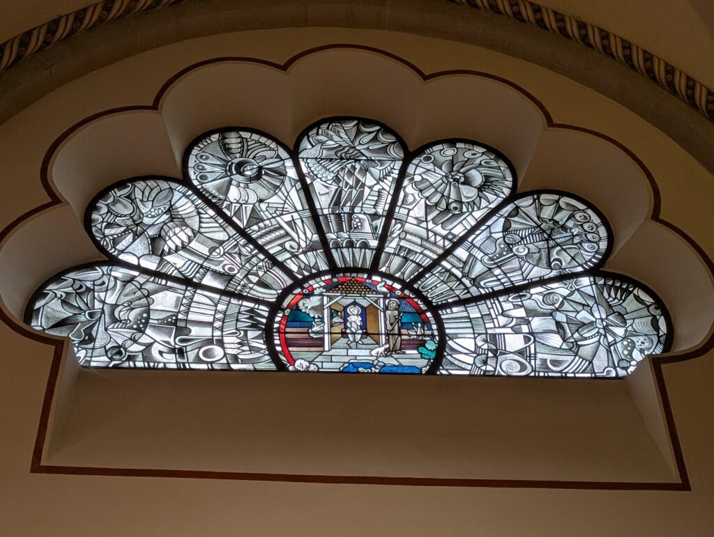
It became an important Christian city in the 8th century. In 1450, Gutenberg revolutionized printing by using moveable type. He was born here and there is a great museum in his name here. It uses many different types of the chnology to explore and explain printing changes through the years and how people’s lives have changed. They have some very old books in their possession including two original Gutenberg bibles. Of the 180 that were printed. Only 49 have survived. Two of them ar hermano in a vault that you can see. Each column has 42 lines of text. These were printed d in 1454.
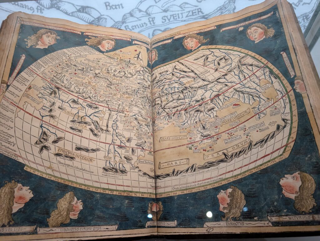
I found the different maps that were on exhibit fascinating. Depending upon the printer, it showed what was known of that day or what that person believed was most important. For example, there is no Americas in this map as it had not been “discovered” yet (1493).
The Hammer of Witches was printed for those to identify and deal with witches. It unfortunately was used heavily after printing in 1486.
They used a special media card that would display information when placed under the scanner.
There are other museums in the area. Landed museum Mainz has Roman and medieval history.
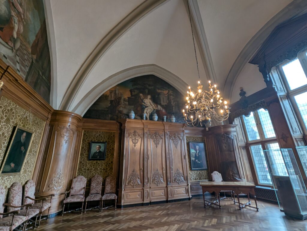
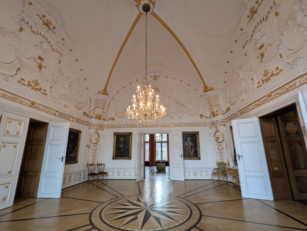
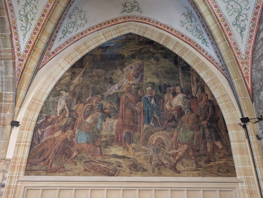
Kurfürstliches Schloss, a 17th century palace.
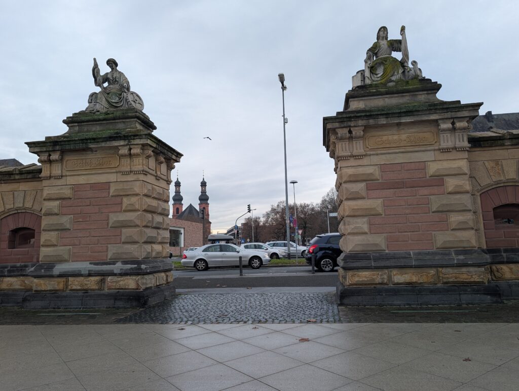
Schlosstor, Castle gate that is beside the Rhine.
Other sights in Mainz:
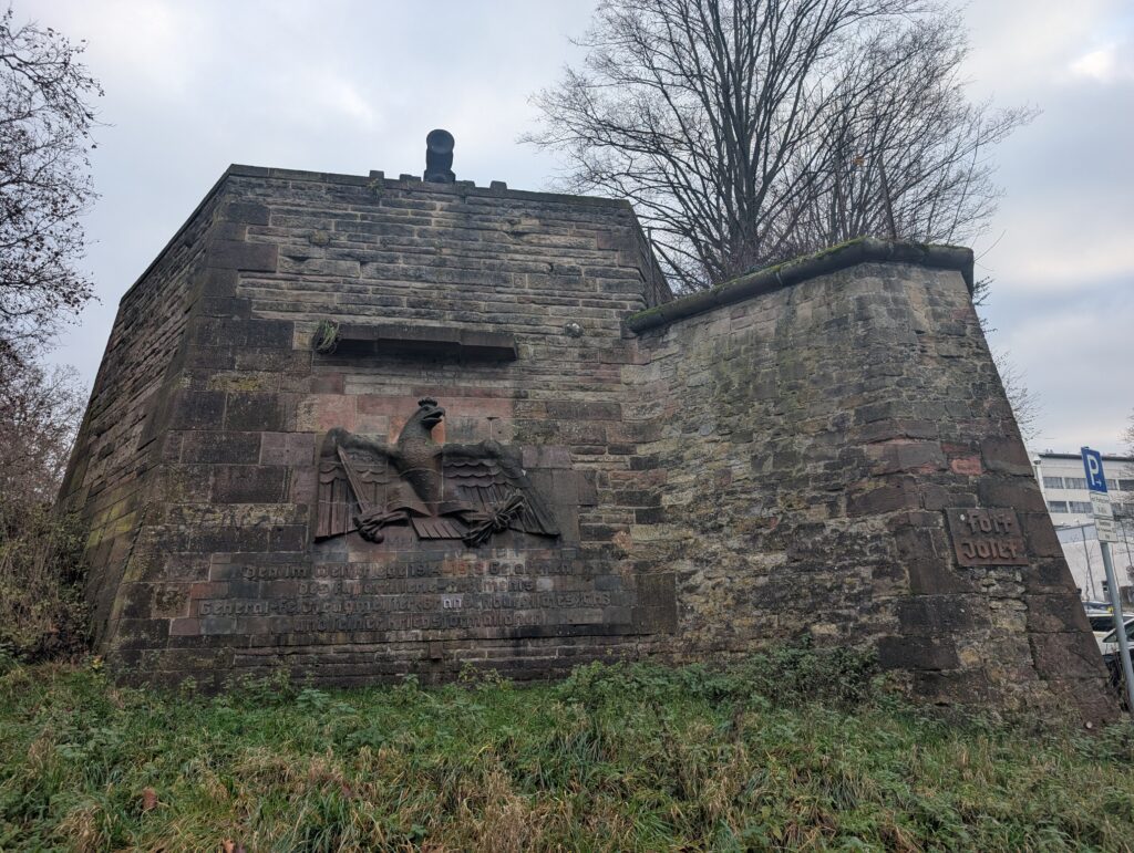
Fort Josef
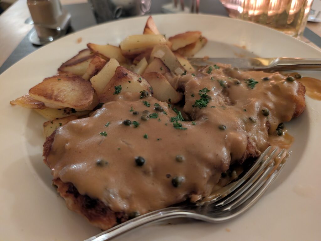
I had not tried wienerschnitzel yet, and I found a restaurant (Stadthaus Schänke) with a peppercorn one. It was delicious.
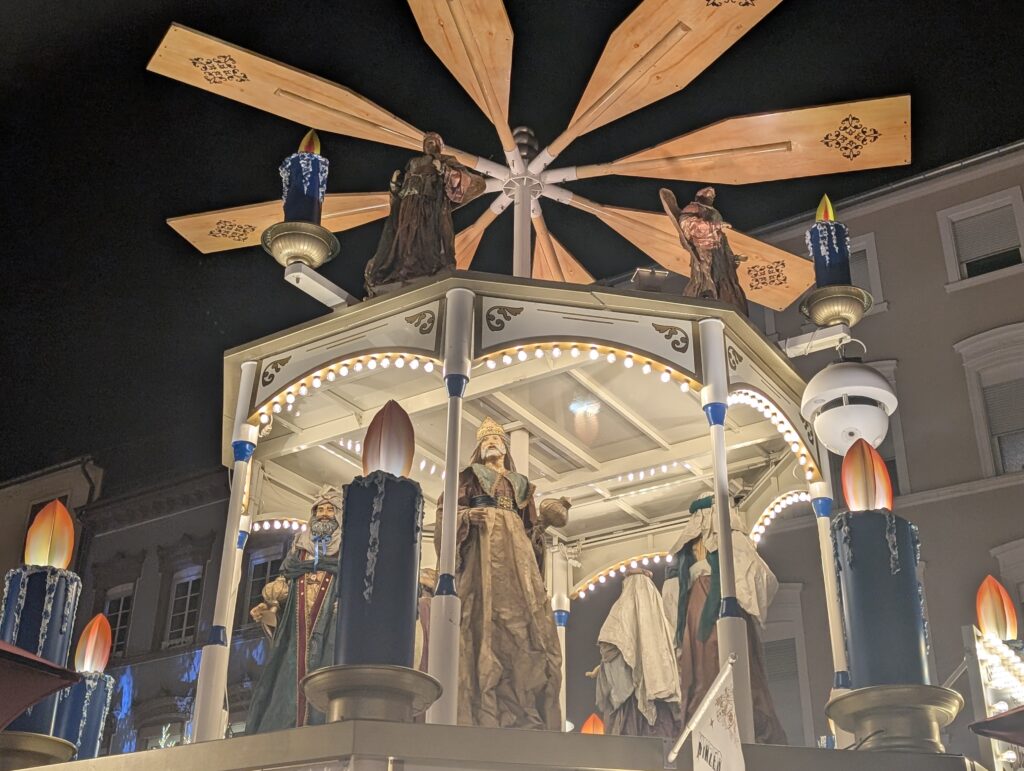
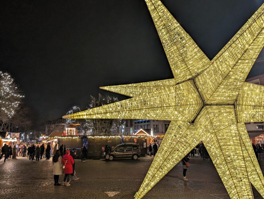
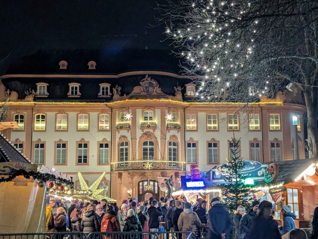
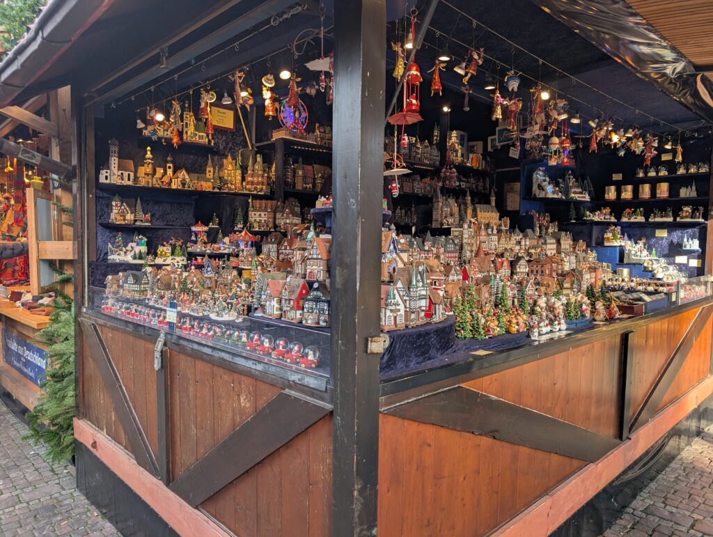
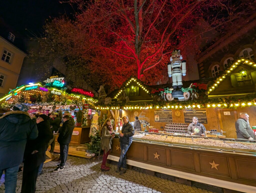
And of course the Christmas markets
Like other areas of West Germany, they were under Napoleanic rule, part of Prussia, and largely destroyed in WWII.
I have been pet sitting in Stommeln, taking care of two adorable cats and a whole bunch of poultry: chickens, ducks, and geese. In some ways I have missed having a farm (but not being unable to vacation often). It was a also a good time to relax, get back into an exercise routine, and catch up with shows and emails, etc. There was a small Christmas market over the weekend.
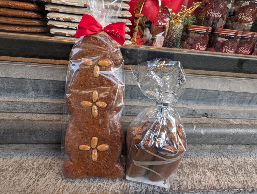
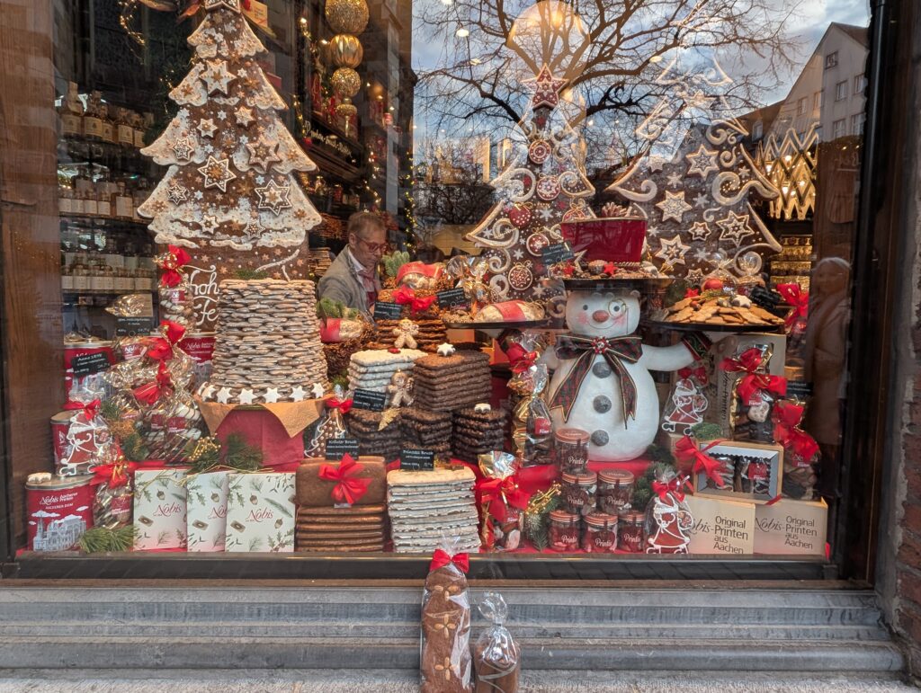
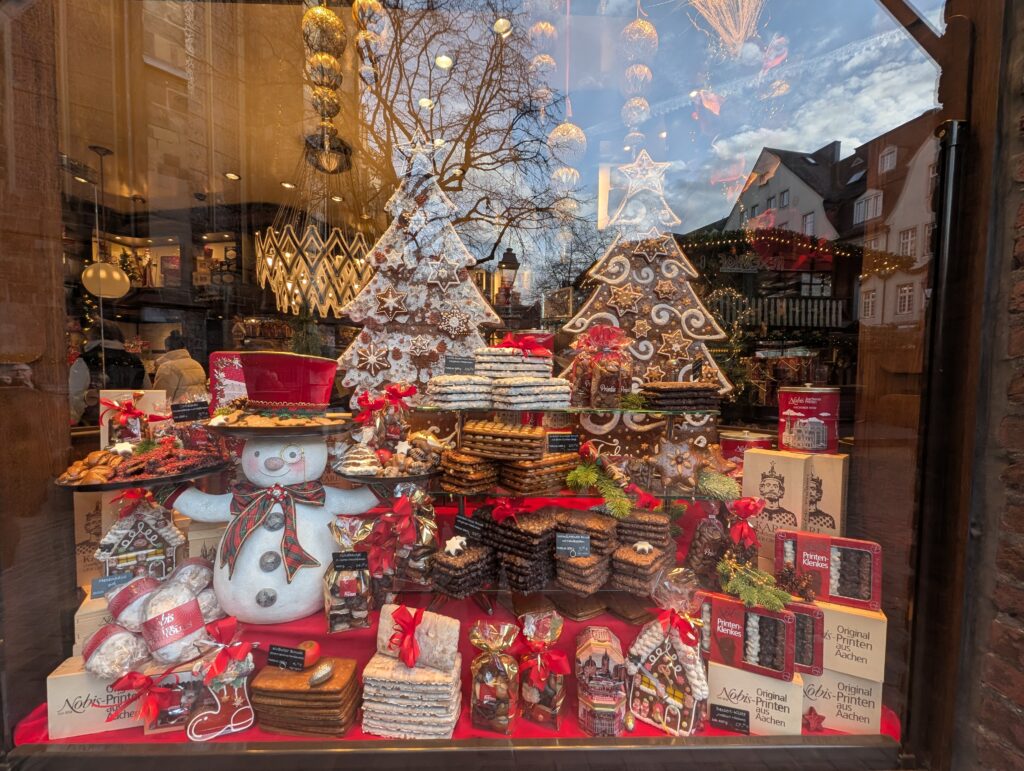
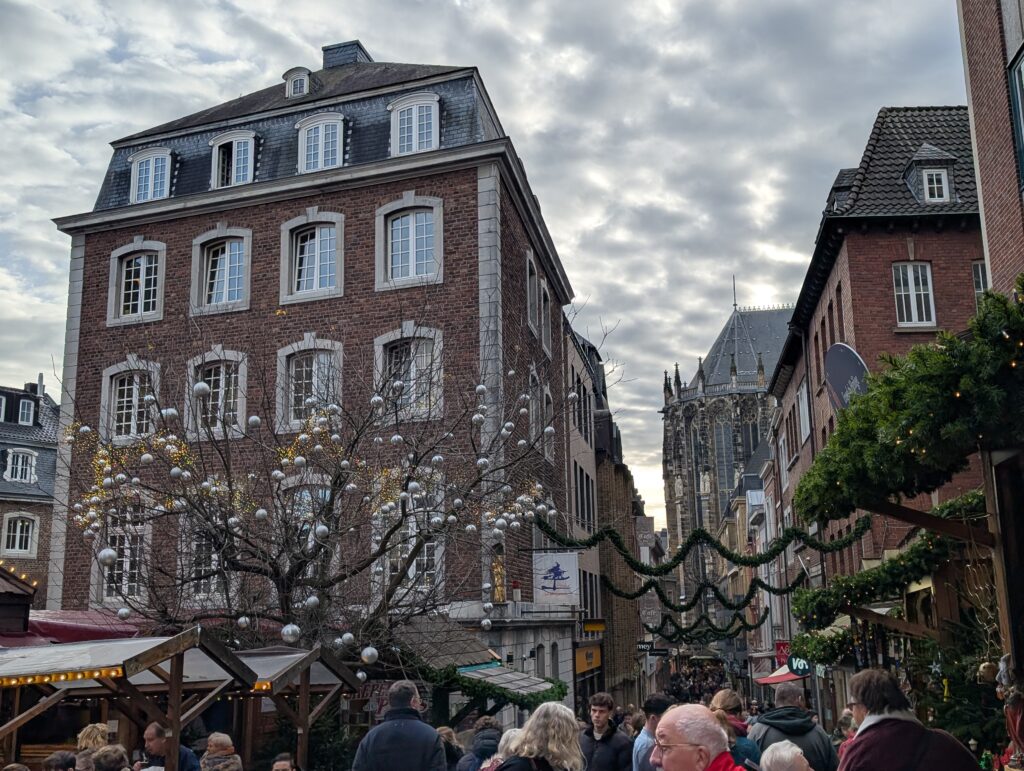
Sylvia and Thorsten were wonderful and even had me stay an extra day to visit Aachen which is a town close to the Belgium border and the opposite direction action if where I would be traveling next. When I learned that Aachen is known for its gingerbread called printen. It is not like American gingerbread, with less spices and orange zest in the cookie. It was delicious.
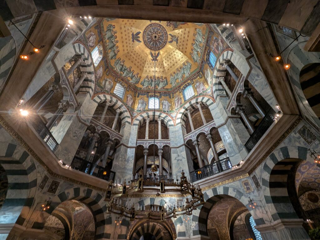
Aachen is one of Germany’s oldest cities having been founded by the Romans (it was called Aquae Granni) as there were natural thermal spring waters here. Roman baths were constructed. In 742, Charlemagne made it his primary residence and the center of the Frankish Empire. in 800, he built the Palantine temple. He was buried in the walls after his death and the present day Cathedral expanded upon those walls.
From the 10th through the 16th centuries, German kings were coronated in the cathedral. Because of the history and the relics here, it is also a major site of pilgrimage. It fell into decline after the 16th century, was under the rule of Napoleon and Prussia, and heavily damaged in WWII.
The inside of the cathedral:
The sarcophagus continuing the remains of Charlemagne.
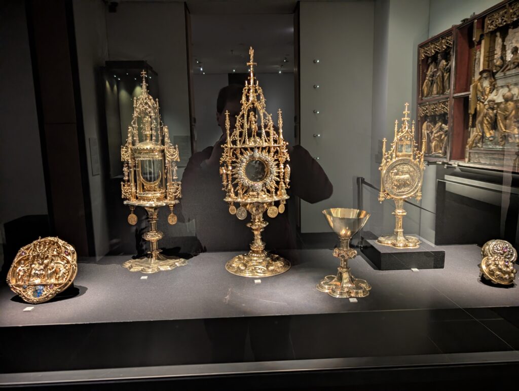
The Aachener Domschatz is the location of the relics from before and the early years of the cathedral built in 1215.
The skullcap of Charlemagne.
The gilded arm that belonged to Charlemagne actually contains a radius and ulna bones that have been analyzed and believed to be that of Charlemagne.
The Rathaus is the town hall and was built on the foundation of the palace of Charlemagne.
In the upstairs, it has an impressive view of the cathedral and the square where the palace stood. Of course, there is a Christmas market there!
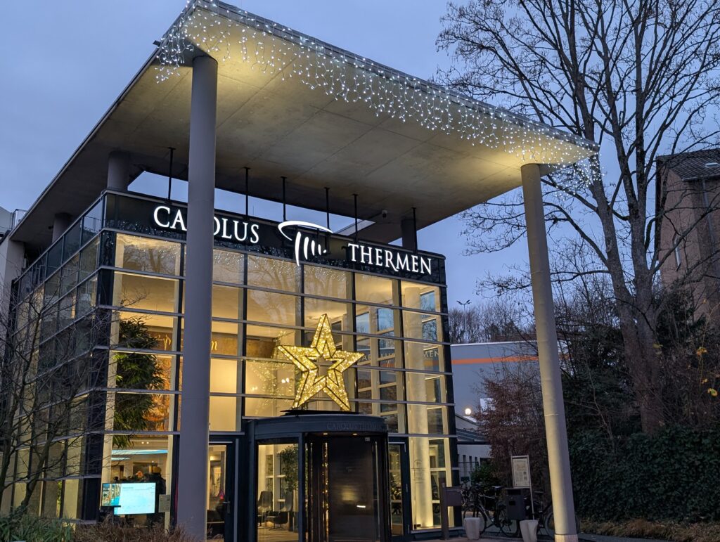
It is still known as a highly regarded spa town with the Caroluus thermen spa. Yes, I went to the spa and enjoyed some great relaxing thermal waters. In
Other photos from Aachen.
I also met with a friend of Sylvia’s to help her practice her English. She is an artist using metals and enamel. She wanted to show me how to make a necklace and gifted it to me which was so nice.
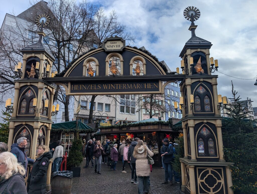
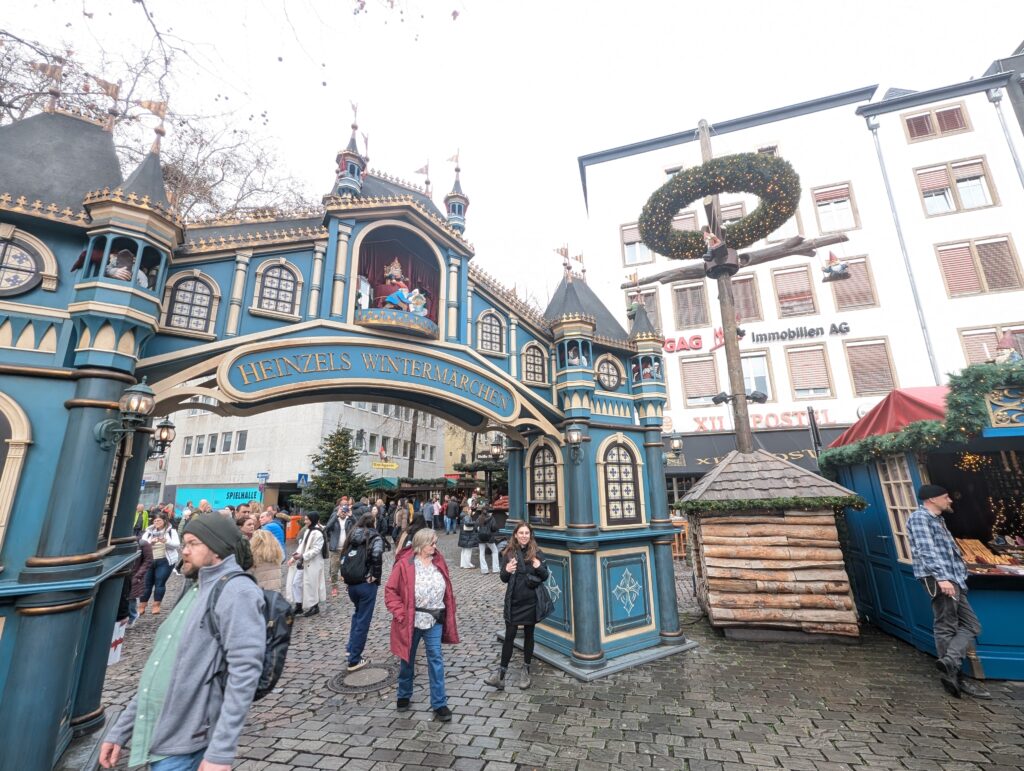
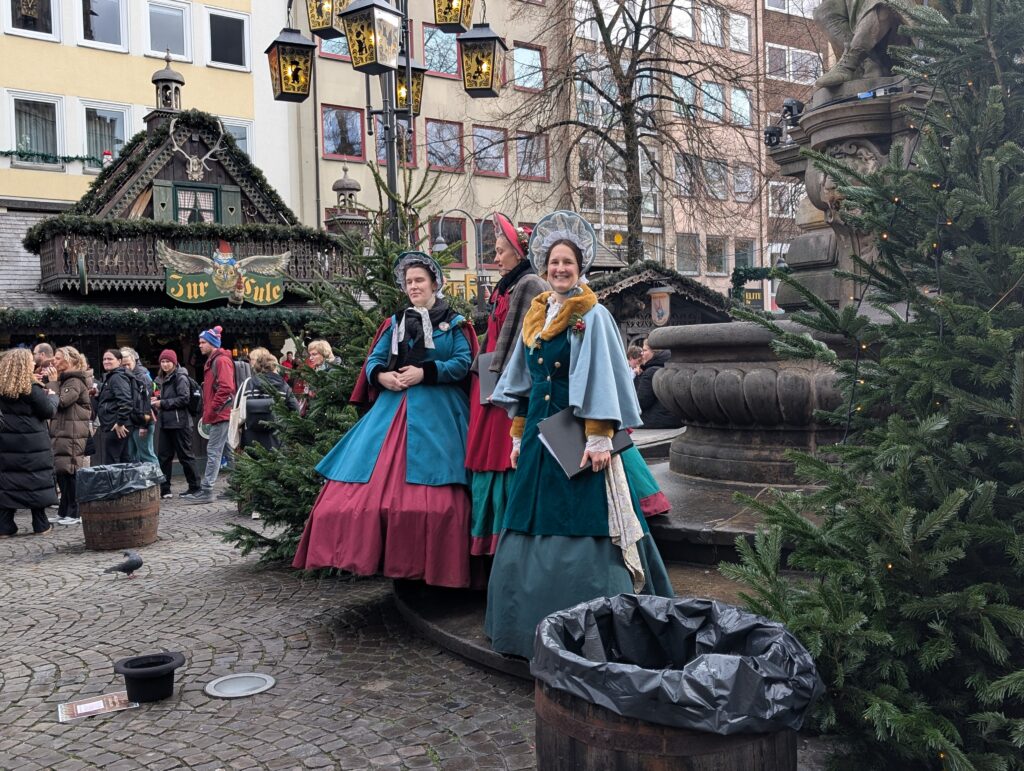
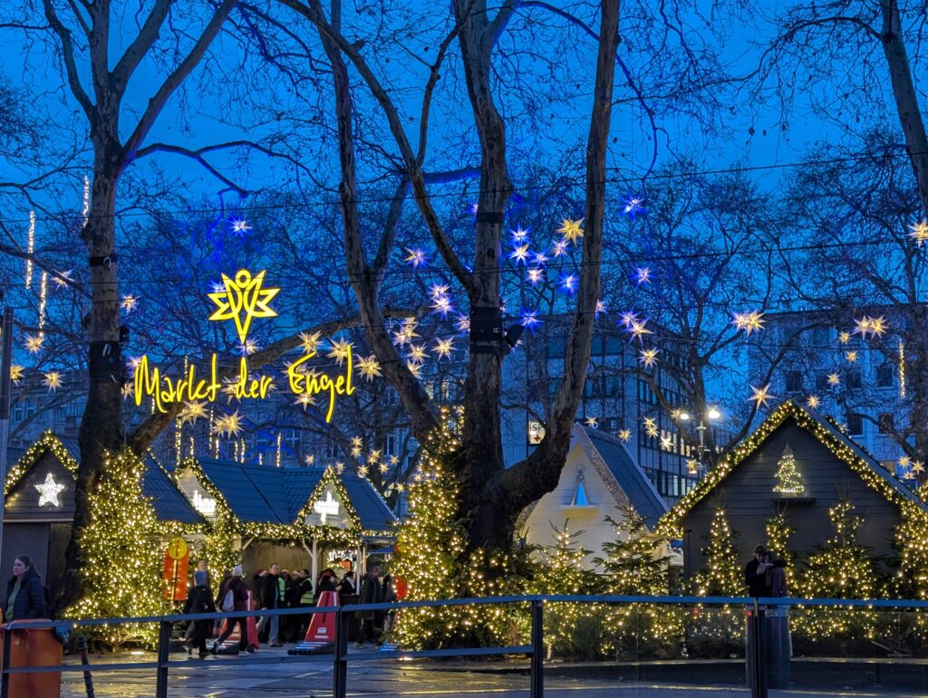
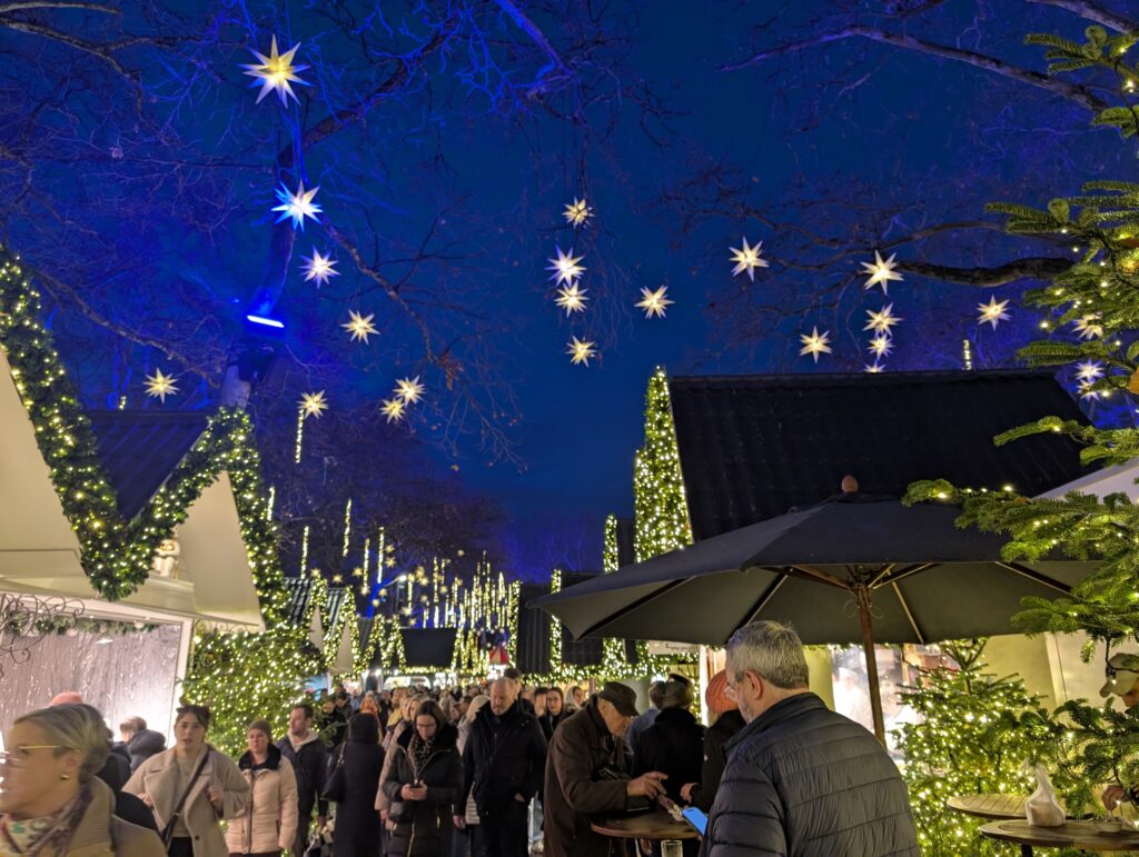
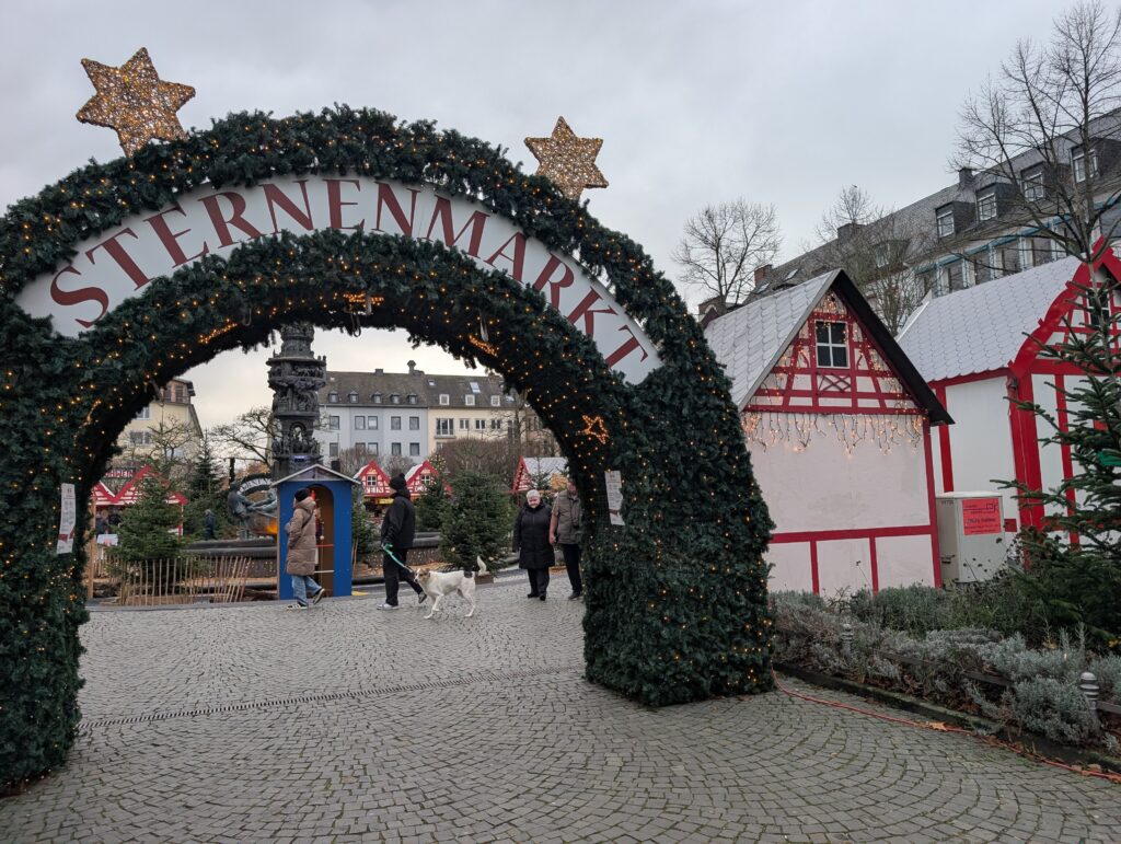
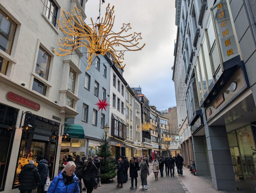
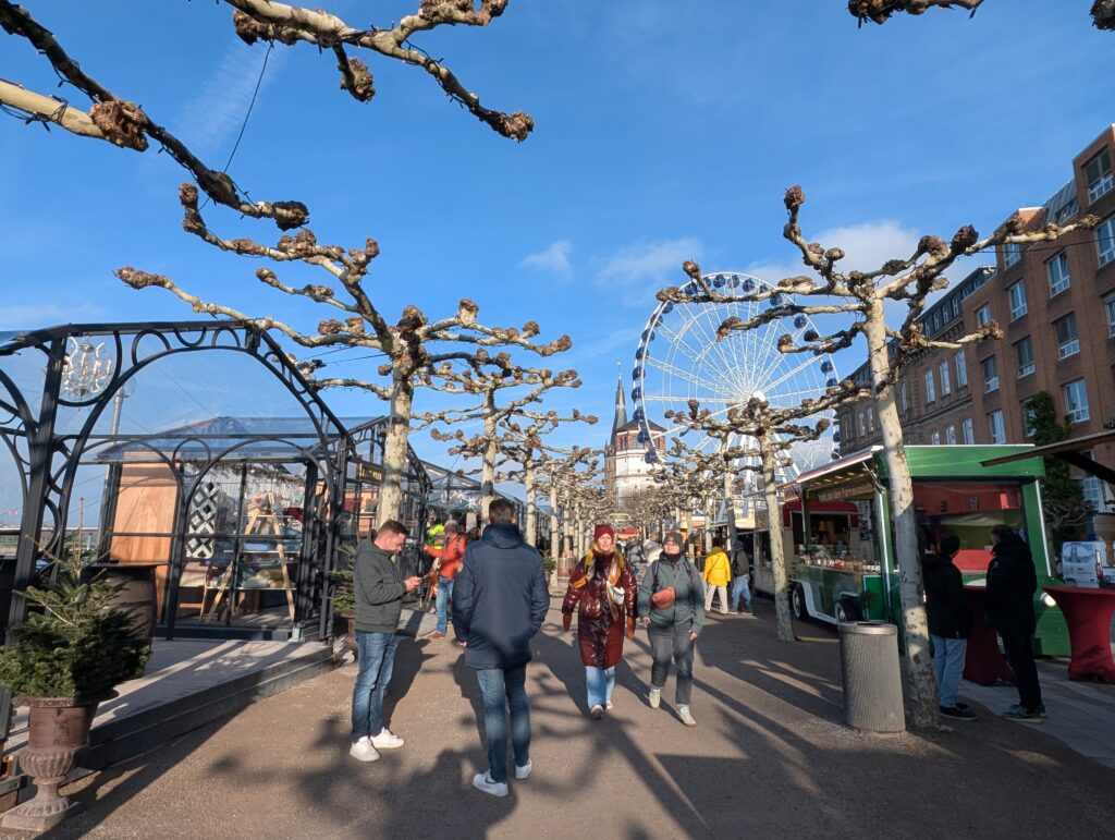
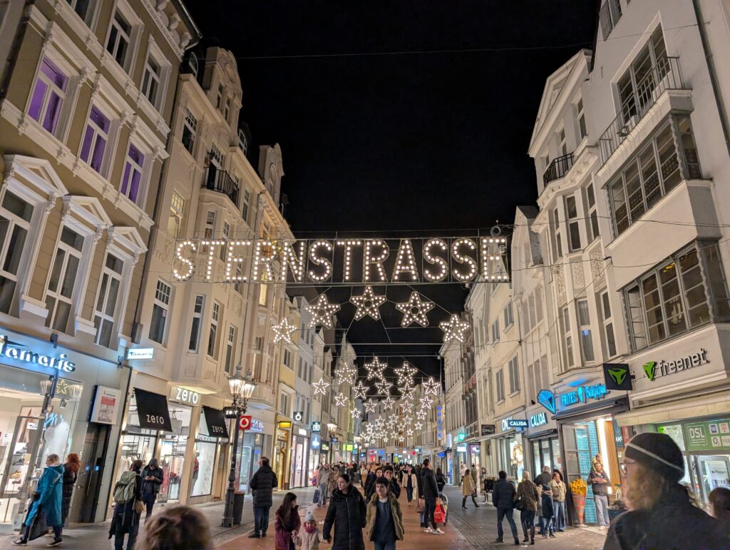
Originally Cologne was to be a day trip from Bonn but I decided I wanted to spend more time here than in Düsseldorf. Also, there is one Christmas market (and it is huge) that has gnomes as its theme: Heinzels Wintermärchen Weihnachtsmarkt Kölner Alstadt and down into the old market.
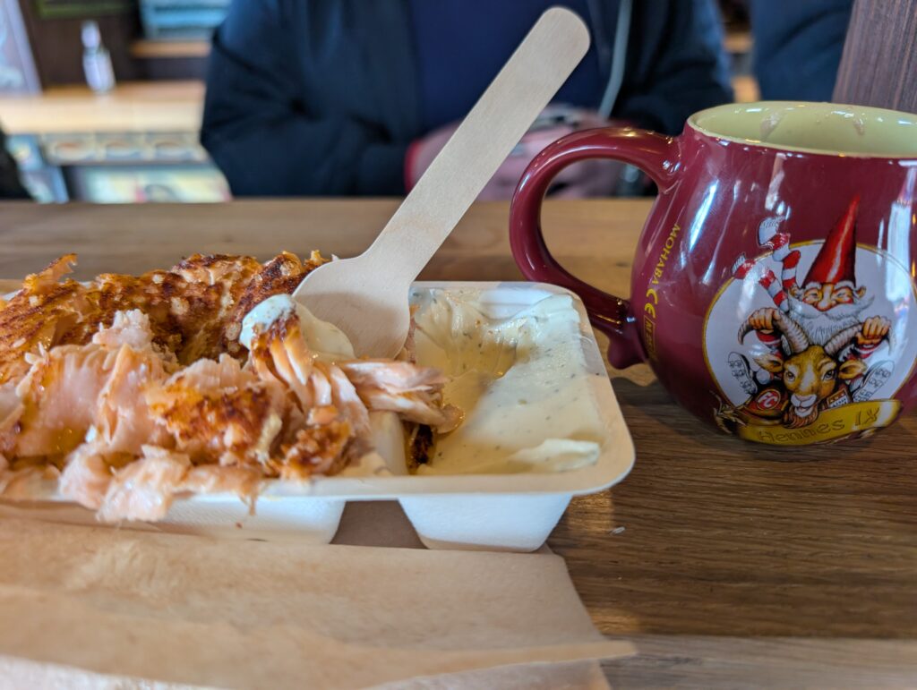
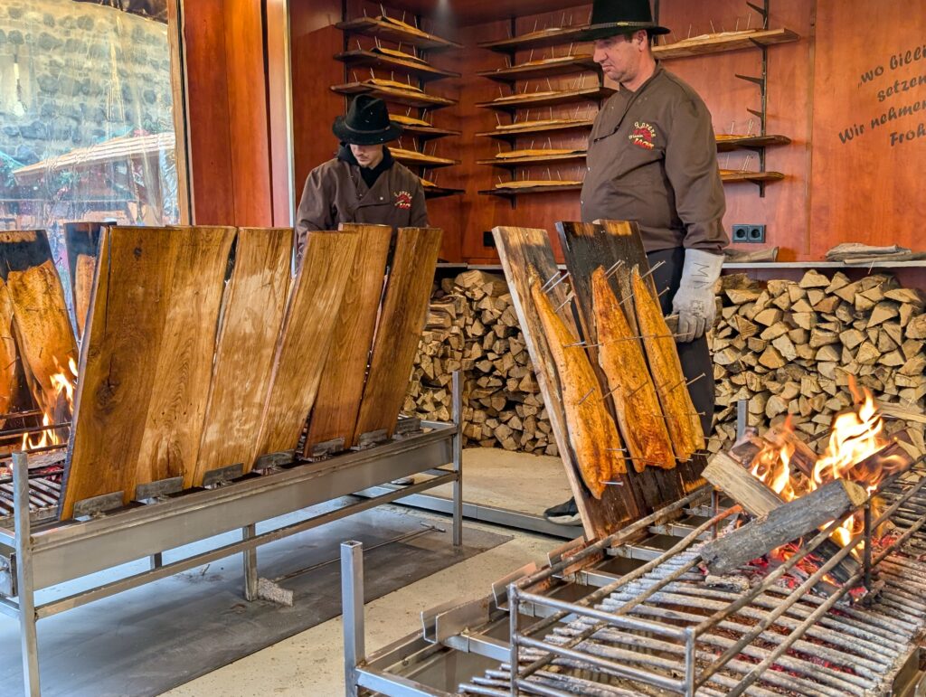
I have been seeing the salmon cooked on big planks on an open fire for several markets. Today was the day and it did not disappoint. I also wanted to go to this market with the gnomes and found a mug with a goat on it. Fitting since I am a Capricorn. I did have to search a few stalls to find one that had that mug.
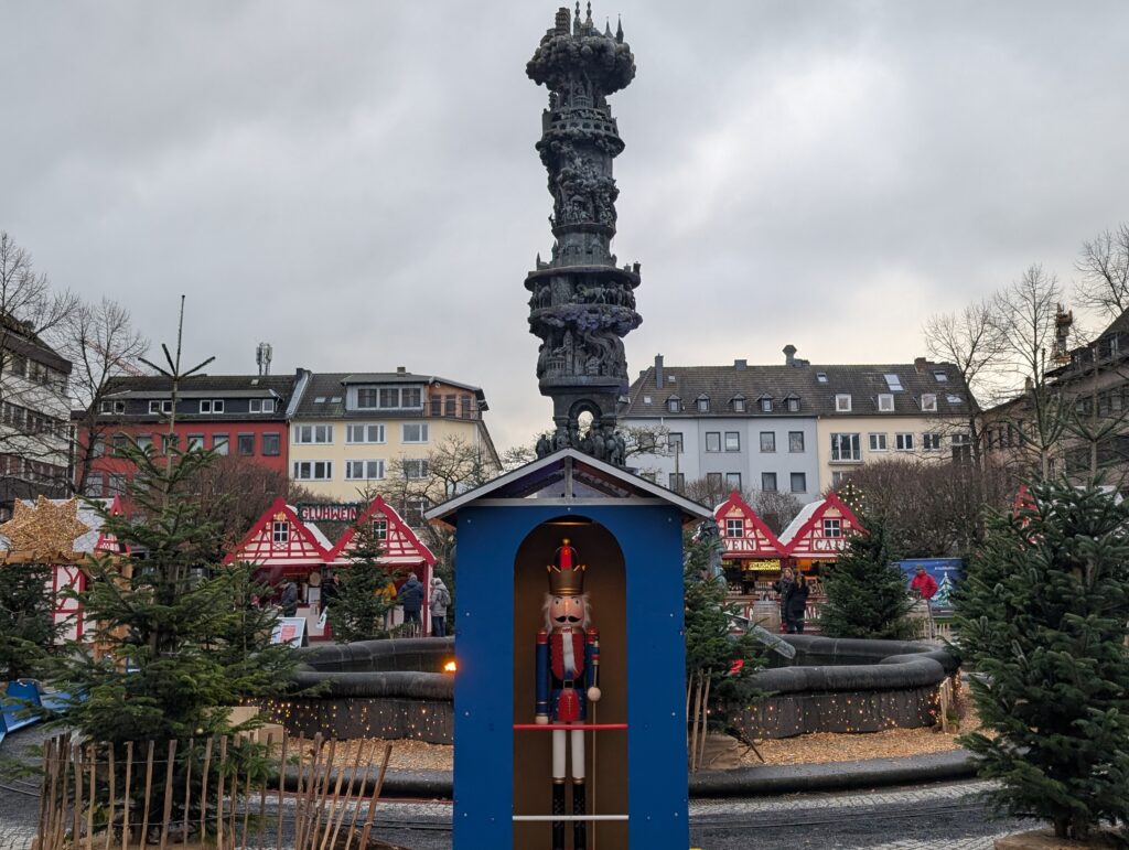
Petrusbrunnen is the fountain of St. Peter of which the cathedral is named. The fountain wasn’t always here nor had a water source since 1870 and was nicknamed Dry Peter. Now in its location it has water and he is said to be holding keys to heaven.
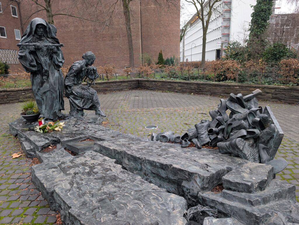
Edith Stein Denkmal was executed in the Holocaust. The scenes are from her life and the shoes represent what was left from her and all those massacred.
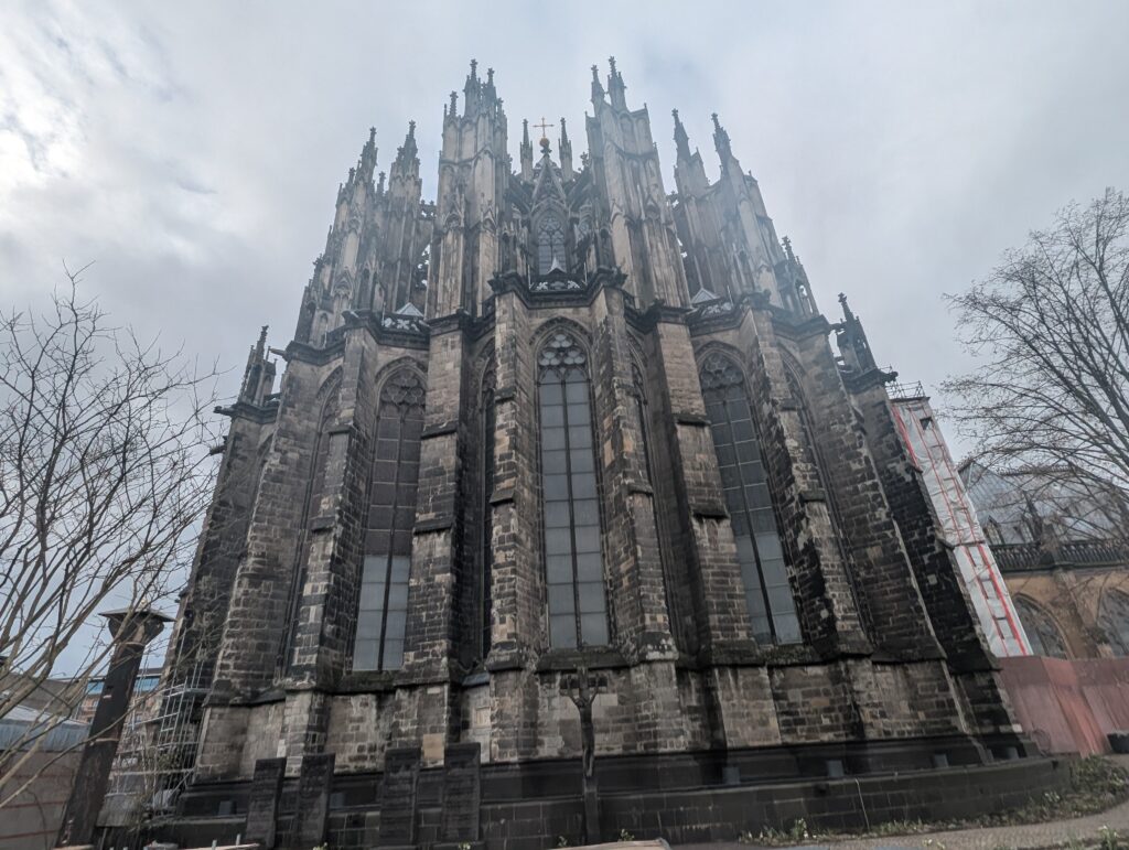
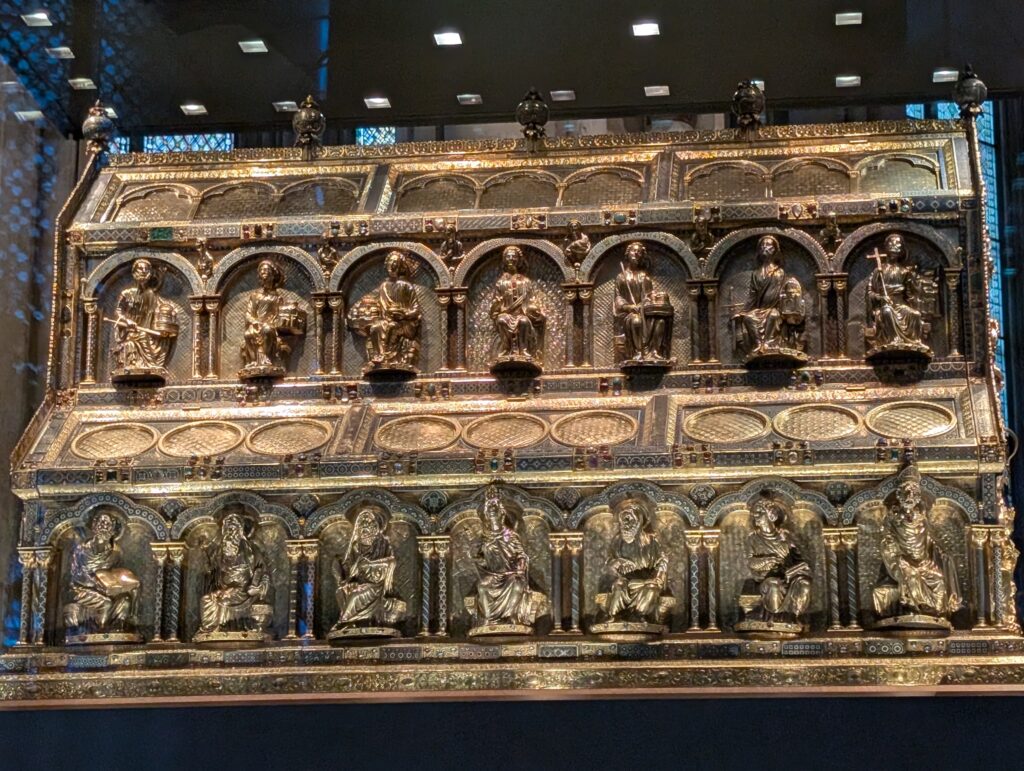
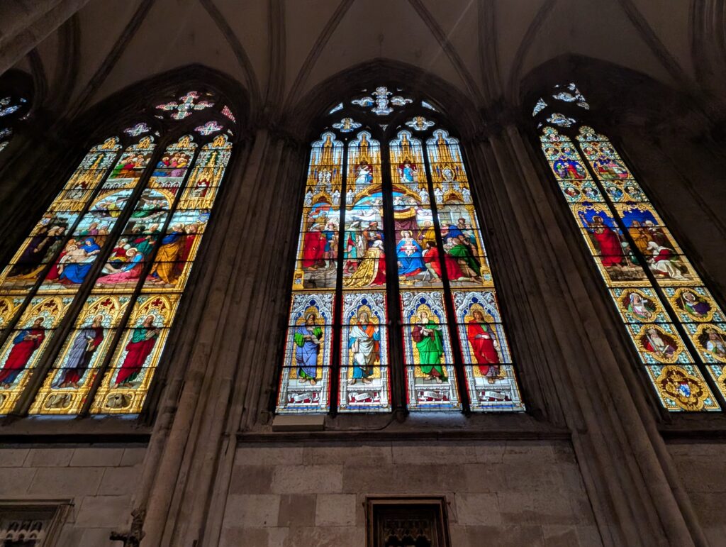
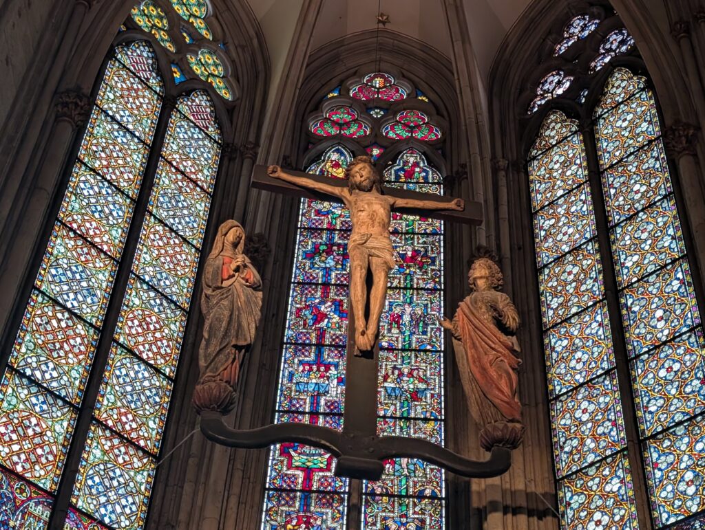
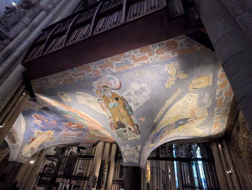
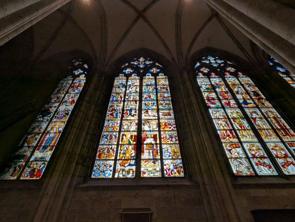
The Dom of Cologne. This is actually not aligned to the Catholic Church and is owned by the people of Cologne. It is free to enter.
Inside the cathedral is a huge, golden reliquary — the Shrine of the Three Kings — built in the 12th–13th century. The relics arrived in 1164, brought from Milan by Archbishop Rainald von Dassel. The Dom is a major pilgrimage site as a result.
Other Christmas markets
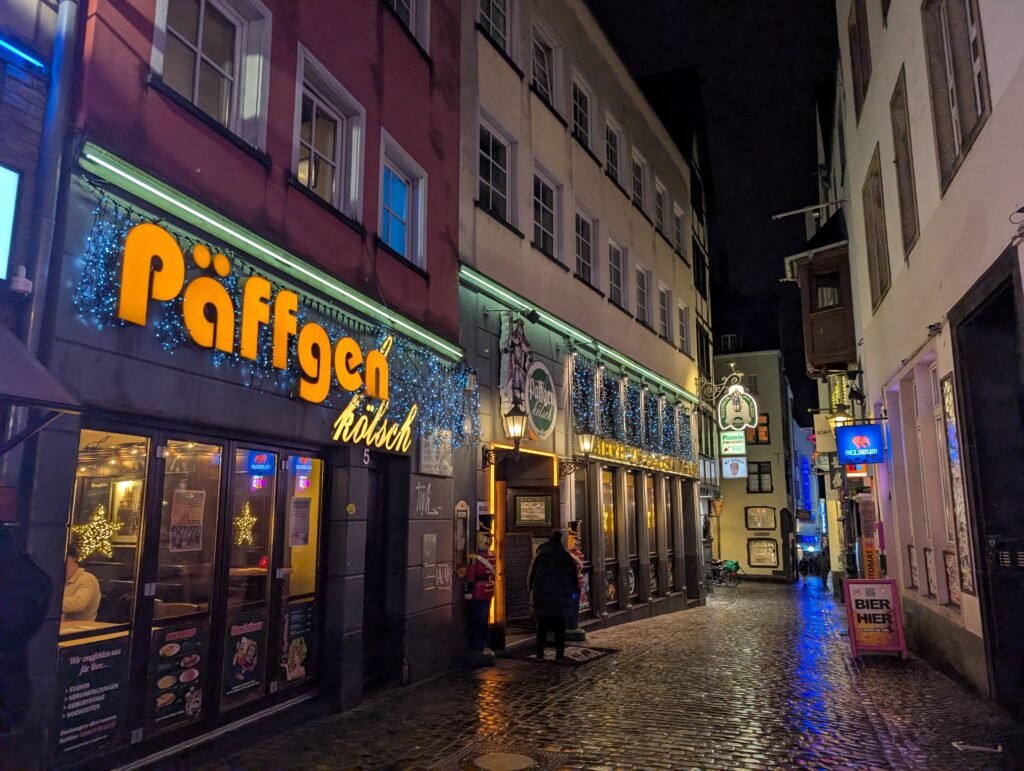
Instead of a regular walking tour I decided to go in a beer tour as the Kölsch beer here is regulated much like champagne is in France and only found in Cologne. It is crisp and light and a too fermented beer which can go flat relatively quickly. Because of this it is served by köbes (waiters) in tall narrow glasses called a stange, not like the big mugs we are used to, to prevent it from going flat. The köbes will keep bringing beer unless you put a coaster on top of your glass.
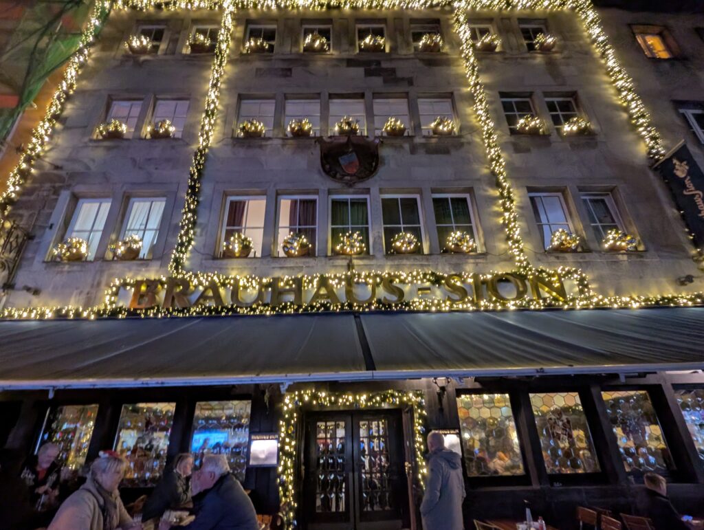
These are three popular beer Haus.
Any effort to tax alcohol leads to revolt and there are a few statues on buildings that show displeasure.
This statue is of a popular old comedian duo (Tünnes and Schäll) here in Germany and it is said that you can have luck, love, or money by stroking the nose or sliding your hand across the chest of the one on the left.
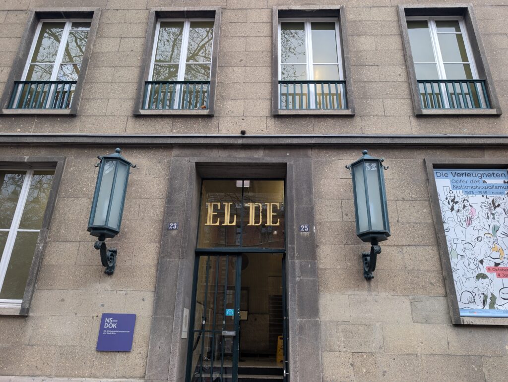
When I saw there was a Gestapo headquarters, I knew I needed to see it. I didn’t expect it to be so powerful and gut wrenching. If you go here, the audio guide is a must since most things are in German and the stories included help in understanding.
Cologne was one of the largest cities in Nazi Germany and an important center for both oppression and the resistance.
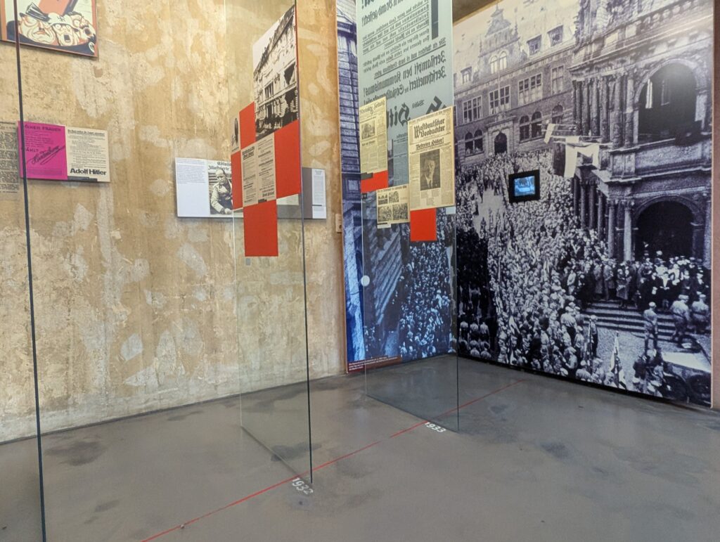
The Gestapo in Cologne. The Gestapo (Geheime Staatspolizei, Secret State Police) established a major regional office in Cologne soon after Hitler took power in 1933. The museum laid out what happened in the 10 years before Hitler took power and all the subtle and not so subtle changes that took place during that time. The timelines on the floor that showed the span in years as you were walking through really brought it all together. As I walked through the area of the changes in societies, attitudes, and how Nazi ideology was slowly permeating throughout, I really felt heavy in my heart and a pit in my stomach with all the parallels currently happening in my country and the world. It was depr swing and terrifying.
The main Cologne Gestapo headquarters was located at: EL-DE-Haus (Ehrenfeld district / Appellhofplatz) and named after the owner Leopold Dahmen (L.D.).
The Gestapo rented the building from him.
Propaganda beginning in 1918. The Jews are our downfall…
The rise of Hitler in 1932/33.
It became one of the most important Gestapo branches in western Germany because Cologne was: a major industrial city that had a railway hub near Belgium and the Netherlands. It was also home to large Catholic and labor communities (viewed as “unreliable” by the Nazis). From 1935 to 1945, the building was used for Gestapo offices, interrogation center, and prison and torture site. It went through all the officers involved, which it seems the majority did not see any trials after the war and were free to live normal lives despite what they did.
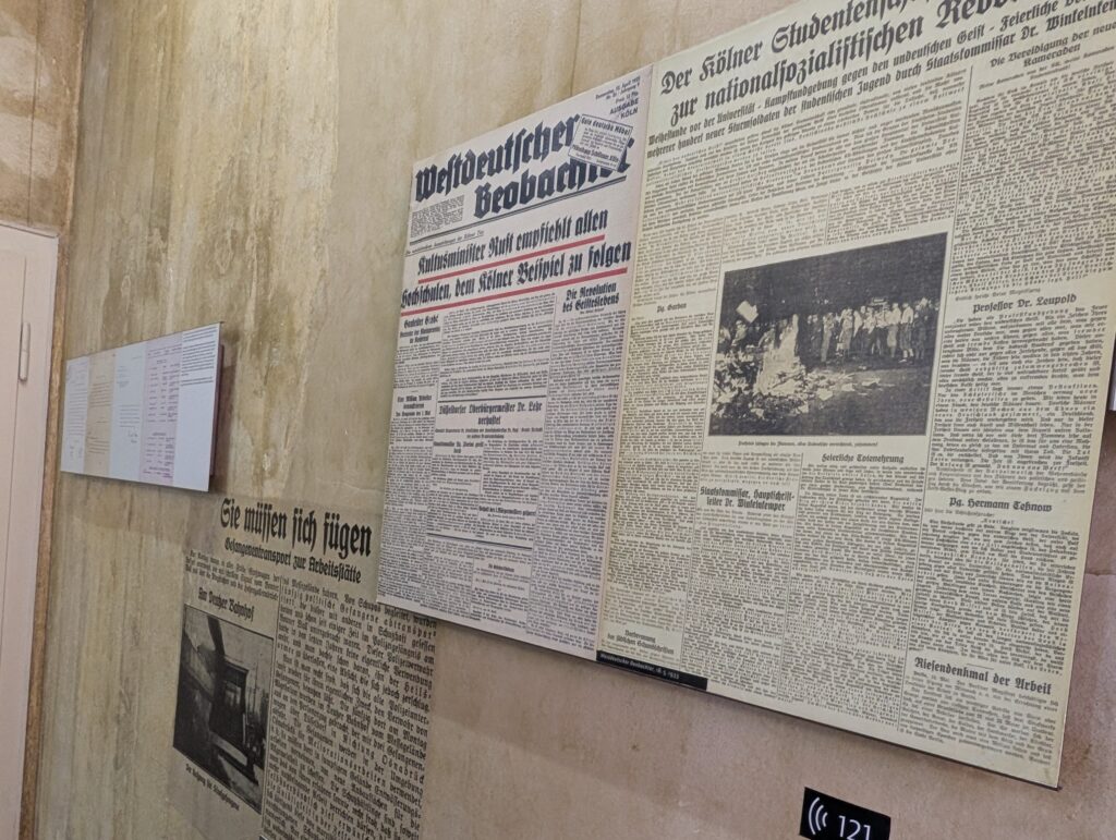
Burning of books is shown in this newspaper clipping. Getting professionals on board to force sterilization, teach the view of history they want, and to enforce any laws that moved fascism forward propelled the viewpoint. Many thought it would go away and stayed silent.
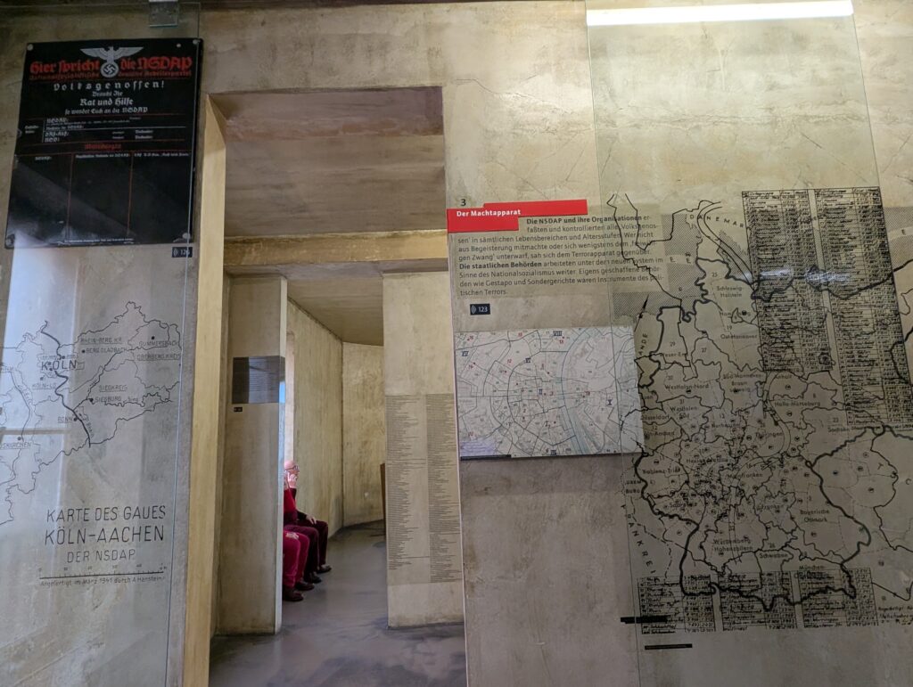
Groups and organizations that were in Cologne are listed on these panels. The ones crossed out were no longer allowed to be in existence. There is a whole room of lists of groups and those with no right to exist.
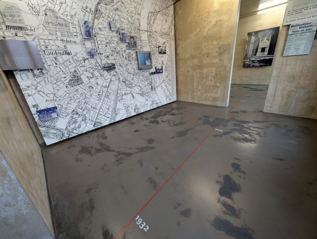
The starkness of the walls and floors added to the feeling and what was being conveyed in the audio guide. What appears impersonal became deeply personal with the stories and artifacts present. These are maps of control of Germany by the Gestapo. All was recorded and everyone was watched and reported on. At the top left is the board of one commander that would report findings on whole neighborhoods.
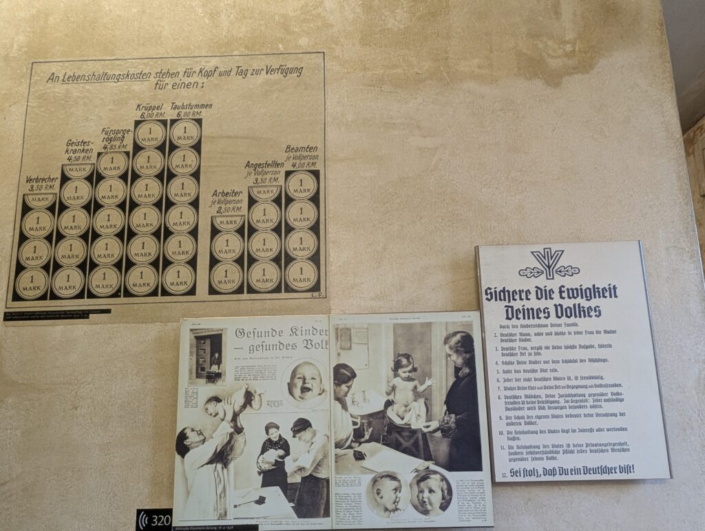
People considered undesirable (disadvantaged, homosexual, neurology conditions, those not fitting into the norm) were sentenced to forced labor. They were identified with patches on their clothes.
Again another timeline of how the rights of people were taken away and how things changed after 1932.
Propaganda of how much certain groups of people cost society and the reasoning for laws against intercultural marriage, the right to exist, and more births of Aryan babies.
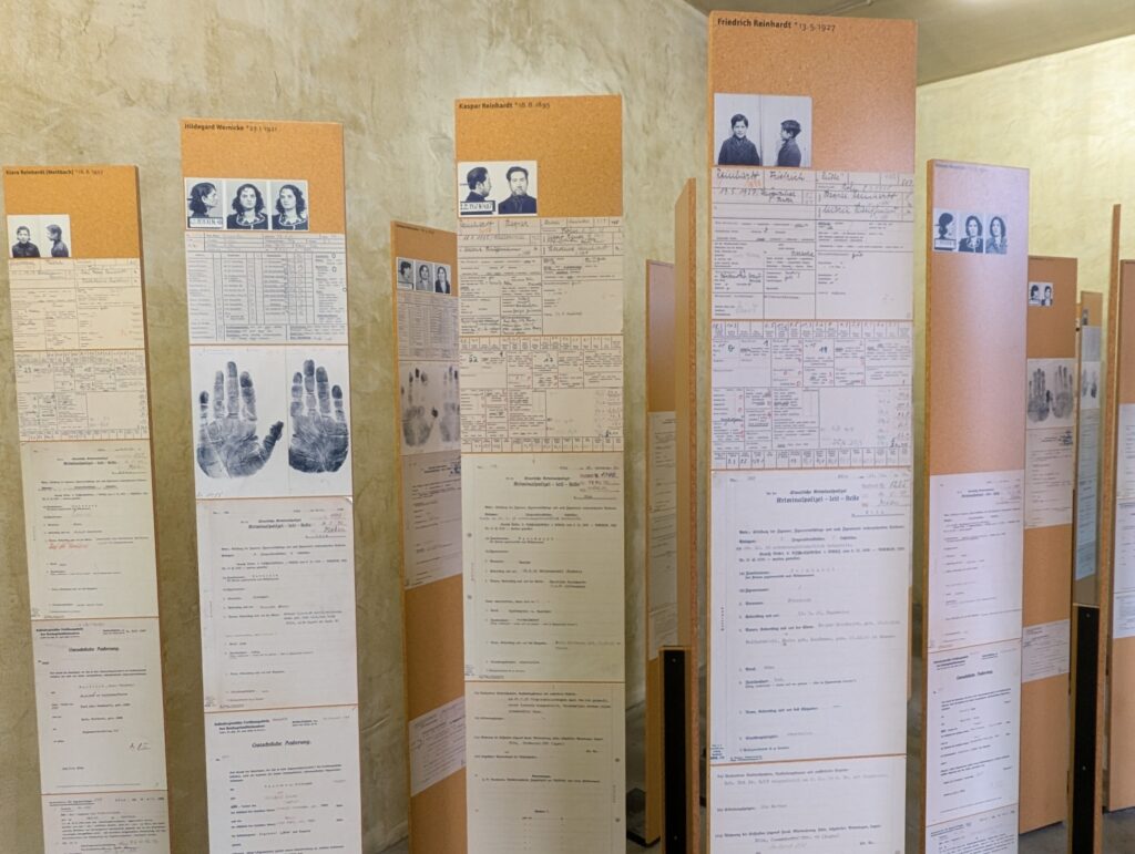
Documentation of whole families of gypsies such as Romani people and homeless (many originally here from the 12th century) and their eventual discrimination and deportation.
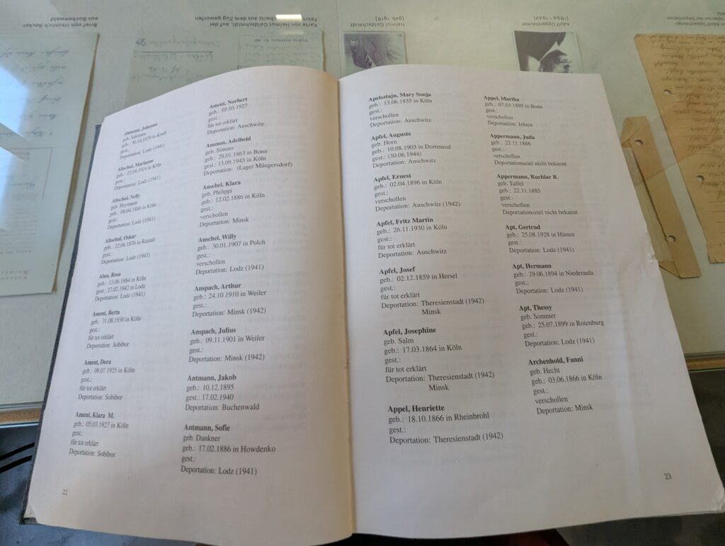
There is a book of all the people who were interrogated and sent off to concentrations camps. I can say that throughout this whole section I found myself actually crying through the rooms. I do not know how someone could not be moved by the personal testimonies, last letters to loved ones, and stories being told.
All Jewish deportations from Cologne (starting in 1941) were organized by the Gestapo. The major collection point was the Müngersdorf assembly camp, from which people were deported to Lodz, Minsk, Theresienstadt, Auschwitz, and other camps.
Cologne had several well-known anti-Nazi groups. There were many stories of people brave enough to show their resistance including many business owners and professionals including the church (though cautiously). Mostly they were put in jail for a time or questioned, but usually released. As the atrocities accelerated, some in the resistance were executed in 1944.
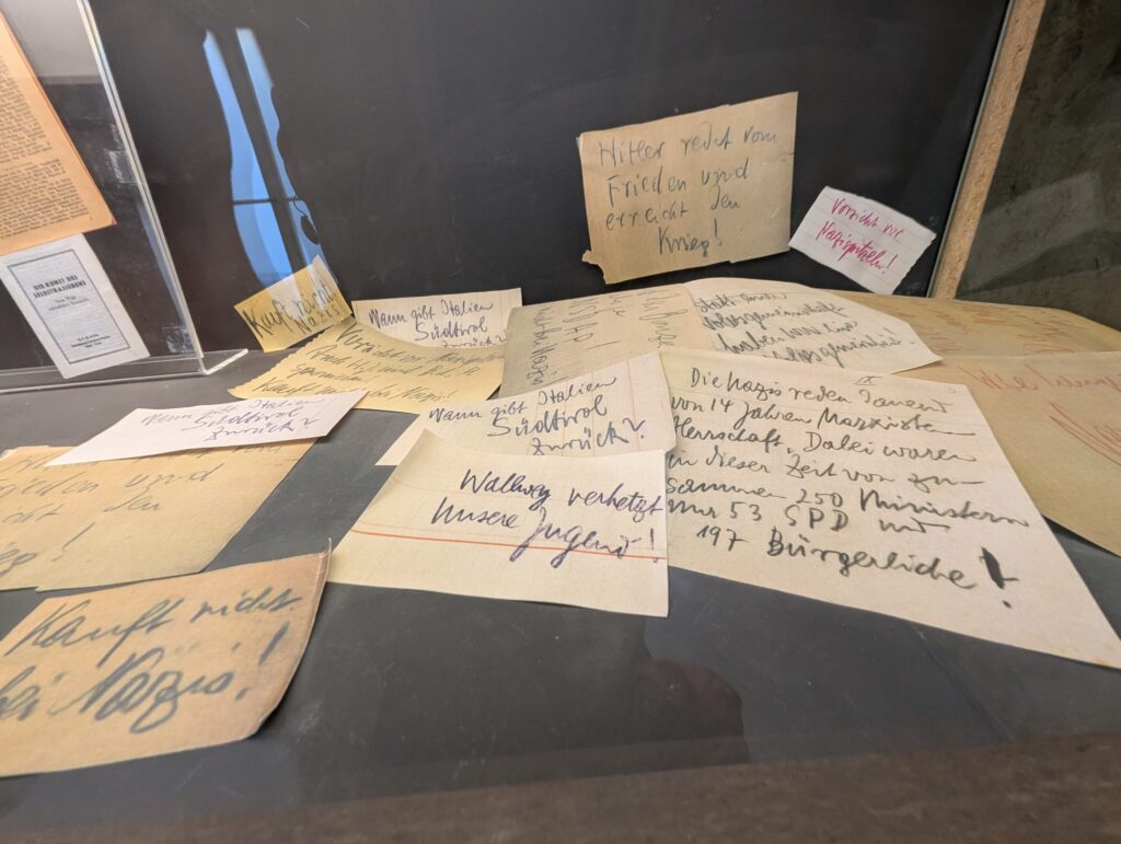
Resistance notes that would be left here and there in the city to get others involved, to continue the resistance, and to let those involved know that not everyone agreed.
This is a great piece of propaganda. It was made in Denmark and shows Hitler bringing war and death to the country. It was correct.
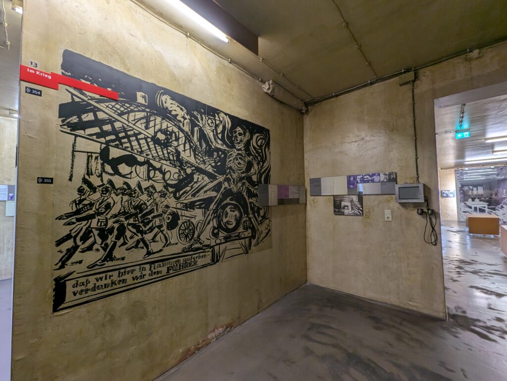
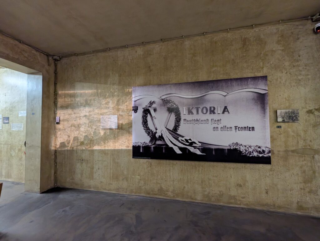
The next few rooms were about war coming to Germany and Cologne. Propaganda from the Reich forecasted prosperity and a new world order for Germany.
Pictures from soldiers who were from Cologne and were at the Eastern and Western fronts.
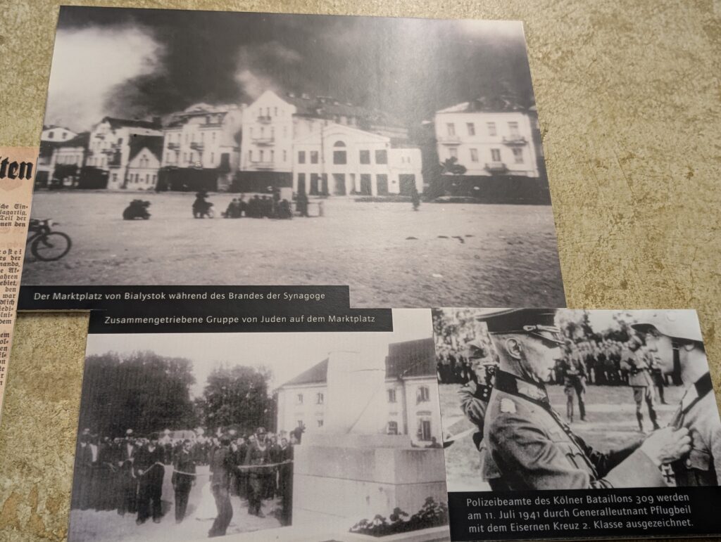
The fire occurring in the background of Bialystok was the result of rounding up local Jews and having them go into the synagogue. Rows of guards surrounded the synagogue to prevent escape as it was set on fire as a mass live crematorium for the 1000 inside.
Destruction in Cologne was massive as it was a major industrial and transport center for the Nazis. Many locals perished in the bomb shelters. It is easy to not be moved by their plight and I wanted to skip over these sections. But it was still easy to care and feel horrible for them despite what those in their country have done. They are still people and if I feel they don’t matter, then I am no better.
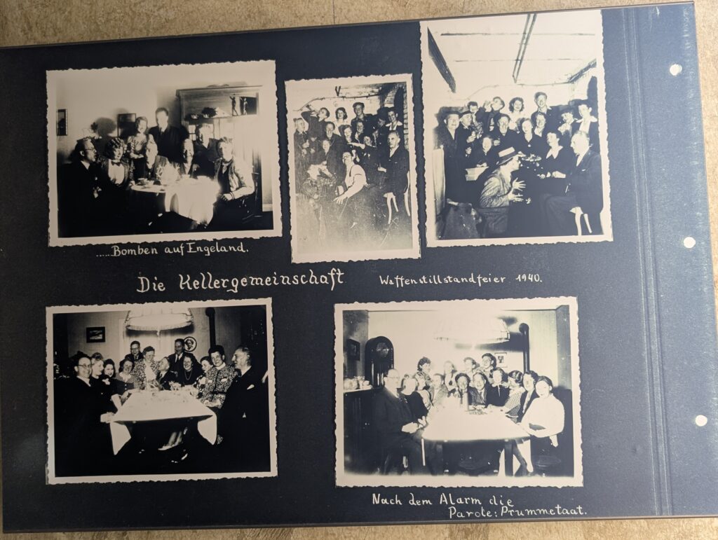
As with the rest of the world, people gave up things and worked for the war effort. Others celebrated every advancement Germany made (taking Paris. Bombing London, etc.) and made a celebration of it. This is underground dinner parties of supporters from a scrapbook found later.
As most men were in the war, workers were needed, and they were brought in from other countries. Sometimes against their will and other times they were coerced (threatening the death of family members). In the last final months of the war, many were killed.
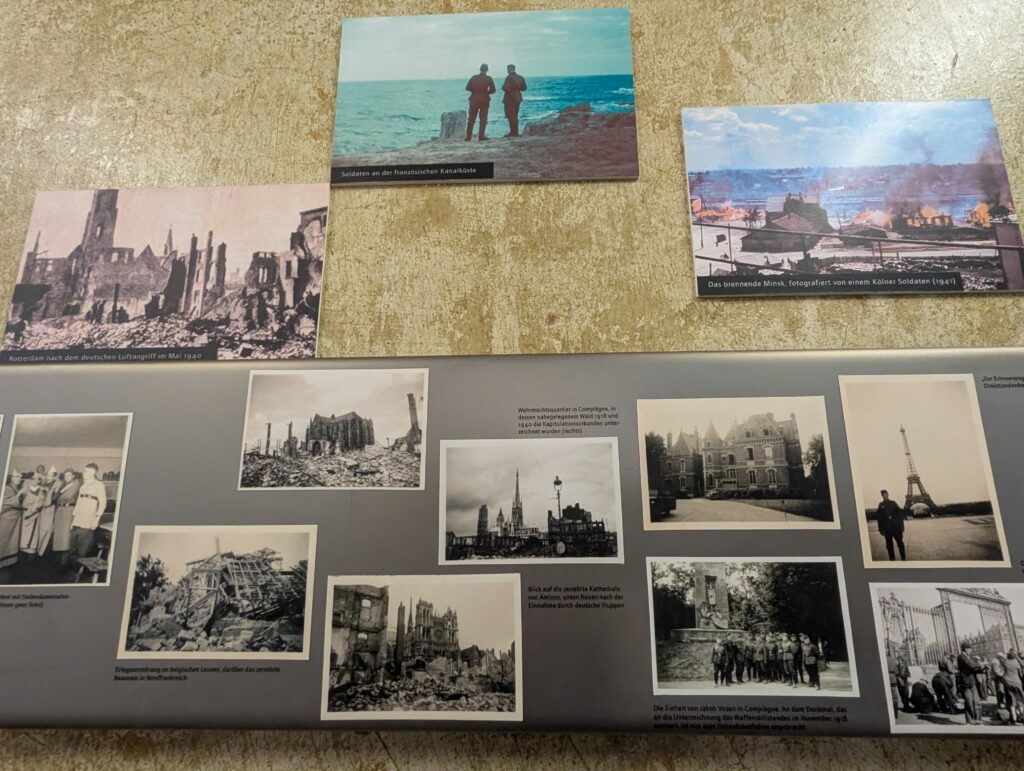
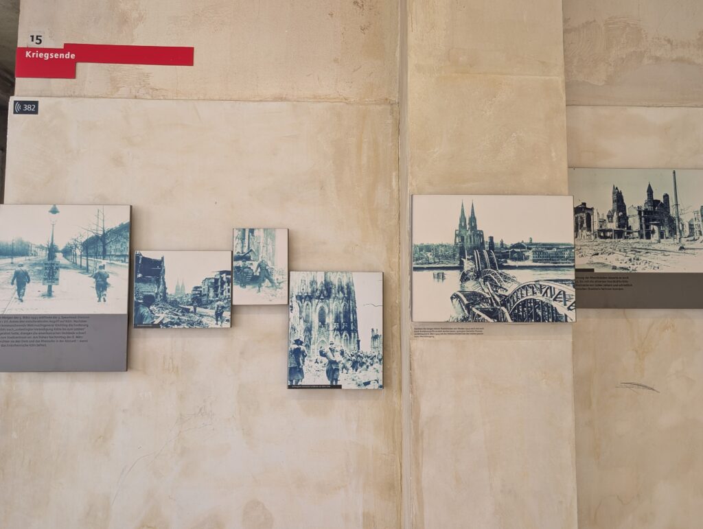
The pictures below is of the taking of Cologne by Allied forces on March 6, 1945. Propaganda reminded residents that Hitler promised prosperity in 5 years and now instead they have ruin. Cologne was bombed 262 times as it was an important target. The cathedral sustained damage but was still standing (despite being bombed 14 times) and the Gestapo headquarters was spared as well. 90% of the city was destroyed and the population of 760,000 was no about 100,000.
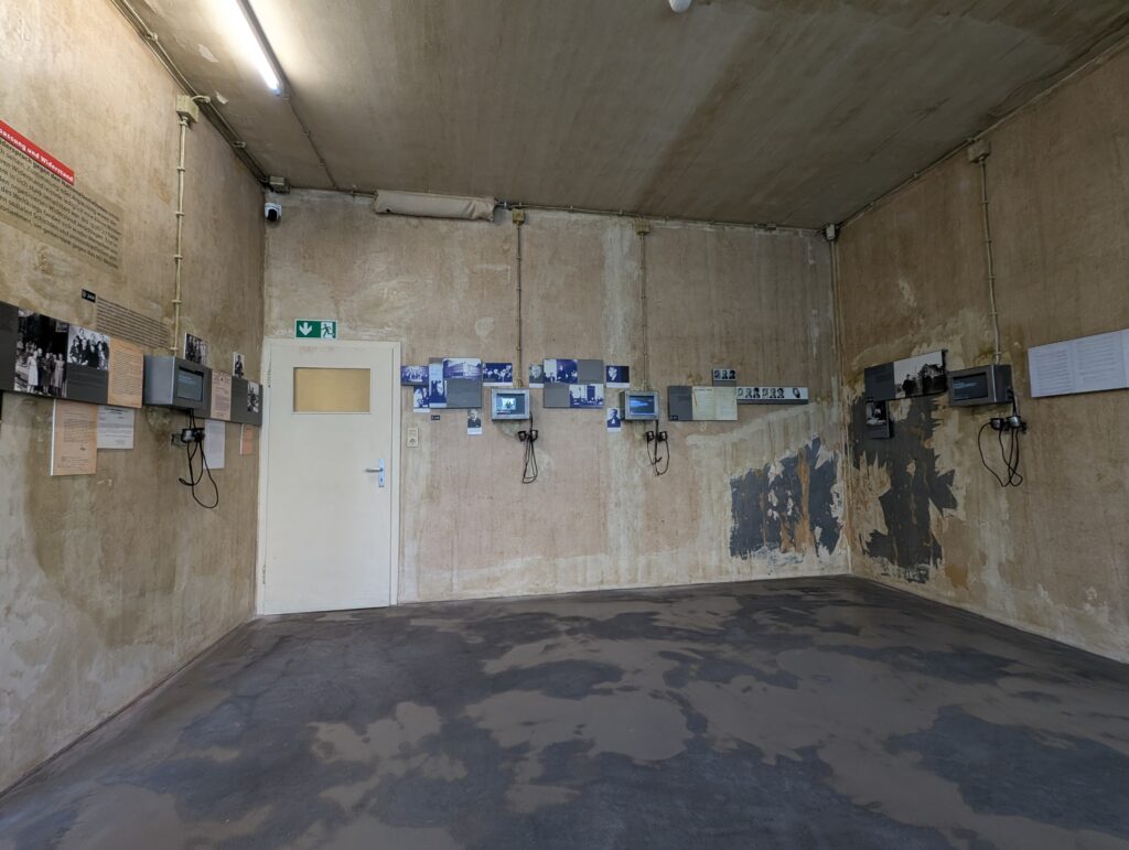
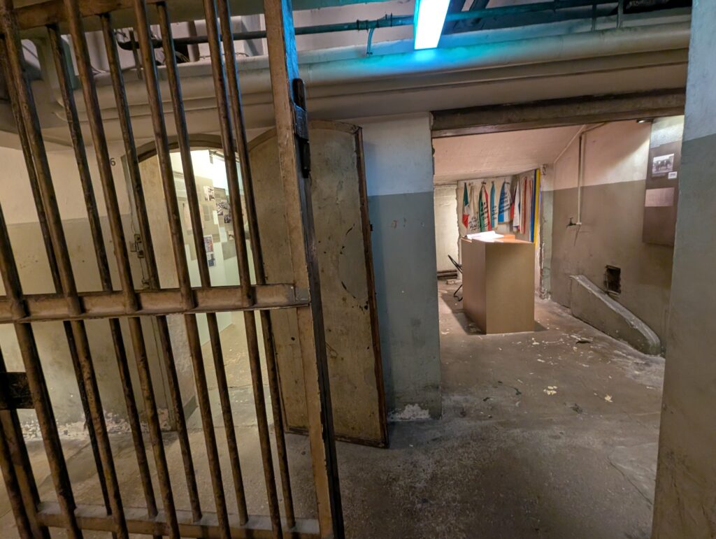
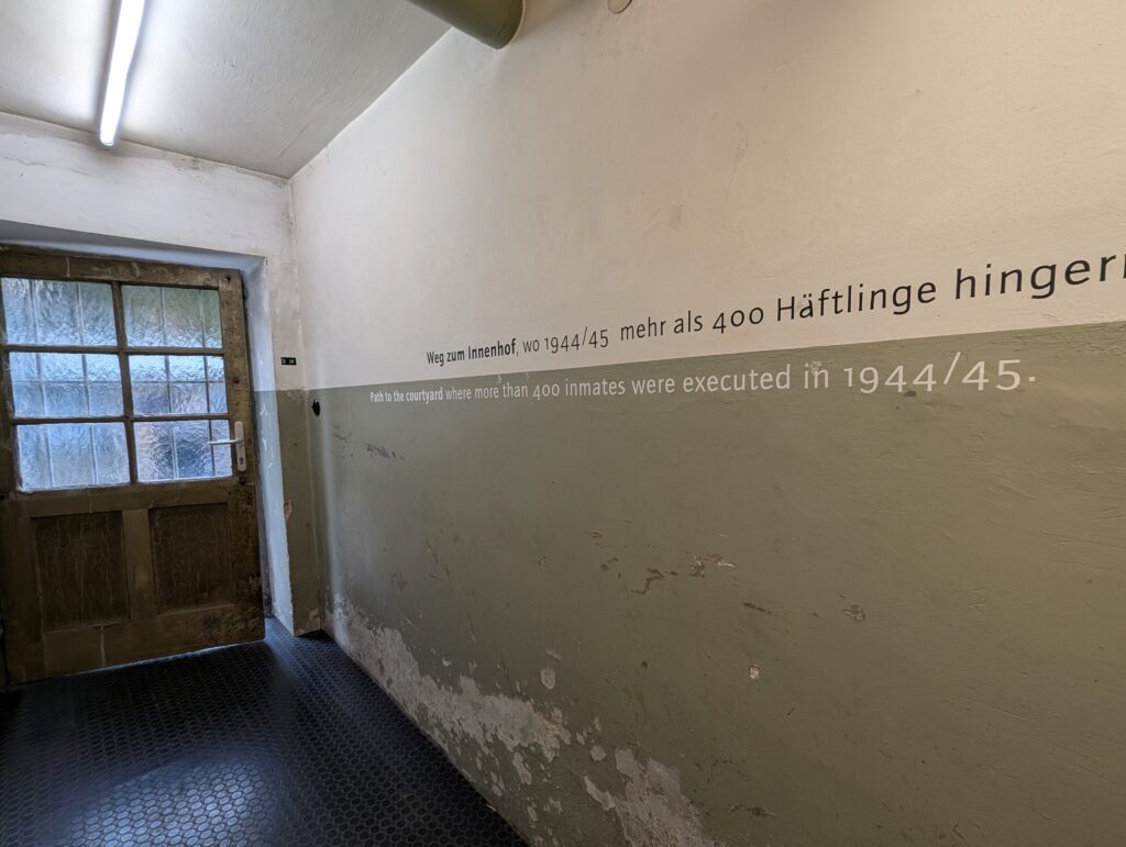
I am glad that I purchased the audio guide and I listened to everything. I really felt emotionally drained at the end and as I went downstairs I realized I was not finished. There was still the basement which was the prison. The words I heard as I went down was “you are walking down the same stairs that prisoners walked down (they did not walk back out). What a sinking feeling. This is the only part of the museum that has translation on the placards in English.
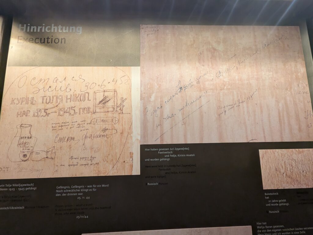
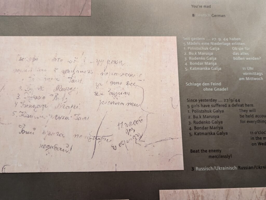
Drawings and scratchings still exist on the walls and many others are recorded in visuals in other rooms. There are 14 prison cells.
A calendar to keep track of days.
They sometimes had 33 people in a cell with bathroom privileges twice a day and buckets for in between. The smell it was said permeated outside and people could hear the suffering on the street but no one did anything.
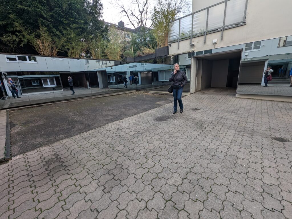
Hanging occurred outside the corridor below in the courtyard. There were buildings overlooking this. And no one did anything.
An artist created these wall of mirrors for the courtyard. Mirrors were positioned in such a way that there was no way that you could not see yourself. It was quite a feeling that you could not be there and not “see”. You were exposed and also able to see everything. Powerful and emotional.
These artifacts were found under the stairs. An actual can that released chemicals to stop the spread of typhus and shoes and other personal effects of the prisoners.
Some of the drawings on the wall from people in the prison.
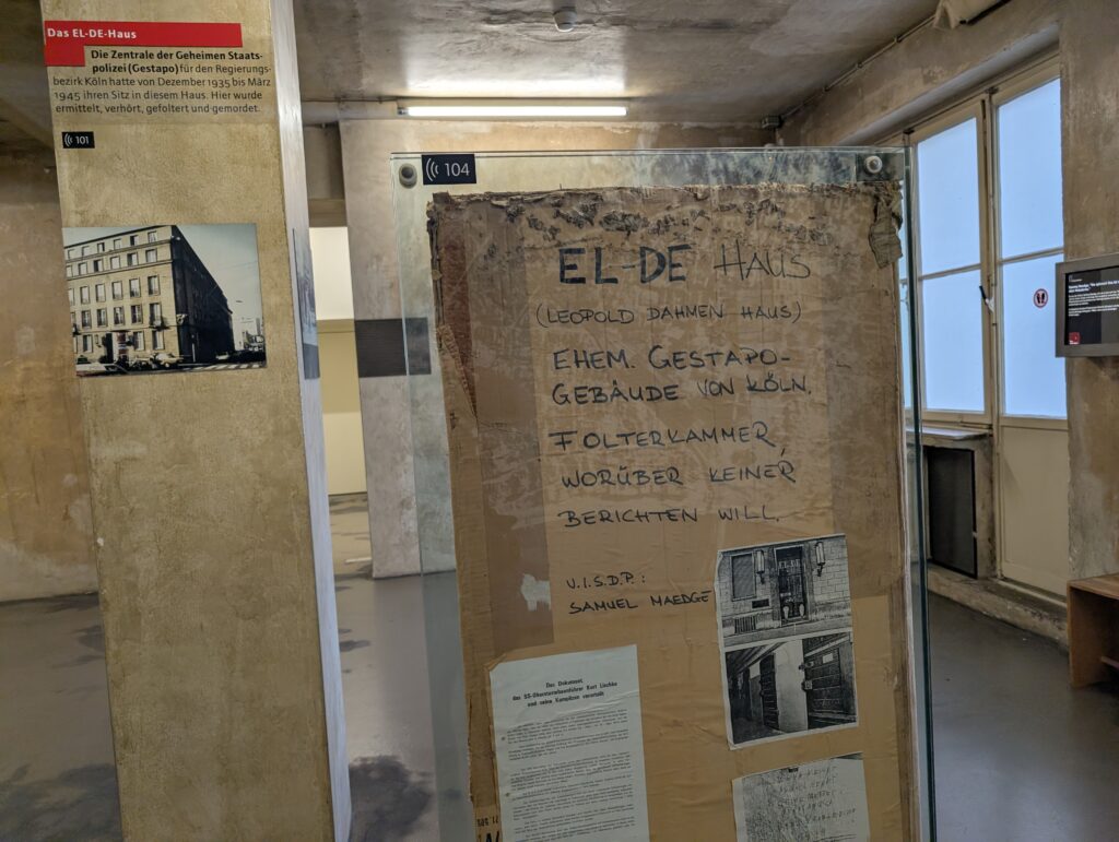
Today, the EL-DE-Haus is the NS-Dokumentationszentrum (NS Documentation Center). It is considered one of Germany’s most important museums on Nazi terror. The basement cells, preserved and covered in prisoner graffiti, are one of the most authentic Gestapo prison sites in Europe. What is interesting is that things were filed and stored here for decades before they were found and realized the prison was completely ly intact. Crazy, but once the war was over everything that happened here was conveniently forgotten.
In 1981 artifacts were assembled into the museum and it is one of the best museums I have seen. It really gives the perspective of locals on all sides and those who were persecuted. It really showcases how the horrors of that time were committed by their own people living here next door instead of a story of people halfway around the world.
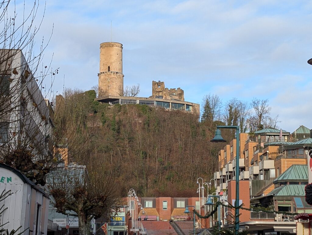
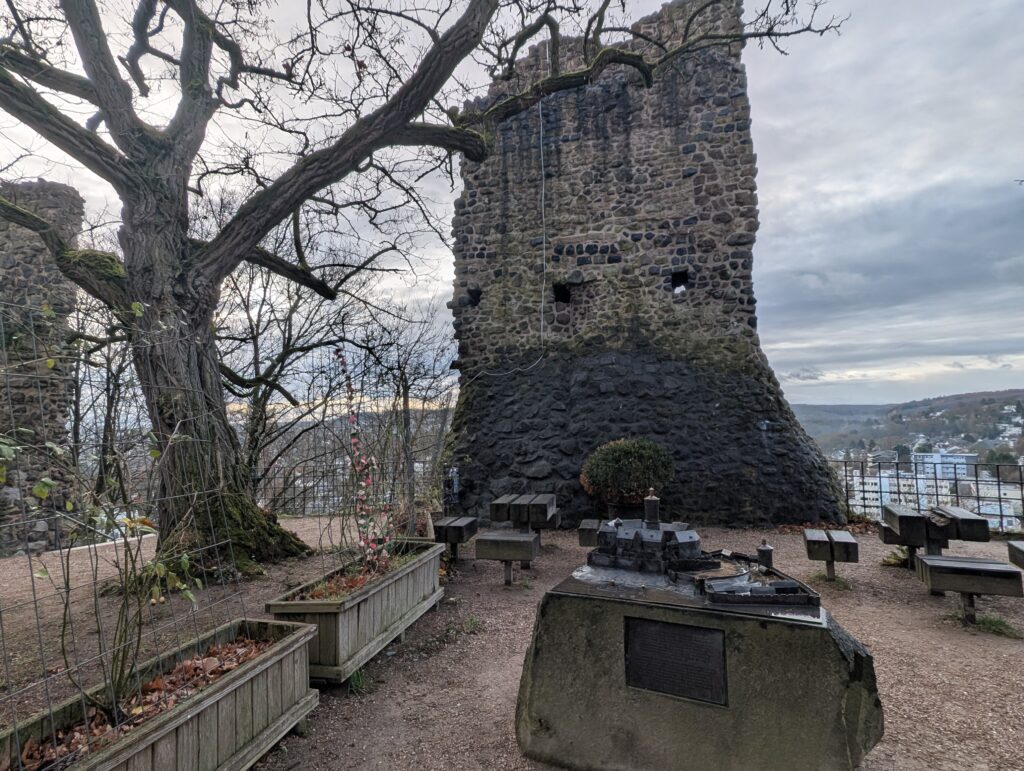
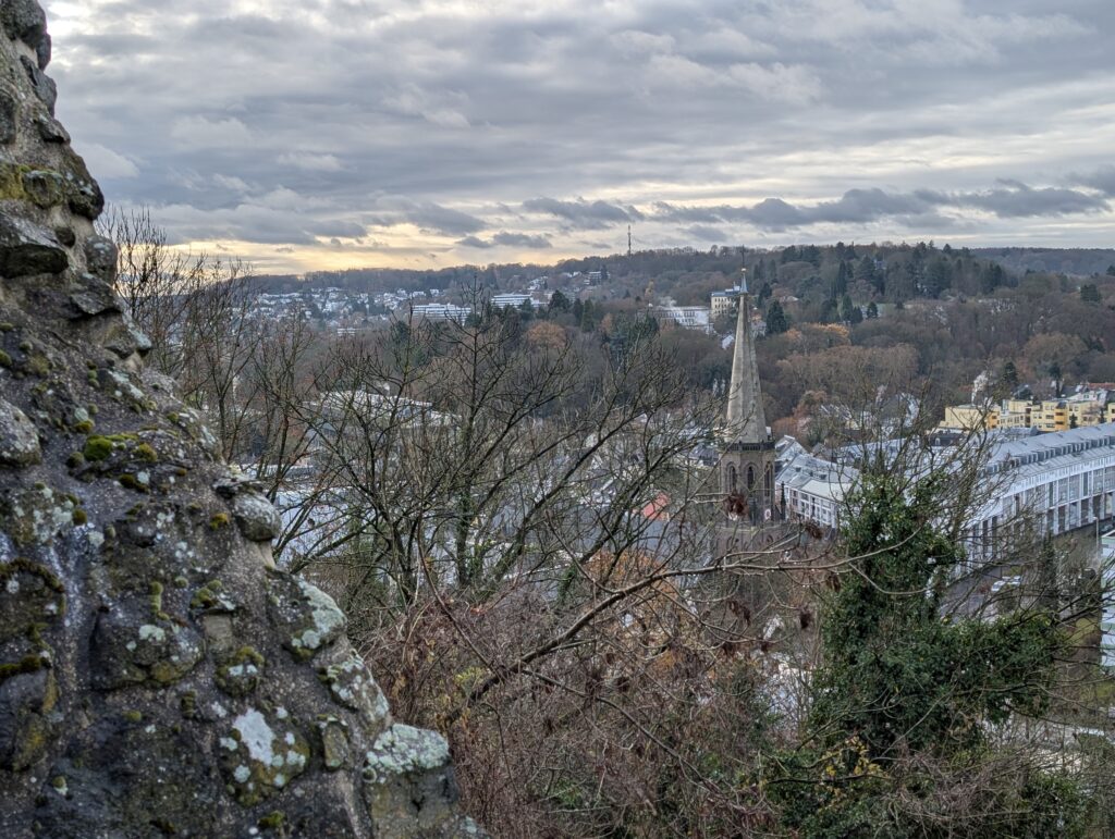
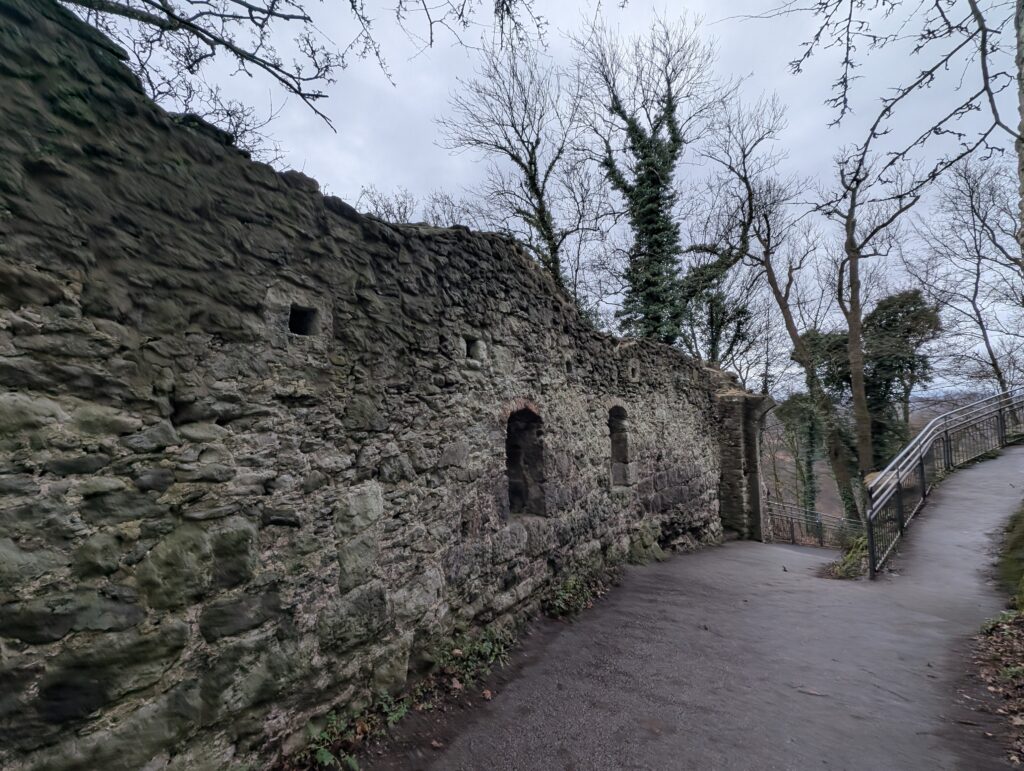
I took another day trip first to Godesburg. Bad means bath in German. The hill that the castle is built on (just ruins now) is part of a dragon rock legend. The rocks underneath are volcanic and have several possible legends attached to it:
A dragon once lived in the caves of the volcanic cone until banished later by a monk and is not protected OR a pale figure known as the white lady haunts the ruins. She was the daughter of a noble an who could not marry her beloved and befell a tragic death OR a gatekeeper helped opposing forces by bringing in explosives. He was either buried alive or thrown from the tower and his restless soul still walks the grounds OR there is a sleeping army that is in the volcanic cone that will come to life in Germany’s greatest need.
Anyway it was a stronghold of the cardinals of Cologne in 1210 and was actually one of the first fortresses to be blown up by mines.
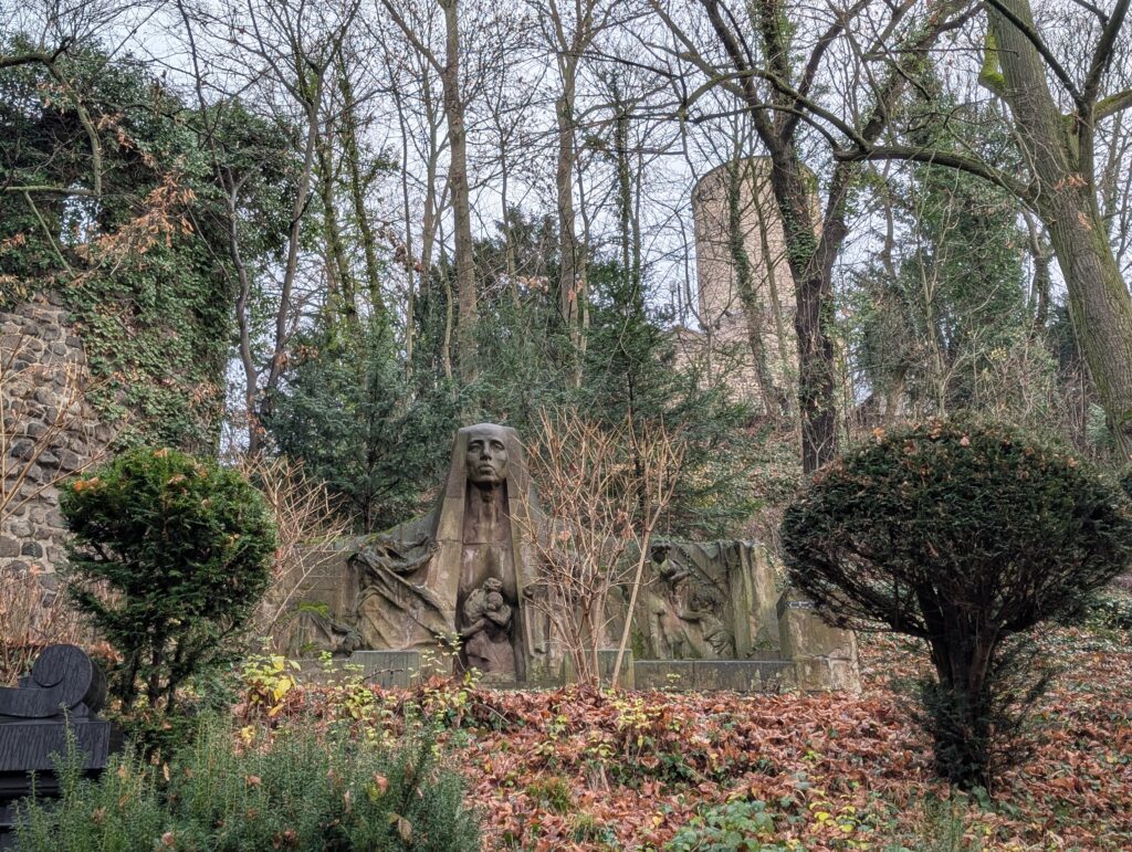
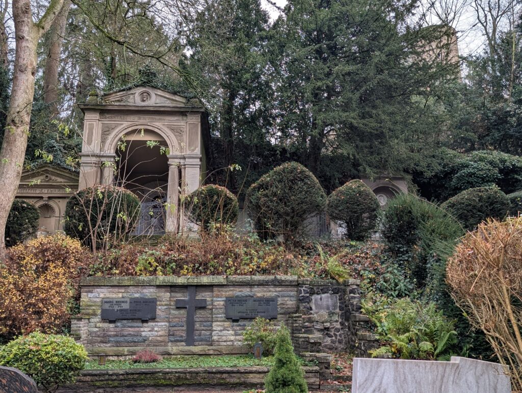
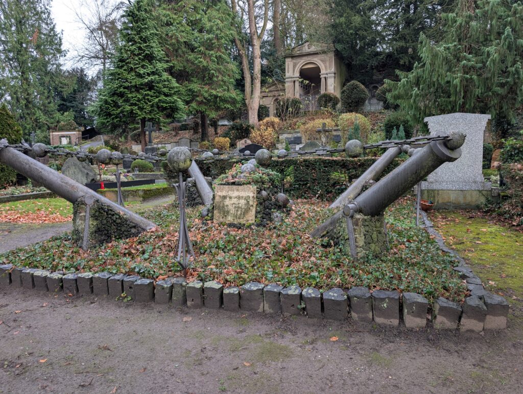
Below the castle is the castle cemetery. It is pretty cool and peaceful. Some important people are buried here including Beethoven’s mother.
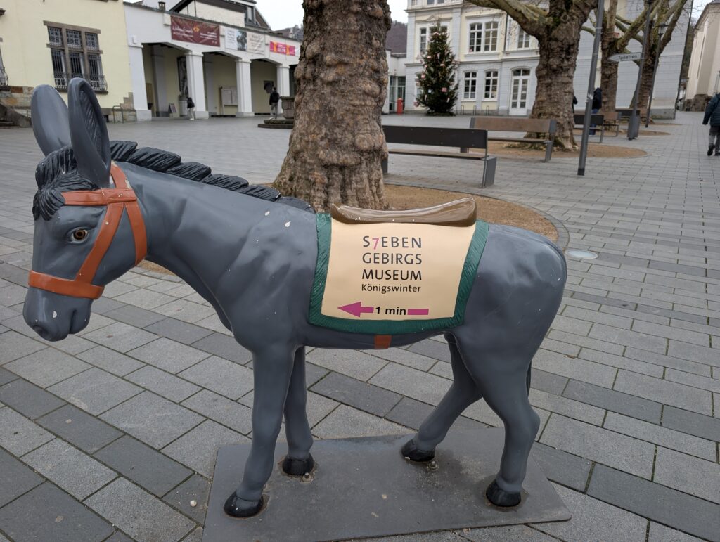
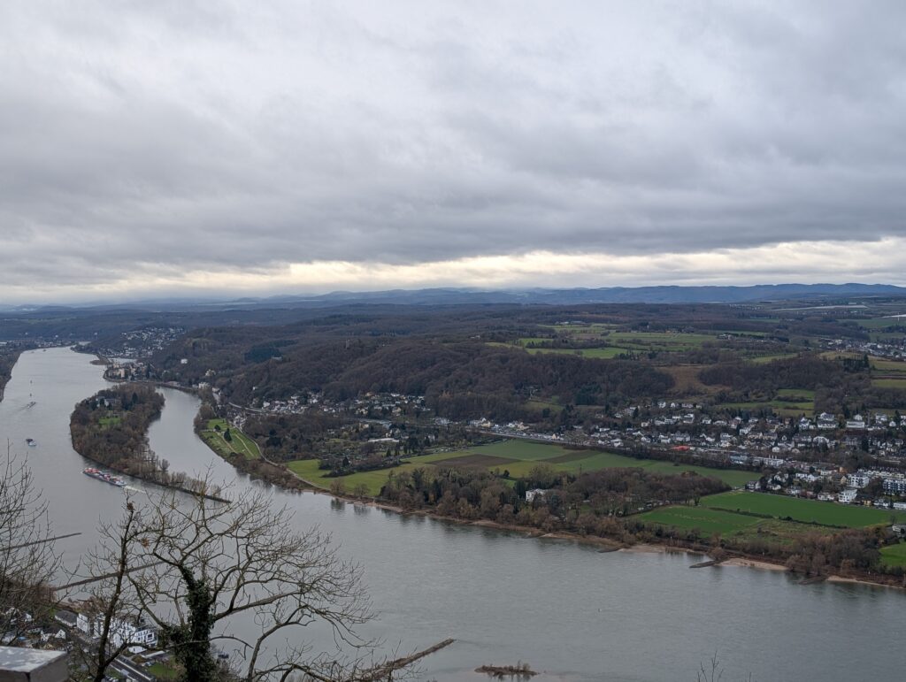
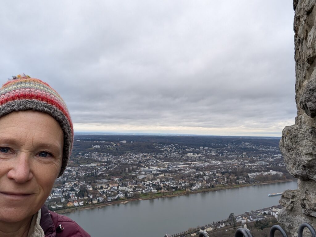
I then traveled to Köningswinter and the Drachenfels. I walked around the town first. It is small but the people are really friendly and there was a large amount of antique stores and many were open in the Sunday I was there. This is a popular tourist area so that would make sense. I enjoyed walking through each one. Lord Byron wrote about the Drachenfels in the 19th century.
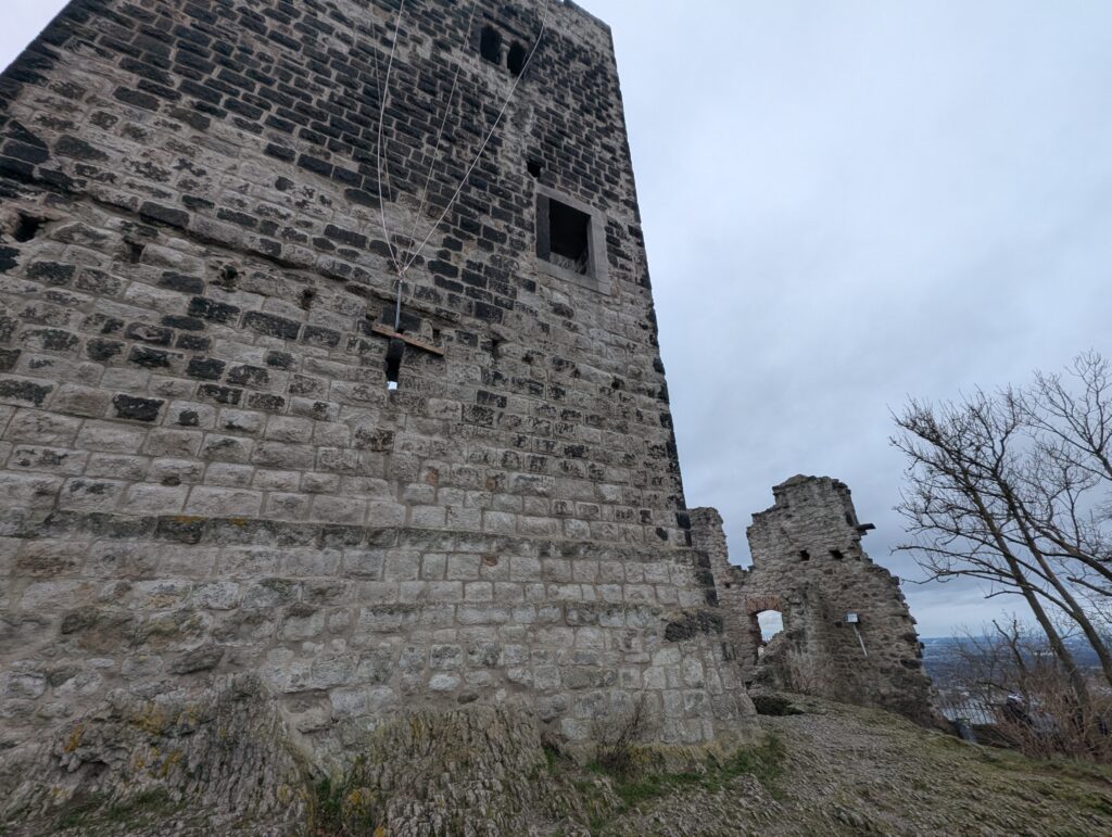
Drachenfels means Dragons rock and refers both to the part of the Siebengeberg range and the Castle ruins at the top
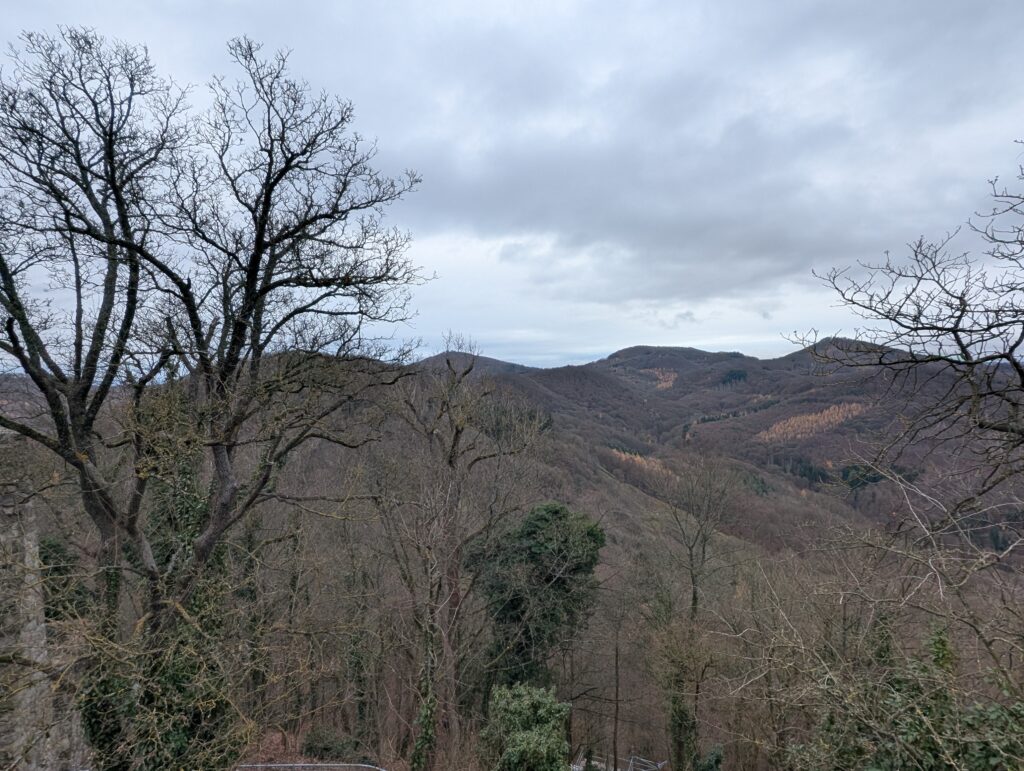
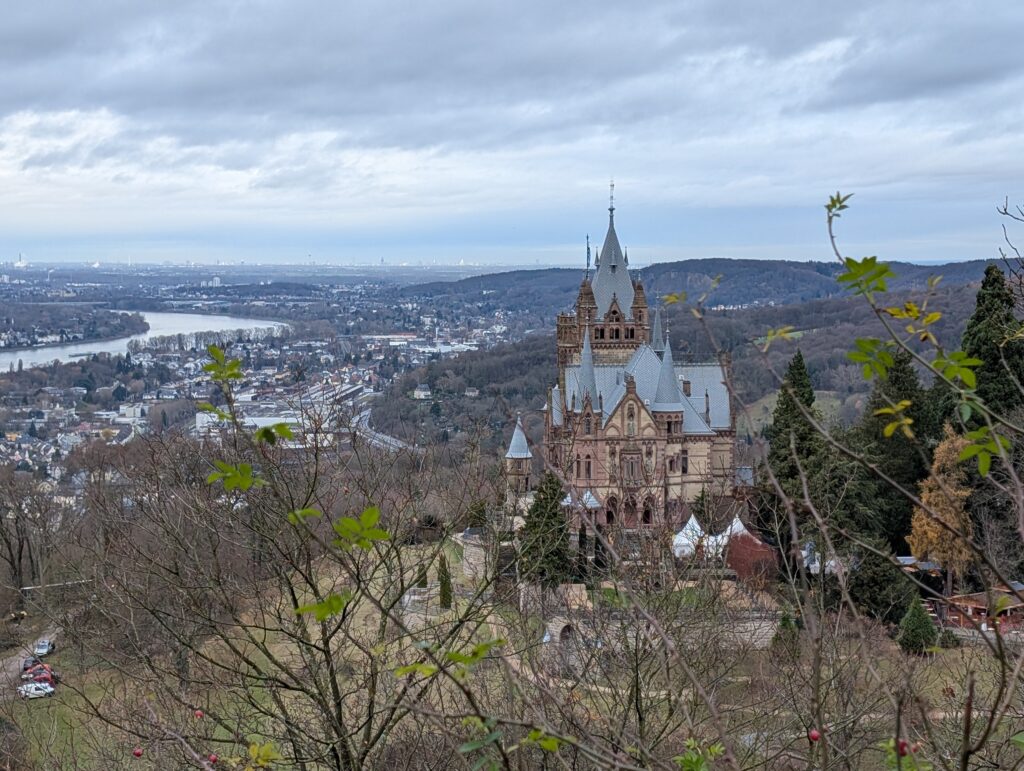
Another building the Schloss Drachenburg is there as well. It is a castle that was made in the 19th century to be more like a villa and also became a hotel. Not a true castle. It was closed for a Christmas event and I did not have the chance to go inside. I took the tram (Drachensfelbahn) where the castle was and walked the rest of the way to the ruins. It is a pretty steep path.
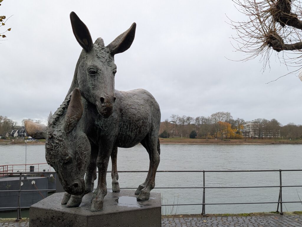
The Drachenfels mountain is a 321 meter tall volcanic mountain in the middle Rhine and is an important landmark. It was a fortress to protect the territory of the archbishop of Cologne and built in 1138 and destroyed in the 30 years war in 1630.Donkeys were used to carry materials up the hill and is the reason you see donkey statues in the town.
Drachenfels is also known for the Nibelungen legend. In the legend, the hero Siegfried slays a dragon here and bathes in his blood to become invulnerable except for the spot on his back where a linden leaf had fallen. It is a story from the medieval epic Nibenlungenlied and Wagner’s opera.
The views from the top was amazing.
This is my last night staying in Bonn. Tomorrow I am going to Cologne and pretty excited to see that town as well.
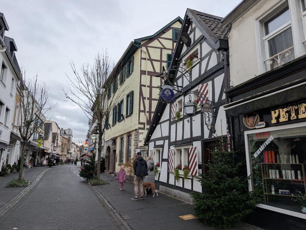
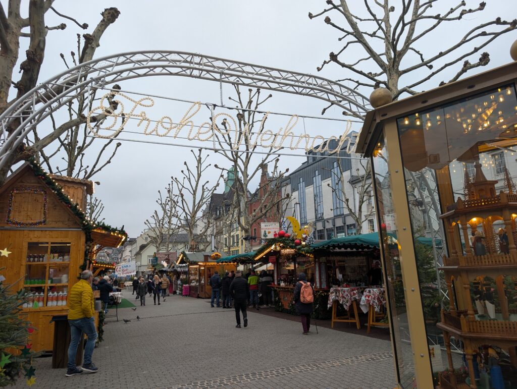
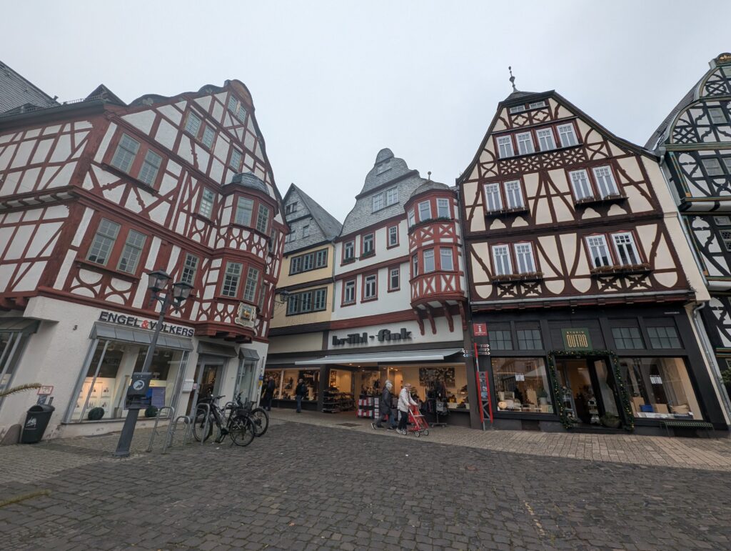
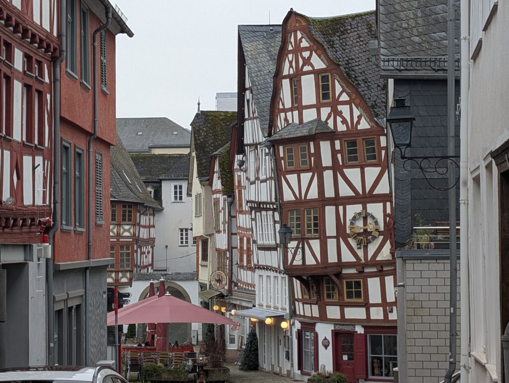
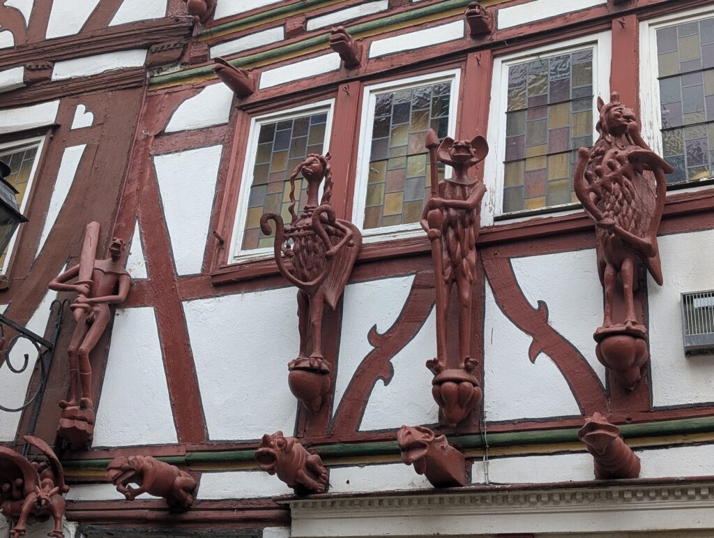
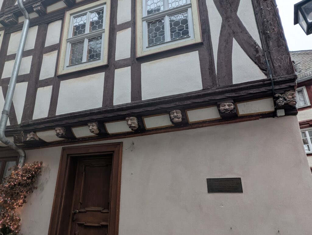
Limburg is a well preserved medieval town that has many of the timber houses still intact. When I think of Old Germany, that is what I wanted to see. It was a long train ride from Bonn but worth it especially since you can also stop at Koblenz on the way back.
I thought that these ornaments on the house were amazing.
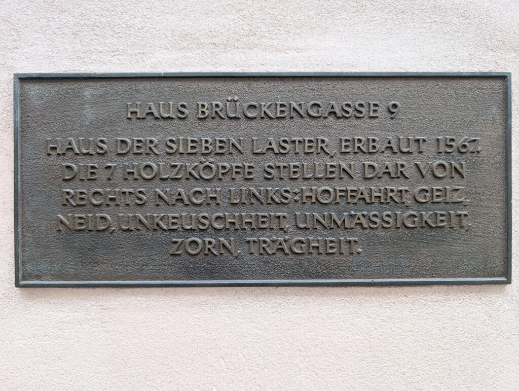
This house is known as the house of the 7 deadly sins. It dates back to the 700’s but was rebuilt after partial collapse in 1567. Its face is decorated with carved wooden masks (“heads”) that represent the seven Biblical vices (sins): pride (Hochmut), envy, greed (or avarice/Geiz), lust (Wollust), gluttony / intemperance (Unmäßigkeit), wrath (Zorn), and sloth (Trägheit) — a vivid visual representation of the “seven deadly sins.”
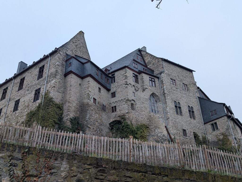
The castle which is under repair.
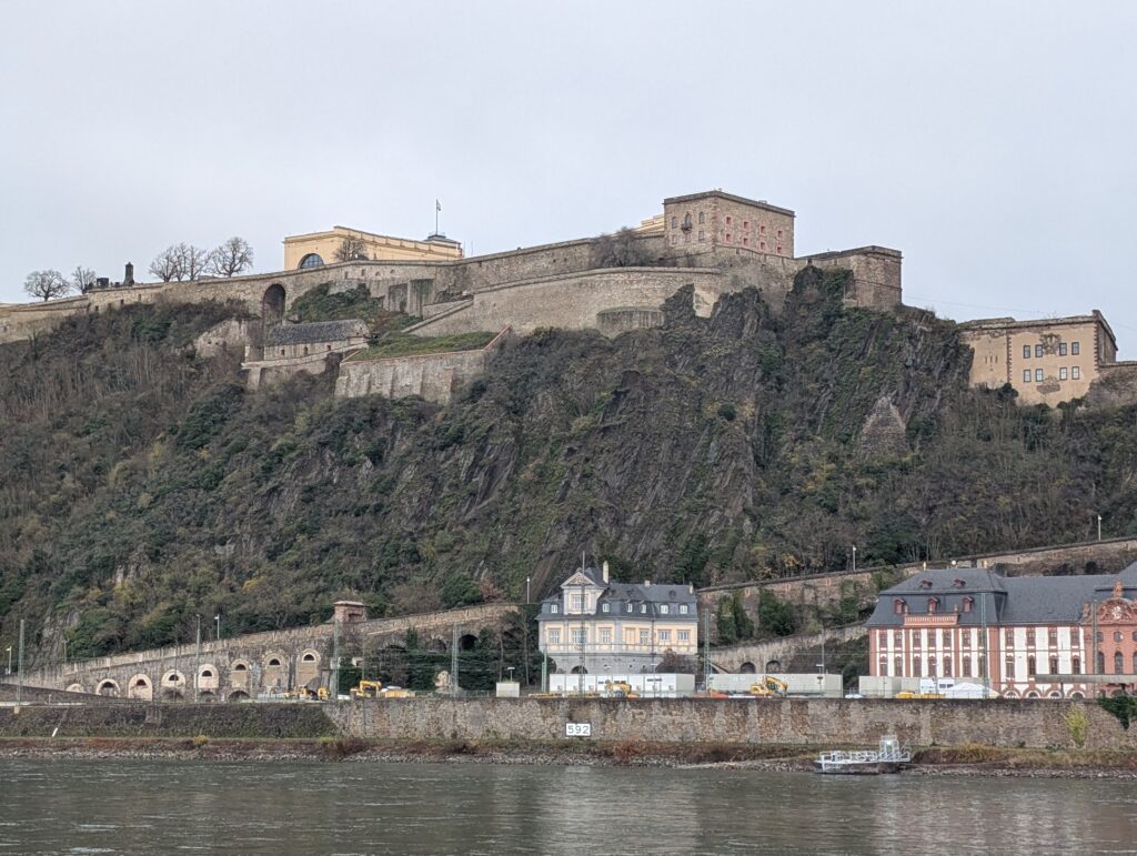
One of my connections was Koblenz, so I decided to spend a few hours here as well. Koblenz has importance in history as the Moselle river meets the Rhine and was important for moving materials and military fortification beginning with the Romans. It also has a history of being under the rule of many and heavily damaged in WWII.
I was cold and tired and decided not to tour the fort across the Rhine.
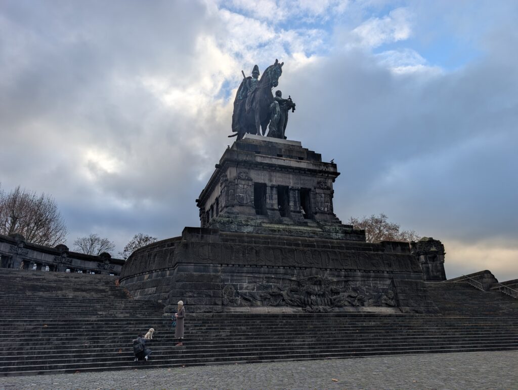
Equestrian statue of Wilhelm I at the confluence of the two rivers.
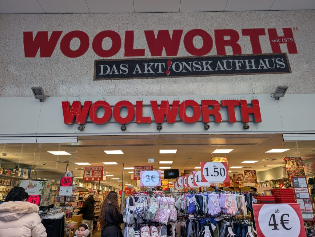
Interesting that there is still a Woolworth here! I wish I had time to go inside but I was on the way to the train!
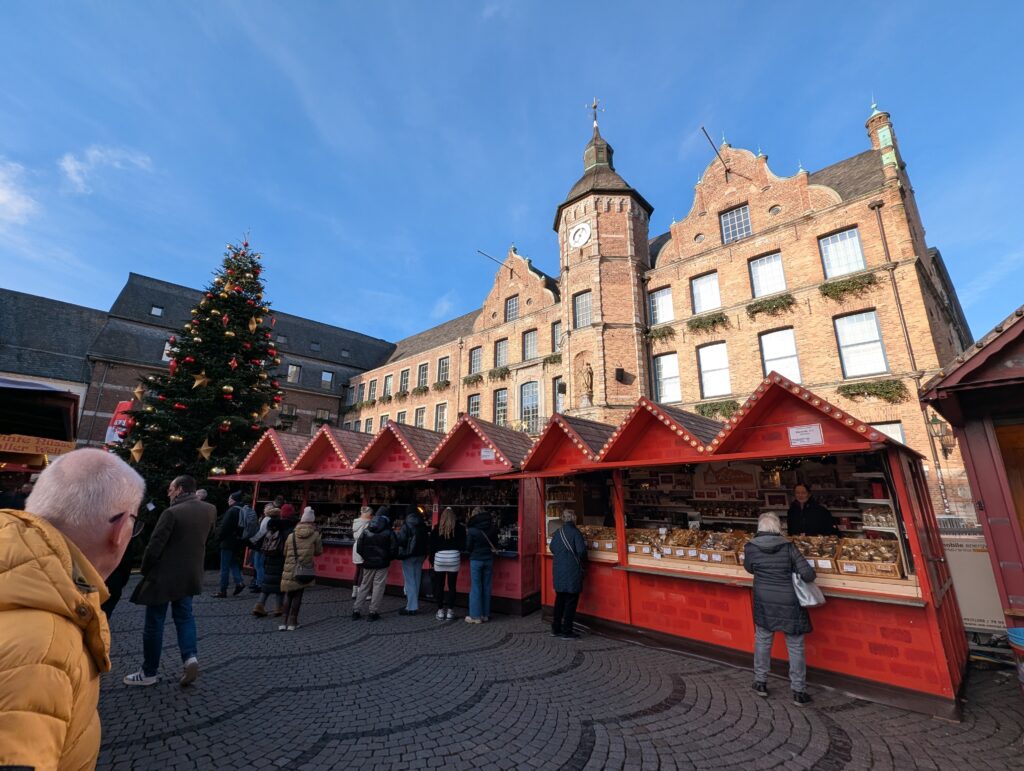
From Bonn, I took a day trip to Düsseldorf. As with many towns in the area, there is evidence of Roman civilization but it was not organized into a town until the 12th century. After rule during the Napoleanic era, it became part of Prussia in 1815 and during that time it was an industrial hub of the area. During WWII, it was heavily damaged and much of the old town was destroyed.
Stadterhebungs monument commemorating city rights to the town.
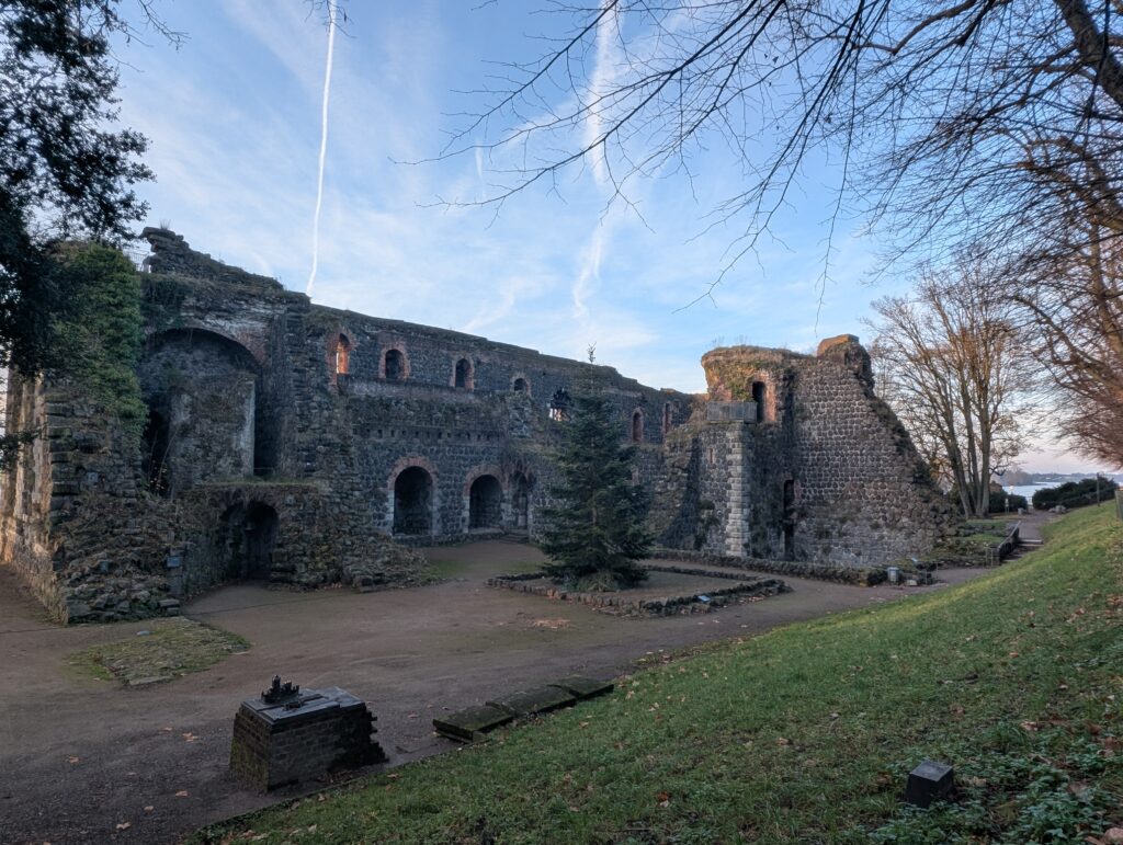
Kaiserpfalz Kaiserswerth is the ruins of a Monastery that dates back to 700. This area is a little bit outside of Düsseldorf and many of the buildings are still intact.
Traveling from Sinzheim to Bonn was interesting. I planned the route in the DB app as I purchased the Deutschland ticket that gives me unlimited regional trains, buses, and trams. Unfortunately, the first train was so delayed (which happens a lot) that I could not make any other connections. I didn’t take the time to look at the different times that the 4 trains would be coming which could take some time in planning. Instead I took one regional train and paid to take two high speed trains instead. Long layovers for those trains but less hassle. Lesson learned. Now I look up each train separately and bookmark in the app two possible choices just in case.
I planned to stay 6 nights here as it is easy to go from some of the cities I wanted to see from Bonn. I also wanted to be able to buy groceries and cook to balance the Christmas market food I have been eating. I am also in search of affordable new footwear, preferably hikers or boots, but they need to be okay to walk distances in.
Also the layovers at the train stations in some cities are pretty interesting. There are so many shops that have every day things people need at normal prices. So many people picking up the things they need while they are waiting. And at this point I need to buy things like face moisturizer, dental floss, and hair styling products. Of course an advent tea box of different teas for each day of December was a good purchase.
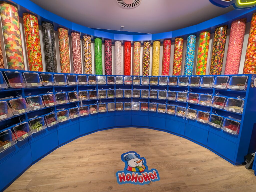
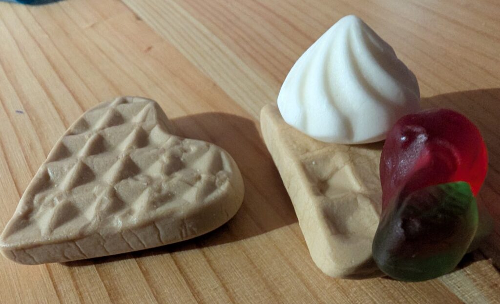
I found a Haribo store. I do love gummy candy and wanted to buy all of it. I had to try the waffle variety. When I opened the bag it did smell like waffles like when you walk into the kitchen for breakfast. It tasted more like vanilla, especially the little cream gummy.
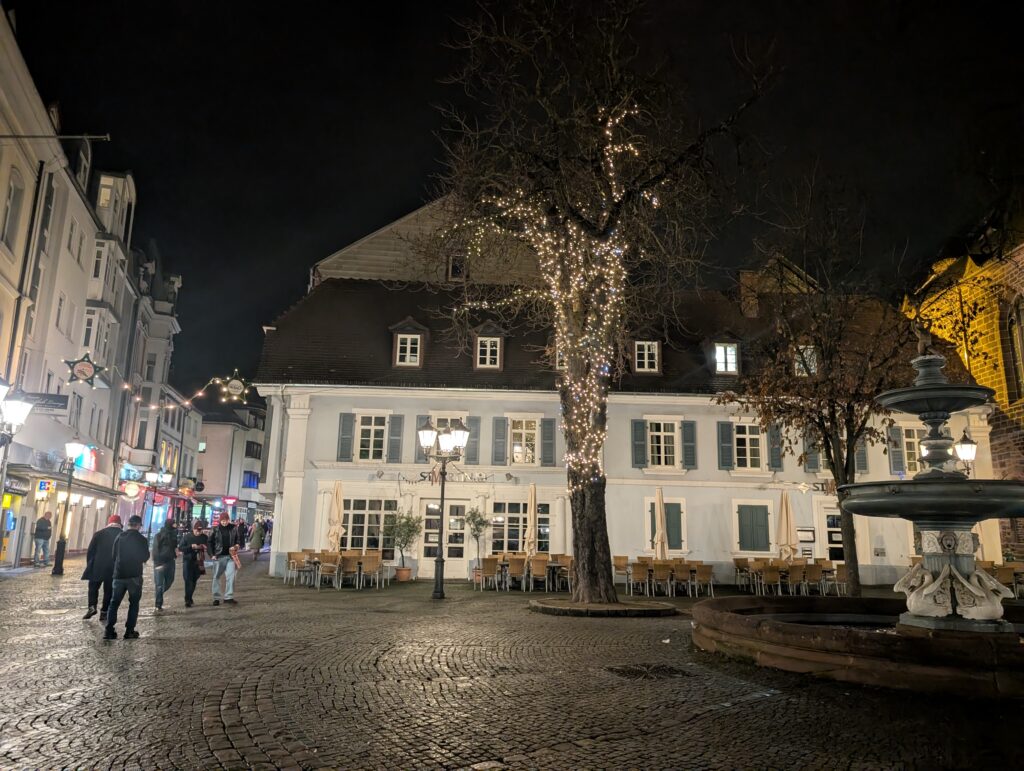
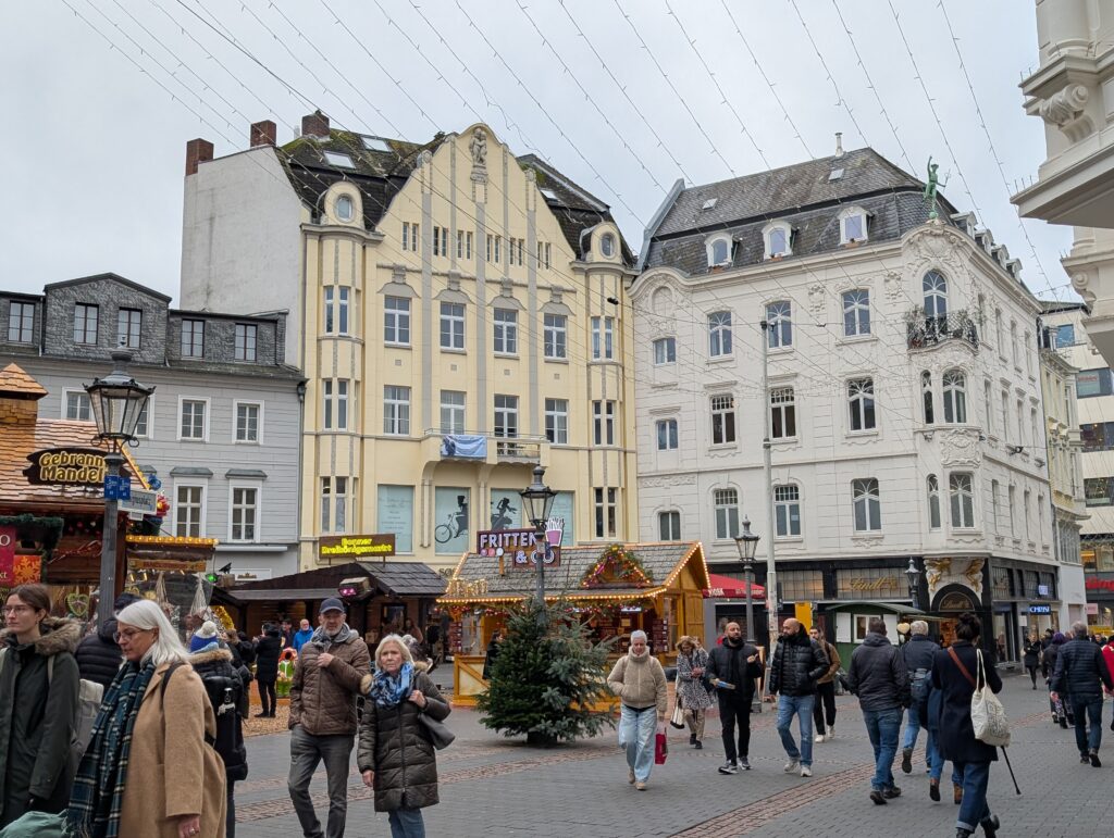
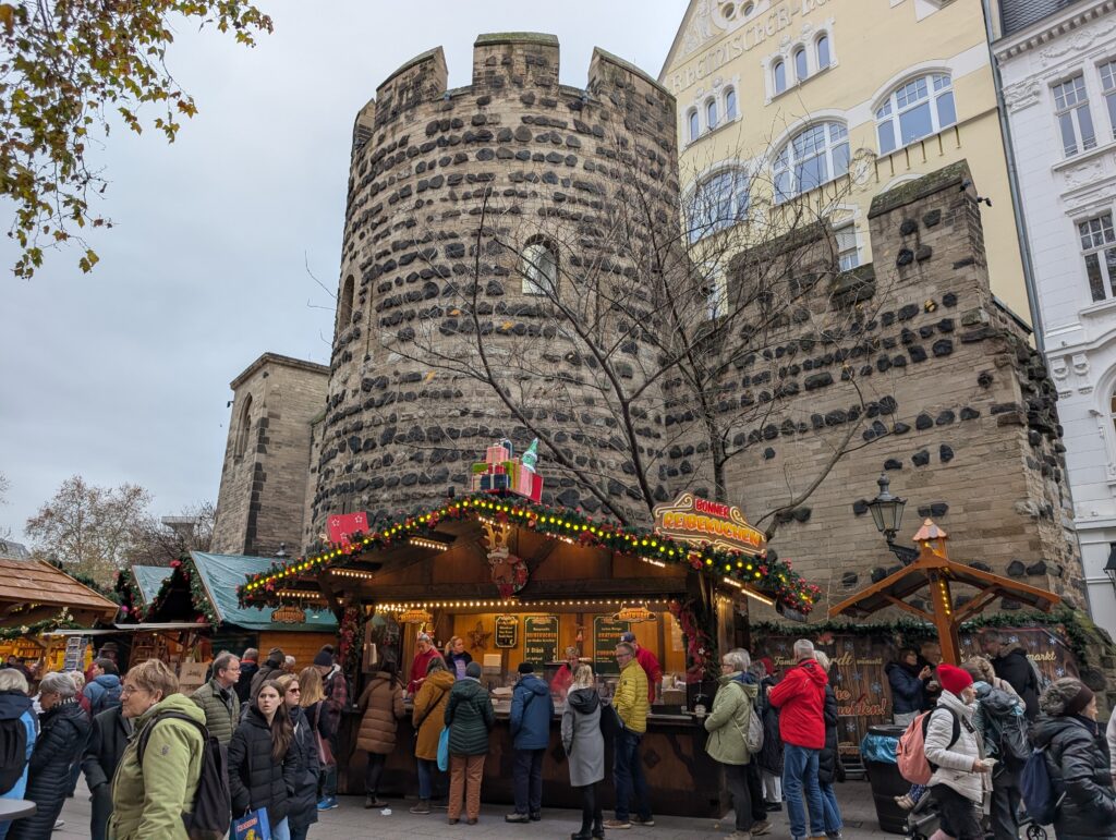
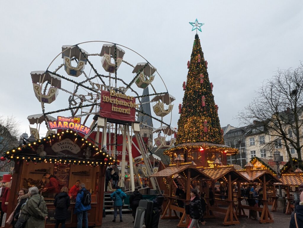
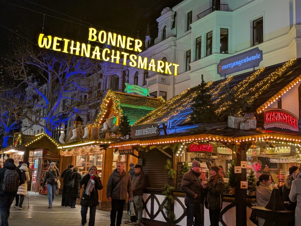
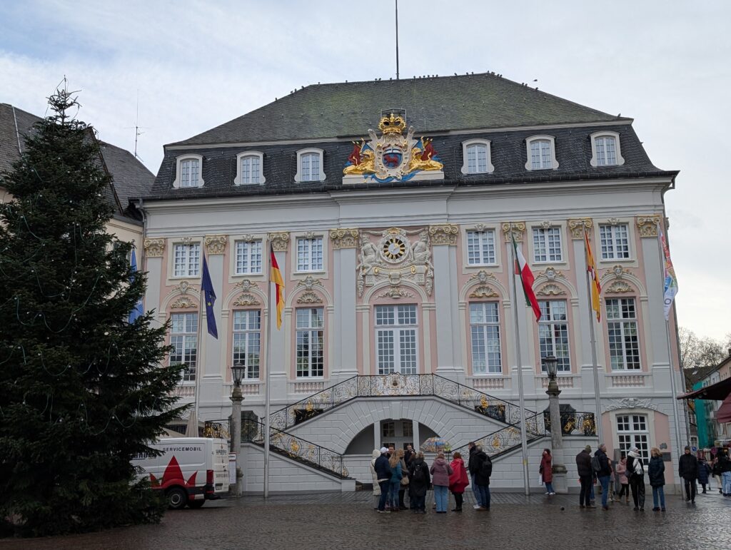
I loved walking around the Bonn alstadt which is the old town in the center.
Beethoven’s house.
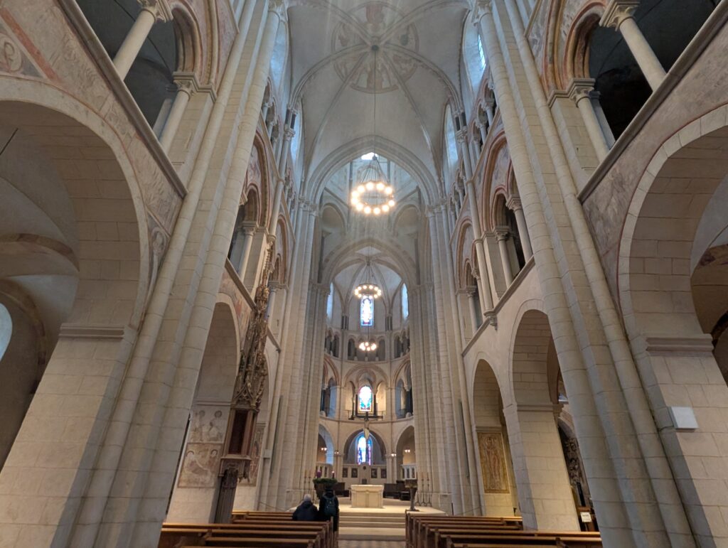
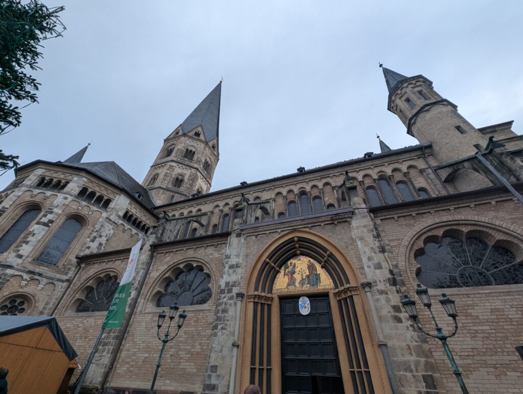
I stopped into the church where a service was being conducted. I stayed for some time to listen to the amazing choir. Bonn minster is one of the oldest church in Germany dating back to the 11th century.
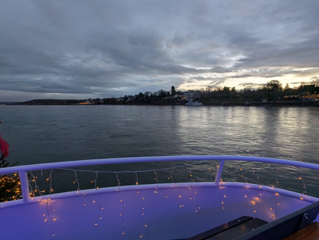
I also took a Rhine river cruise. We sailed down to Köningswinter where we could see the castle at the top of the hill.
I also booked a ticket to see the opera Hansel and Gretel at the Opera house. More pictures to follow.