
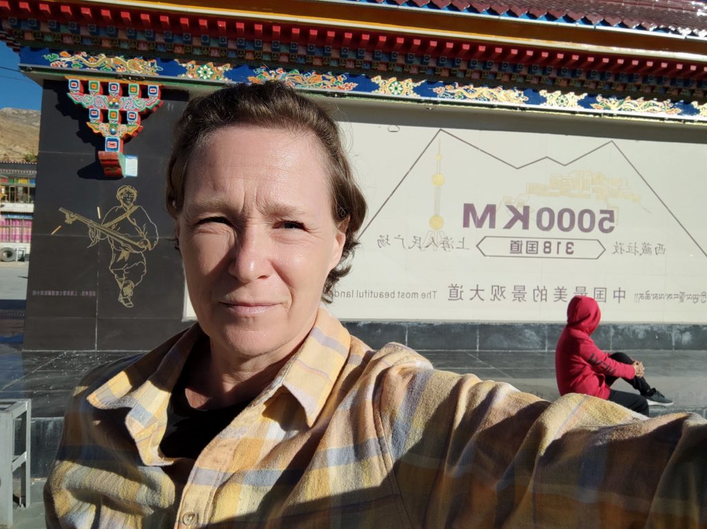
We drove a long time (8 hours and 340 km), stopped at several points, and had several checkpoints for ID. Travel was along the Shanghai Nepal road and where we stopped was at 5248 meters elevation. I definitely felt the lack of oxygen.
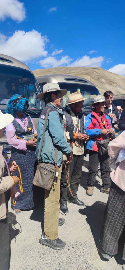
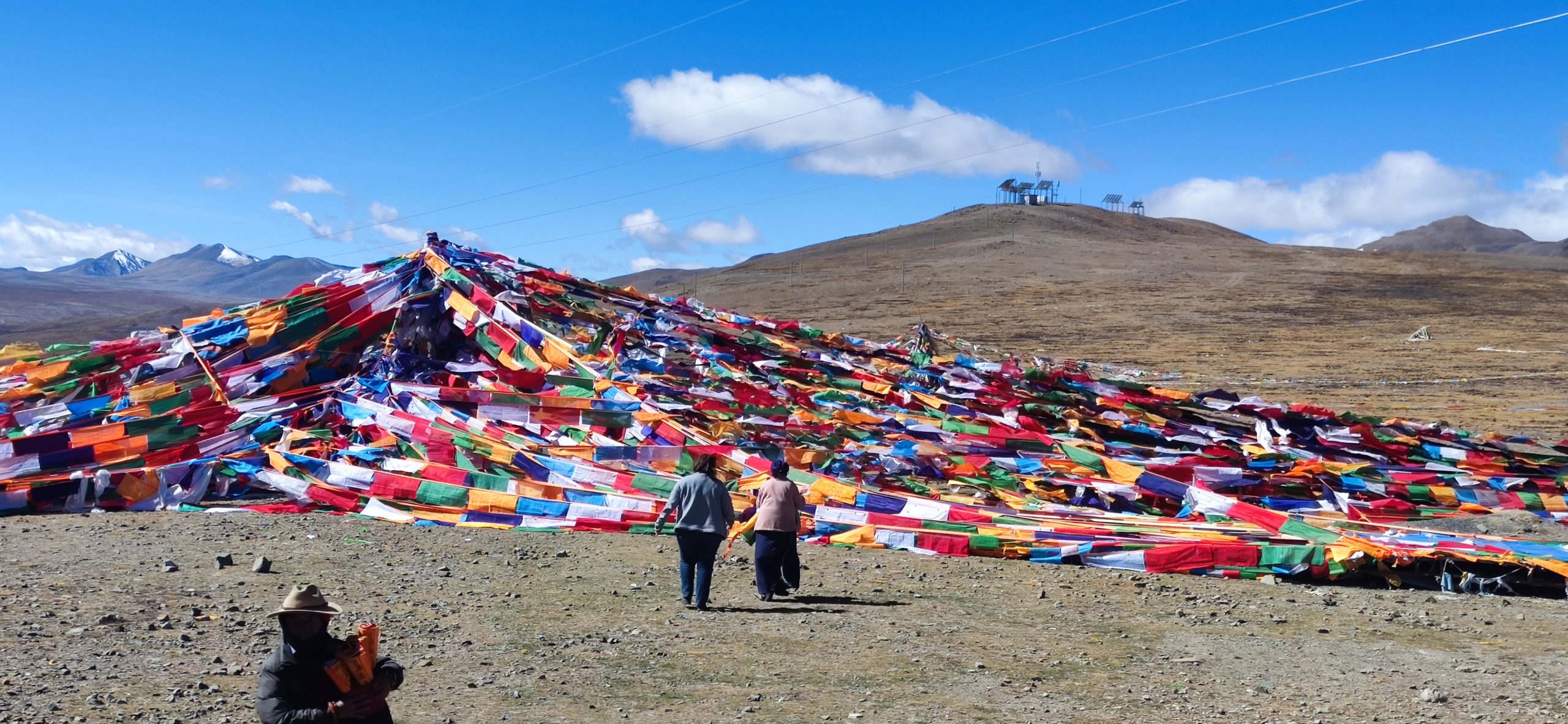
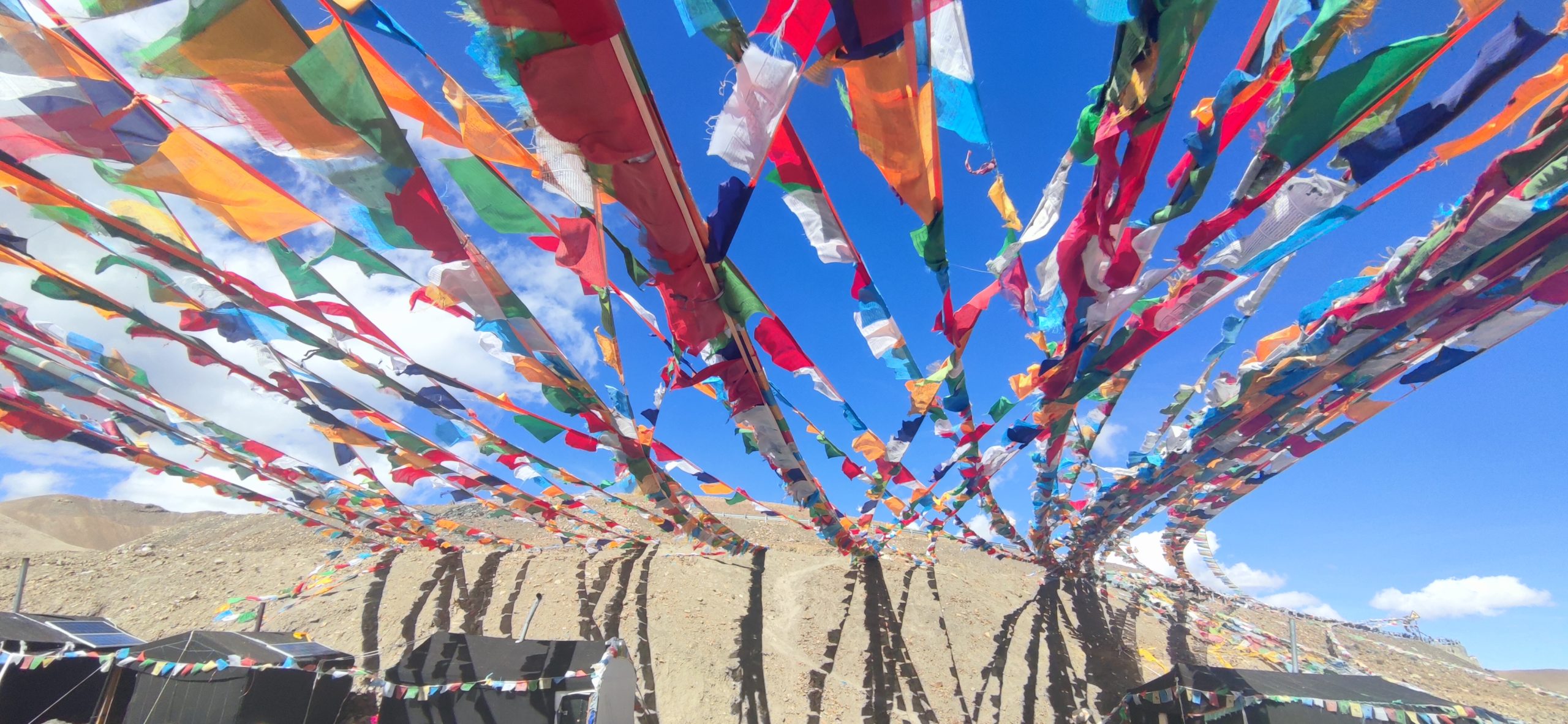
Along the Gyitso pass we stopped for bathroom break and also to take pictures. You can purchase a prayer flag and write a recipient name on it. They tie it for you and the blessings and prayers are sent by the wind.
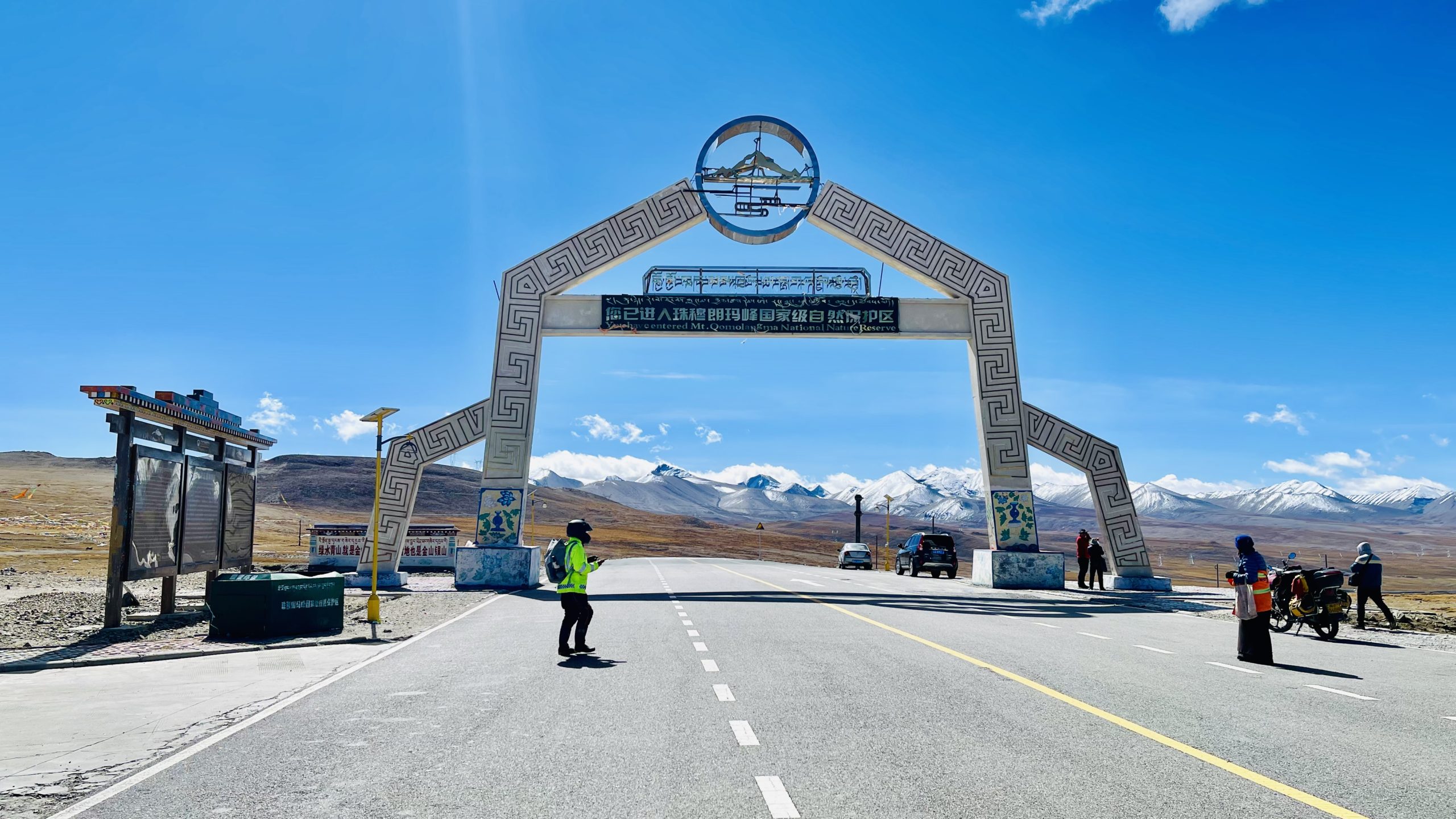
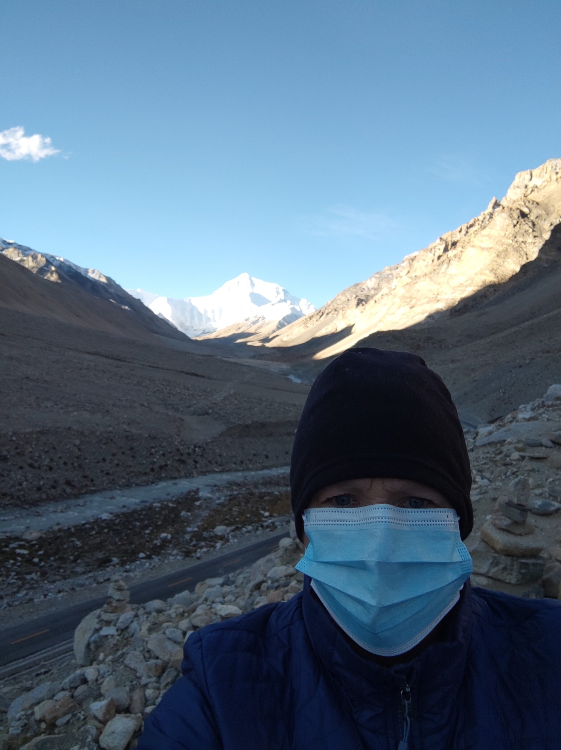
We hiked a short section to get to Everest base camp at 5,150 m elevation. The camp is located below the moraine slopes from the Central Rongpu Glacier. A moraine is the earth and rocks pushed by the Glacier when it was advancing.
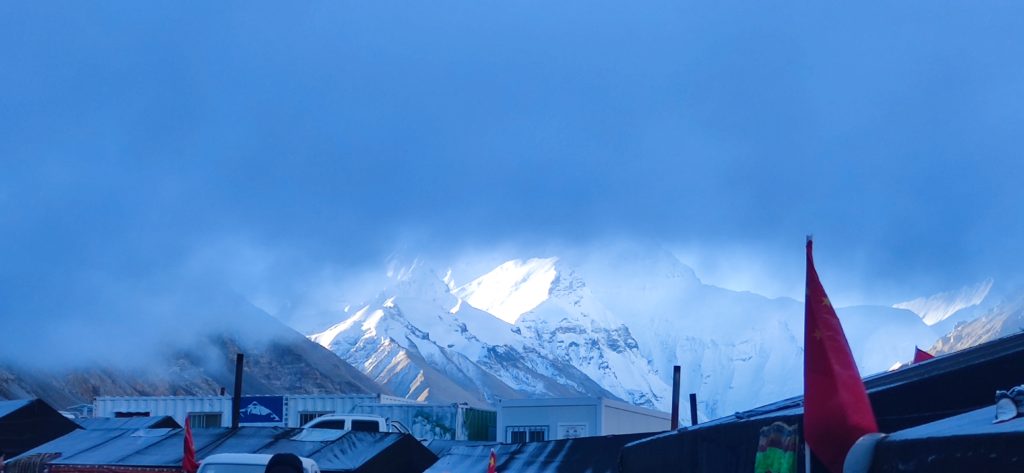
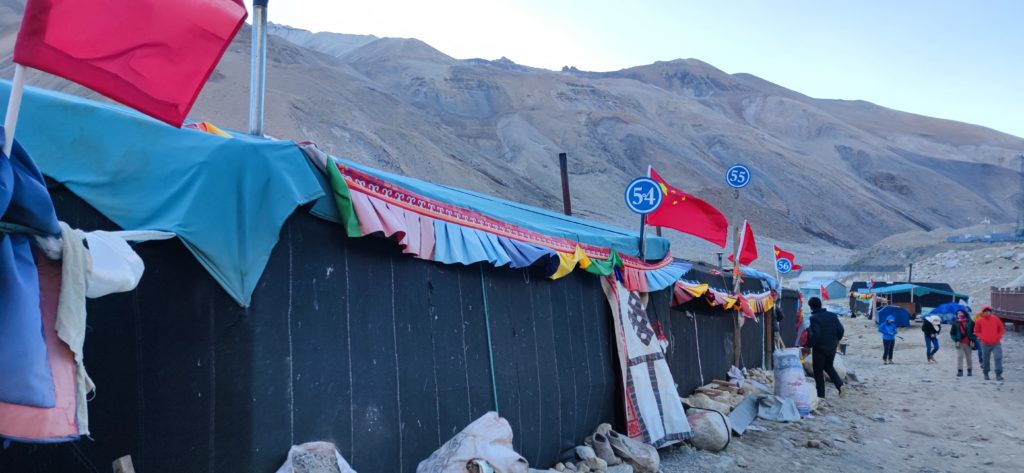
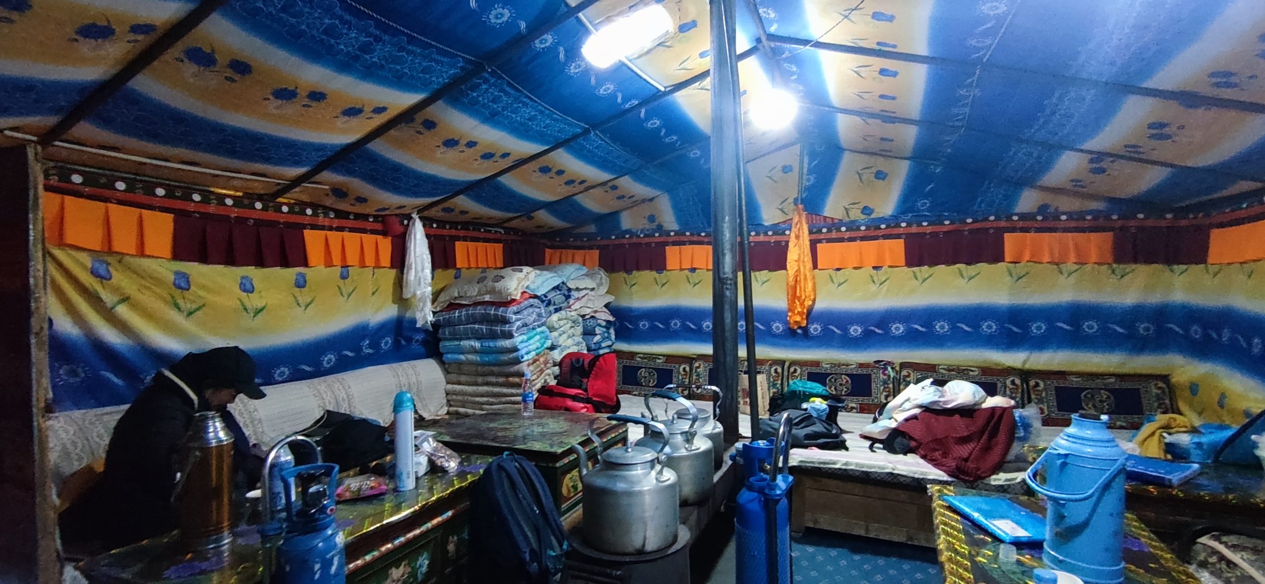
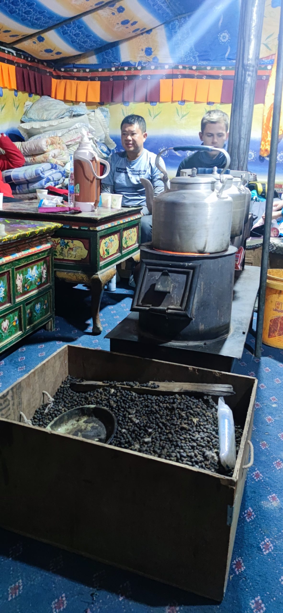
We stayed in a large tent at the base camp. The blankets they use are very thick and the tent is heated by using dried sheep and yak poop. It actually gives off less ash and is more plentiful than wood. Our tour group was interesting : 1 Japanese, 1 Chinese, 1 American, 1 Brazilian, 1 Singaporean, 1 Russian, 2 Brits, and 3 Germans. We spent a lot of time together! The tent owner would cook fried rice with yak meat for dinner and an omelet or pancake for breakfast. Lowest temperature was – 4C at night.
The base camp for hiking Everest is another 4 km away. You can no longer get a permit to hike unless you have Sorvino prior experience. We are about 20 km to Nepal.
I came on this trip already with a headache and stuffy nose so not sure when or if I was acclimated to the altitude. But when I arrived at Everest base camp, I was definitely struggling. My vision pulsed with each heartbeat and I had no energy. I used a nasal cannula with oxygen for 30 minutes. I felt better and then continued to feel better as we went back down in elevation. My sports watch measures my pulse. My resting heart rate is normally 46 bpm but jumped to 68 after arriving in Tibet. No wonder it shows in under great stress.
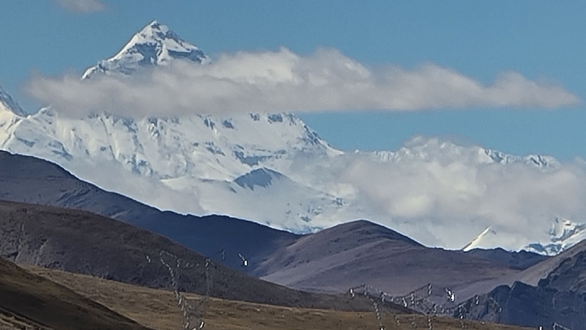
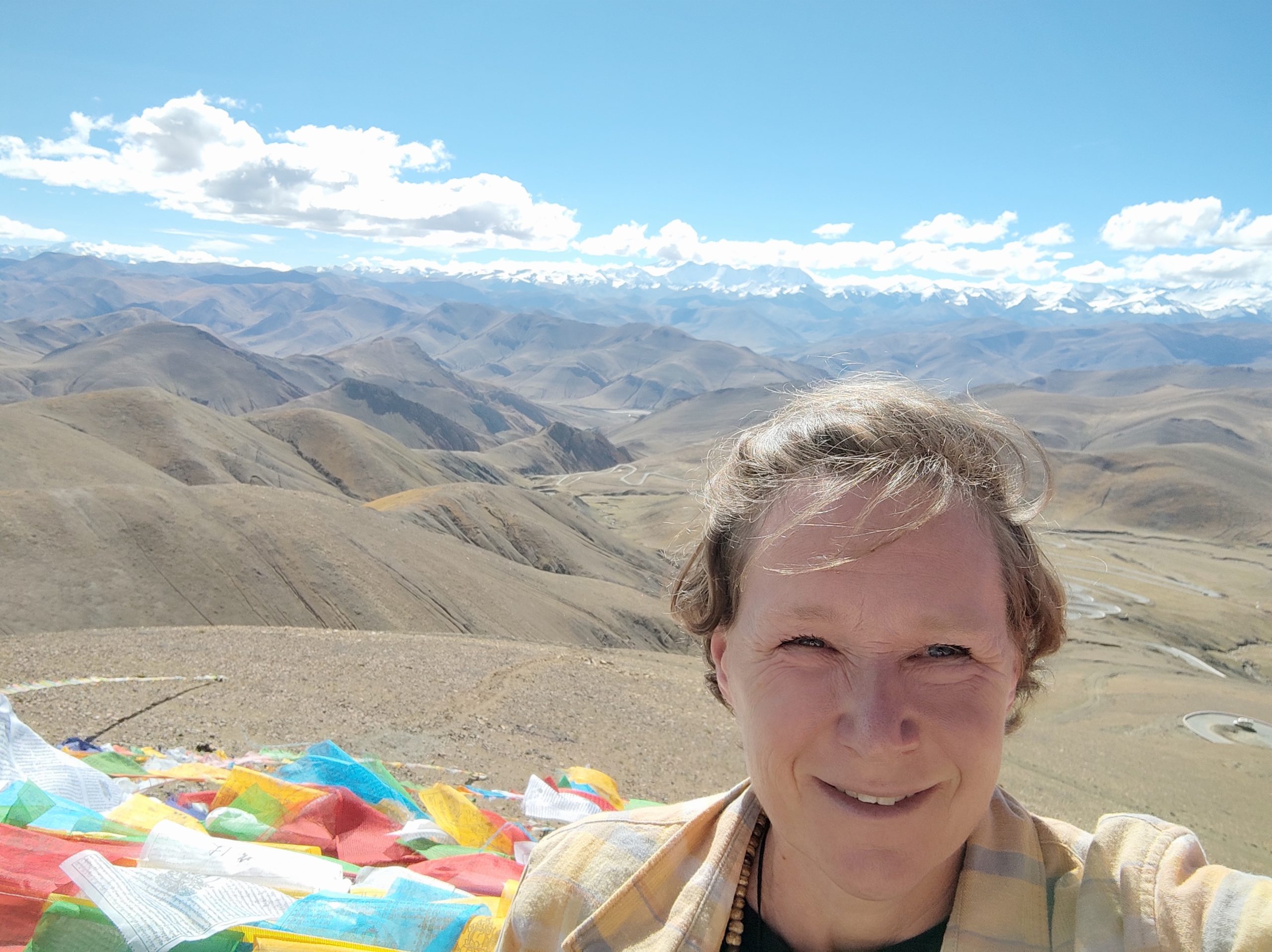
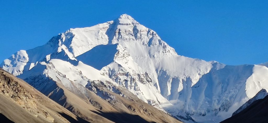
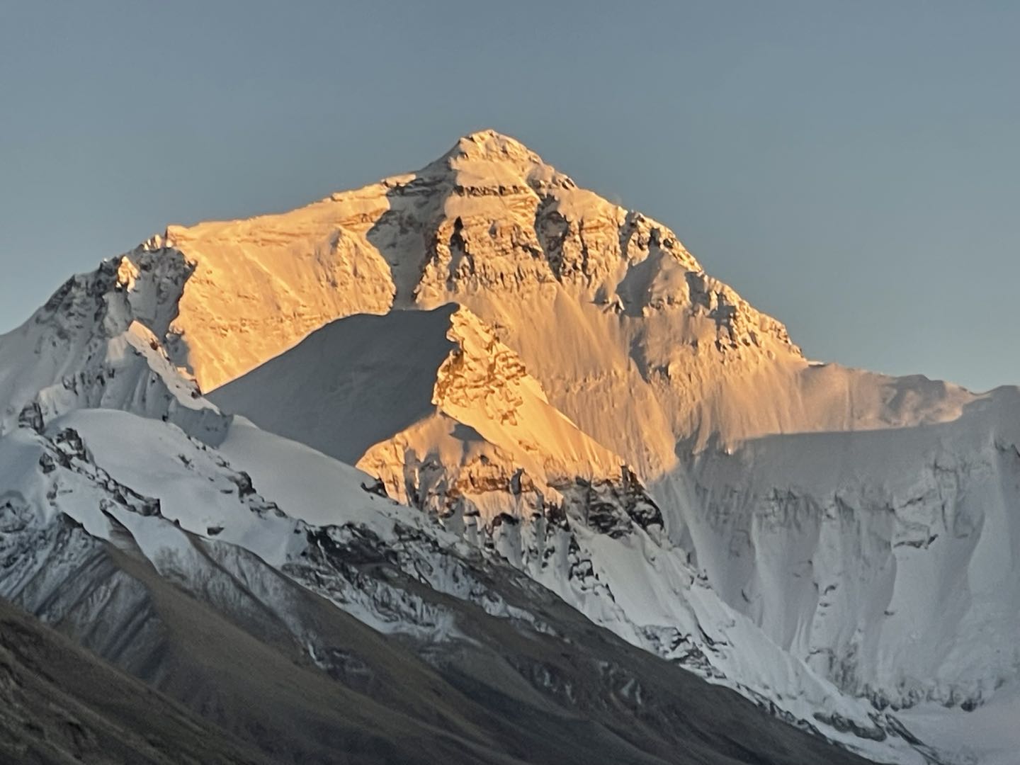
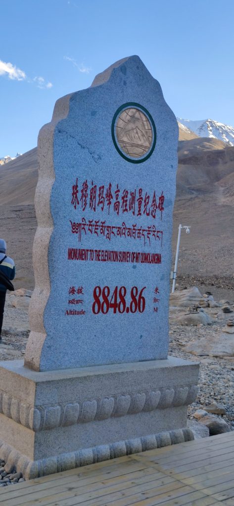
The Tibetan name for everest is Chomolungma, meaning “Goddess Mother of the world”. This marker is the height at the top of Everest.
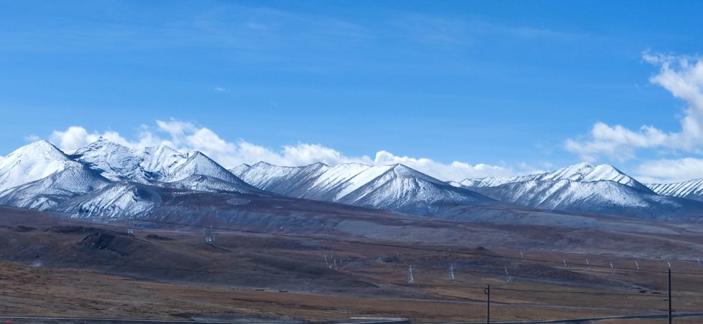
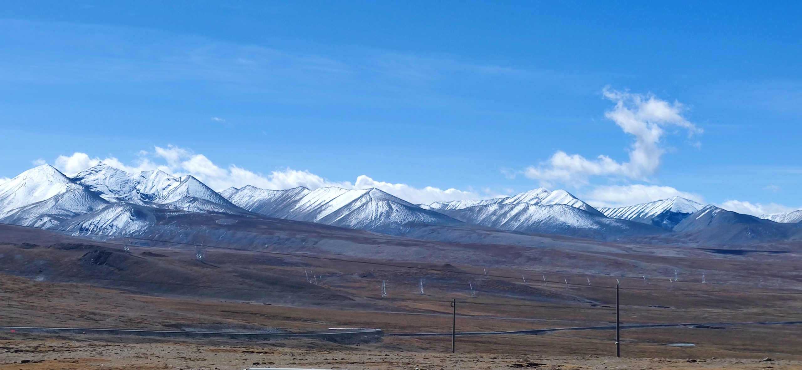
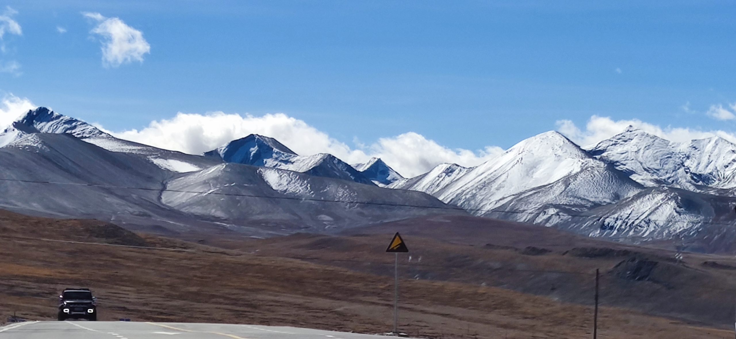
Himalaya means “abode of snow”. There is about 15,000 glaciers throughout the whole range. The Himalaya form an arc that separates the Indian subcontinent in the south from the Tibetan Plateau in the north. Many of the world’s major rivers, the Indus, the Ganges, the Brahmaputra and the Yangtze all begin here. The next three pictures are the Himalayan range. A panorama would not let me zoom in so close.
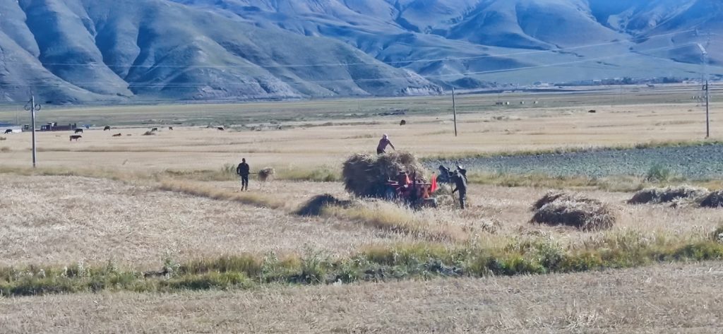
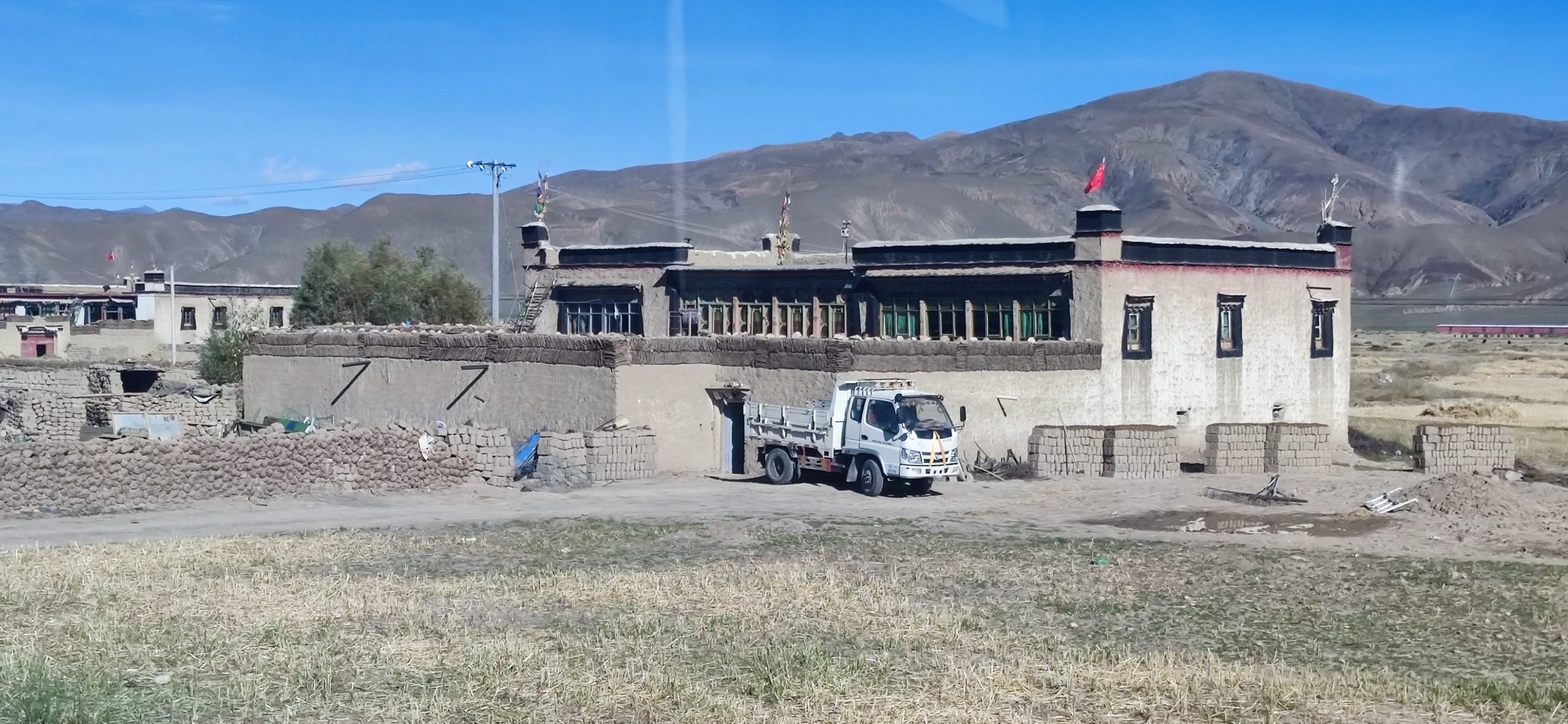
Along the way we could see Tibetan farmers cutting and taking hay by hand. They did lift the hay wagons pulled by tractors. They keep the hay in their yards to feed livestock.
D and I are both looking at your pictures, breathless. You had amazing weather to be able to see so much without clouds. We LOVE your pictures. The shots of you in front of Everest and of Everest at sunset are hard to look away from. I don’t usually like to see people’s “I was here” pictures, but in this case, it is quite cool to see someone we KNOW standing in front of Everest. D keeps saying you should write a book.
Hope you got back to a tolerable elevation. Elevation sickness feels awful… and I can’t imagine what it would be like up THAT high.
Yes. I never had trouble in Denver but this was three times the altitude. It was amazing and Tibet is very different. The people are great and very peaceful. They do not act like the rest of China. Unfortunately a typhoon in Guangzhou has made travel home crazy. I’ve been stuck in Chengdu for almist a day but am boarding now. Others have told me to write a book but not sure what the angle would be. I looked at having the blog printed and it currently would be 9 volumes!